
Also check out:
- Case #1: 17 Ipswich Curiosities →
- Case #2: 16 Ipswich Peculiarities →
- Case #3: 19 Ipswich Intrigues →
20 Ipswich Oddities at a Glance:
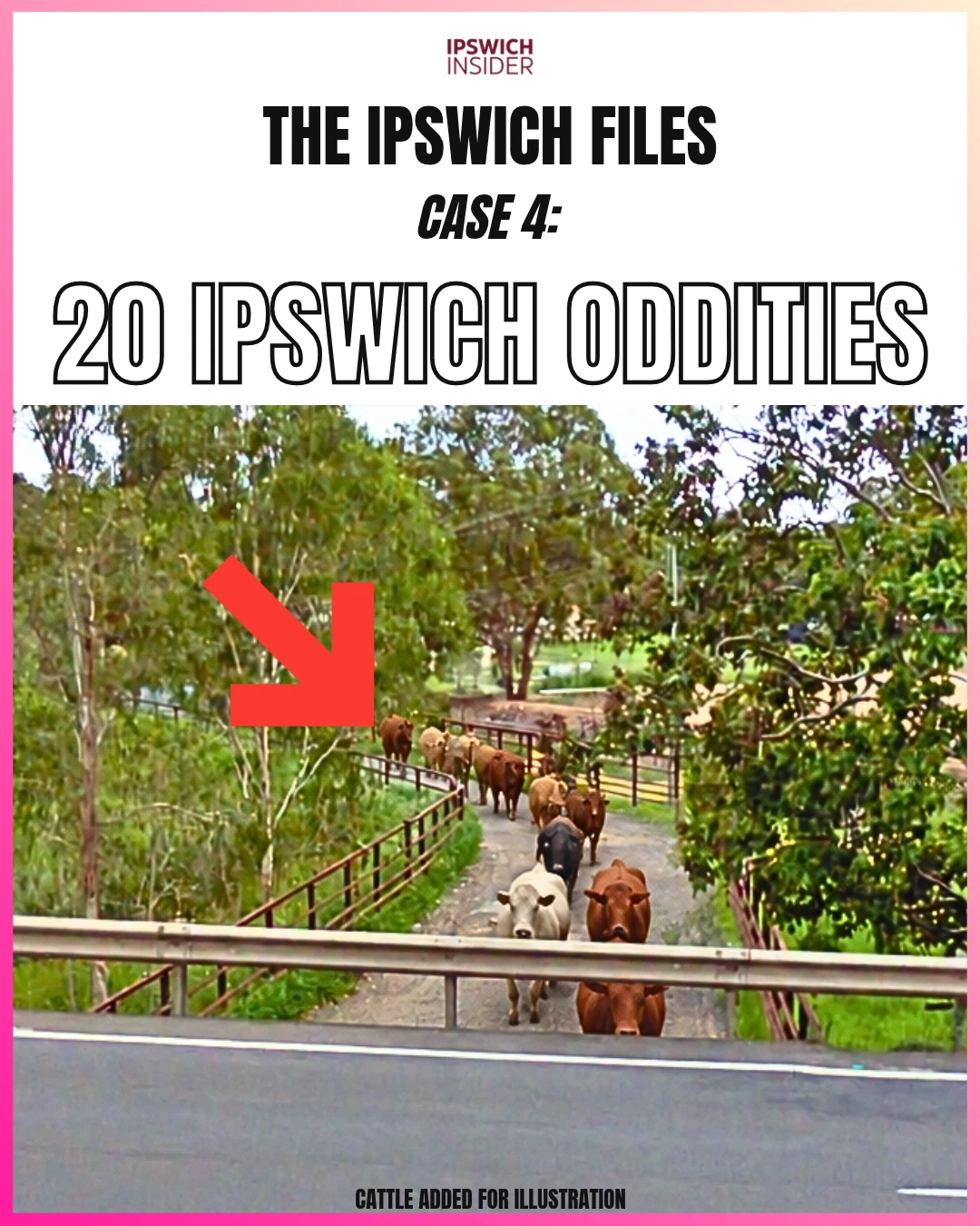
- Unique underpass: Cattle walk from the Dinmore rail yard (beside Dinmore train station) to JBS beneath the Warrego Highway. You could drive straight over them without knowing they were there.
- Hiding in plain sight: An old electricity company’s name still on a building beside the Booval Fair car park. A mysterious music venue in Chuwar. An 1842 map of Ipswich when it was called Limestone and still in NSW.
- Sticky numbers: A house 391m above sea level. A billboard with million-dollar potential. An $18.5 million wildlife pledge and 138 Tesla Megapacks on an old power station site.
🔢 By The Numbers
- 20 – oddities in Case #4 of The Ipswich Files
- 391 metres – above sea level for the highest house we found, on Paidley Road at The Bluff
- $1.014 million – potential yearly Goodna billboard revenue in our sold-out advertising model
- $330 a week – billboard ground rent advertised with the Goodna property in 2024
- 1842 – Dixon’s map calls Ipswich Limestone, 17 years before Queensland became a separate colony
- 15 homes per hectare – the starting minimum density in Ripley Valley, counting local roads and parks
- 20 homes per hectare – our count for the Providence pocket pictured, or 500m² per home including its share of roads and parks
- 1982 – the year Ipswich declared itself a nuclear-free city
- 138 – Tesla Megapacks at Swanbank
- $18.5 million+ – pledged by Graham and Jude Turner for Hidden Vale’s wildlife work
- 68.6 metres – height of the Redbank Plains tower topping our Skyline Standings survey
The first three Ipswich Files uncovered 52 local curiosities, peculiarities and intrigues. If you missed them, start here:
Now we’re opening Case #4: 20 Ipswich Oddities.
Start with cattle walking beneath the Warrego Highway. Then there’s a billboard with million-dollar potential, a house higher than the weather radar, and Blackstone’s castle imagined back on its hill.
We’ve also got Ipswich when it was still in New South Wales, the small-block maths behind Ripley, and that question about Box Flat that keeps coming back.
Some came from readers. Some were hiding in maps, old newspapers and planning documents. All give you another reason to look twice at somewhere you thought you knew.
Let’s get stuck into it.
More Ipswich Gold
Jump to:
- 1. Cattle under the Warrego
- 2. Goodna’s billboard
- 3. Ipswich’s highest house
- 4. Blackstone’s lost castle
- 5. Box Flat mine fires
- 6. Ipswich in New South Wales
- 7. Ripley’s small blocks
- 8. Nuclear Free Zone signs
- 9. Drones in Ipswich CBD
- 10. Street names for living people
- 11. Booval Fair’s substation
- 12. Splash park shutdowns
- 13. East and Limestone streets
- 14. Swanbank’s Tesla battery
- 15. Hidden Vale’s wildlife pledge
- 16. Ipswich’s tallest tower
- 17. Willowbank’s wartime airfield
- 18. Fiddlers Inn in Chuwar
- 19. The rail museum closure
- 20. Raymonds Hill and Tivoli Hill
1. Cattle walk under the Warrego?
Details
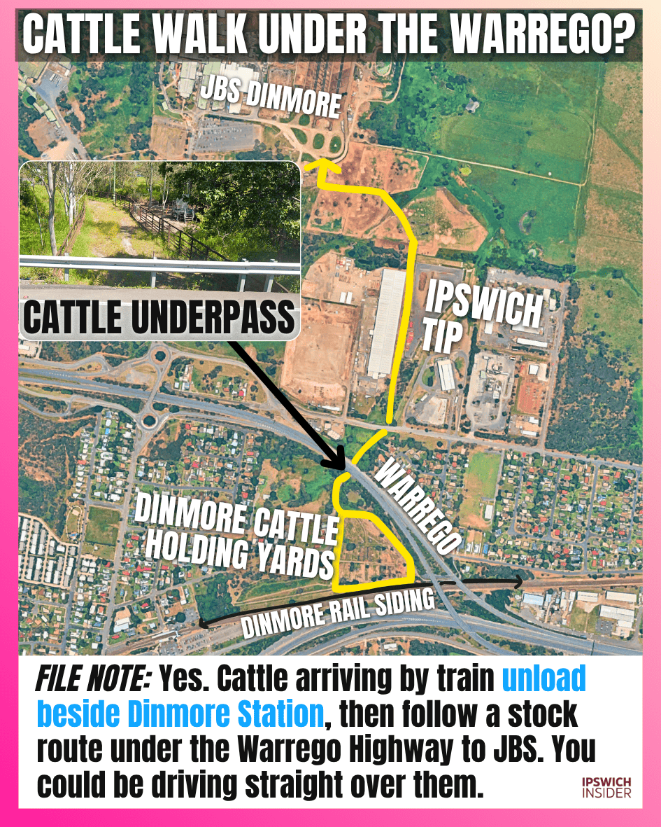
FILE NOTE: Yes. Cattle arriving by train unload beside Dinmore Station, then follow a stock route under the Warrego Highway to JBS. You could be driving straight over them.
- Off the train: Cattle unload into the Dinmore Cattle Holding Yards beside Dinmore Station, south of the Warrego and just north of the Cunningham Highway.
- Under the traffic: The fenced stock route passes beneath the Warrego Highway and continues north to the JBS meatworks. Council’s 2018 lease report describes this connection between the rail yards and the plant.
- A sense of scale: JBS reported receiving 160,000 cattle by rail at Dinmore in 2013, averaging about 900 head per train. Watco advertises cattle trains carrying up to 1,000 animals per trip.
Did you know this one?
2. Could Goodna’s billboard earn $1 million a year?

Details
FILE NOTE: YES! 6 slots at an estimated $13,000 every 4 weeks could bring in $1.014 million over a sold-out year. The Goodna landowner received just $330 a week in 2024.
- The million-dollar maths: Six advertising slots at an estimated $13,000 per four-week booking, sold for 13 booking periods, comes to $1,014,000. That is a sold-out revenue model, before costs.
- The landowner’s share: The 2024 property advertisement listed billboard rent of $330 a week. That works out to $17,160 a year for hosting the sign. The electricity for the sign costs more!
- Two different businesses: Selling the advertising and renting out the patch of land beneath it produce very different numbers. The million-dollar figure is our estimate, not the operator’s reported takings.
Read the Goodna billboard breakdown →
3. Where is Ipswich’s highest house?
Details
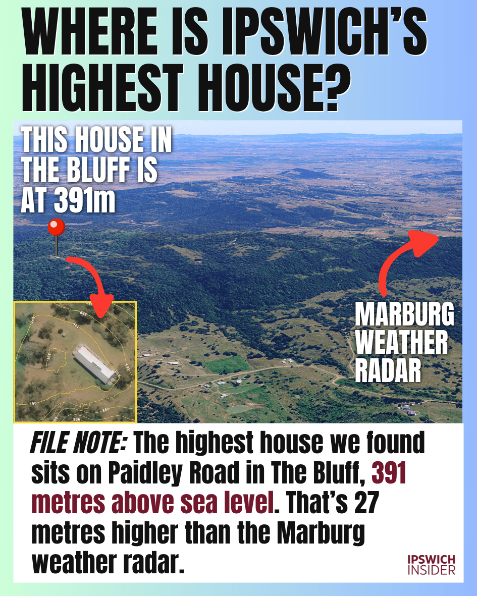
FILE NOTE: The highest house we found sits on Paidley Road in The Bluff, 391 metres above sea level. That’s 27 metres higher than the Marburg weather radar.
- Where to look: Paidley Road in The Bluff (Ipswich’s steepest street), the same road as the Marburg weather radar. The house we found is about 2.1 kilometres west of the radar.
- The height: 391 metres above sea level. The comparison is ground elevation, rather than the height of the house itself.
- Higher than the radar: The house site is 27 metres higher than the weather radar site.
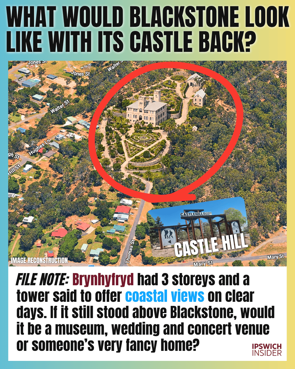
4. What would Blackstone look like with its castle back?
Details
FILE NOTE: Brynhyfryd had 3 storeys and a tower said to offer coastal views on clear days. If it still stood above Blackstone, would it be a museum, wedding and concert venue or someone’s very fancy home?
- A proper hilltop mansion: Coal owner Lewis Thomas’s home stood on Blackstone Hill. It had 3 storeys, a tower and a hydraulic lift. You can still visit the site of the castle. Castle Hill is now a public mountain bike park.
- Gone from the skyline: Brynhyfryd was demolished in the 1930s. The image imagines the mansion and its gardens back on the hill above today’s streets.
- Imagine it now: A museum, a wedding and concert venue, or a very fancy private home. Any of those would give Blackstone a very different skyline.
Did you know about this castle in Blackstone? How cool…
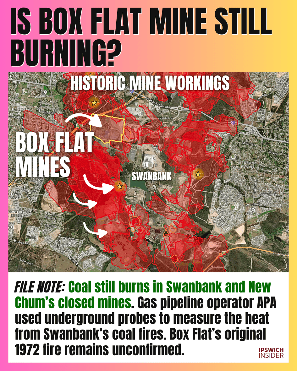
5. Is Box Flat mine still burning?
Details
FILE NOTE: Coal still burns in Swanbank and New Chum’s closed mines. Gas pipeline operator APA used underground probes to measure the heat from Swanbank’s coal fires. Box Flat’s original 1972 fire remains unconfirmed.
- Sealed after the disaster: Box Flat Extended Nos. 5 and 7 were permanently sealed after the 1972 disaster. Those are the workings behind the question locals keep asking.
- Fires in the district: Queensland Health’s 2025 inquiry describes persistent underground fires in the Swanbank and New Chum industrial areas. It does not identify which individual mines are burning.
- Heat worth watching: APA’s 2015 pipeline plan describes underground probes used to measure heat from Swanbank’s coal fires, with monthly temperature checks scheduled. Those records do not establish whether Box Flat’s original 1972 fire is still burning.
6. Ipswich used to be in New South Wales (and called Limestone)?

Details
FILE NOTE: Yes. Ipswich was in New South Wales until Queensland became a separate colony in 1859. This 1842 map calls it Limestone, alongside Red Bank, Bundanba Creek and Woogoroo Creek.
- Read the old labels: Robert Dixon’s 1842 map marks Limestone, Red Bank, Bundanba Creek and Woogoroo Creek. The last two are creek labels, with the spellings used on this map.
- Seventeen years before Queensland: In 1842, the land that became Queensland was still part of the colony of New South Wales. Queensland became a separate colony in 1859.
- Other names were already around: Brassall appears on an 1851 plan, Chuwor was recorded by 1853, and the Estate of Boovall was advertised in 1855. These names predate today’s suburb boundaries.
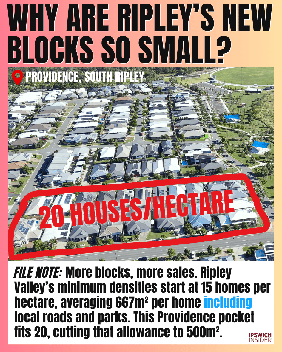
7. Why are Ripley’s new blocks so small?
Details
FILE NOTE: More blocks, more sales. Ripley Valley’s minimum densities start at 15 homes per hectare, averaging 667m² per home including local roads and parks. This Providence pocket fits 20, cutting that allowance to 500m².
- The starting rule: Ripley Valley’s minimum densities start at 15 homes per hectare. A hectare is 10,000m², so that works out to about 667m² per home across the residential area, including local roads and parks.
- The pocket in the picture: Our aerial count for this Providence pocket is 20 homes per hectare. That divides the same hectare into 500m² per home.
- Why smaller blocks appeal: Smaller lots let developers sell more individual blocks from the remaining land. Roads, parks, planning requirements and the market all help shape the final layout.
- Another real example: Bellevue’s approved Stage 7 plan has 36 lots across 18,270m². Roads take 3,505m², or about 19.2% of that stage. The plan lists an average lot size of 410m².
Money talks!
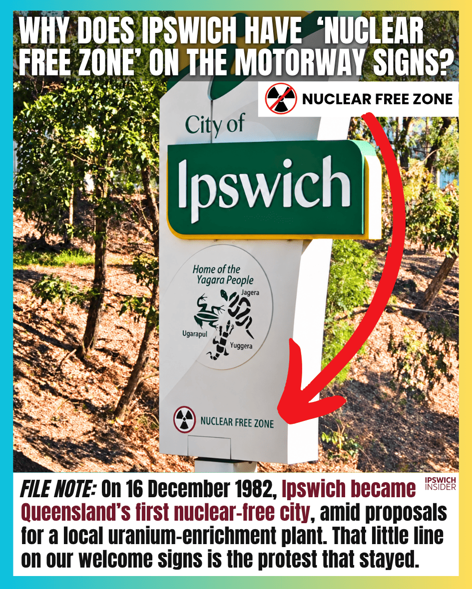
8. Why does Ipswich have ‘Nuclear Free Zone’ on the Motorway signs?
Details
FILE NOTE: On 16 December 1982, Ipswich became Queensland’s first nuclear-free city, amid proposals for a local uranium-enrichment plant. That little line on our welcome signs is the protest that stayed.
- The date: Council made the declaration on 16 December 1982. Ipswich was the 1st city in Queensland to do it.
- The argument at the time: Proposals for uranium-enrichment plants in the Ipswich and Pine Rivers areas helped drive the declarations. Council also opposed nuclear weapons, waste and material.
- The leftover clue: That small line on the welcome signs carries a piece of an early-1980s political argument most drivers would never guess was there.
Interesting indeed 🧐
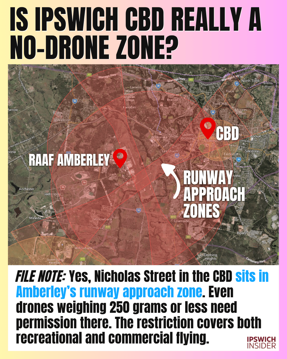
9. Is Ipswich CBD really a no-drone zone?
Details
FILE NOTE: Yes, Nicholas Street in the CBD sits in Amberley’s runway approach zone. Even drones weighing 250 grams or less need permission there. The restriction covers both recreational and commercial flying.
- The local catch: Nicholas Street lies in the approach and departure area for Amberley’s runway. That is why a drone app can show a restriction over the middle of town.
- Small drones count too: The usual exception for drones weighing 250 grams or less does not let you fly in the runway approach zone without permission.
- Check your exact spot: Use a CASA-verified drone safety app before flying. The airspace restriction depends on where you are, so the Nicholas Street finding should not be treated as a map of every CBD address.
Now you know!
10. Do you have to be dead to get an Ipswich street named after you?

Details
FILE NOTE: No. Plenty of Ipswich streets honour living people. Ripley alone has Brigginshaw Way, Keary Place and McDermott Way, named after Ali Brigginshaw, Luke Keary and Craig McDermott.
- Ali’s street: Council approved Brigginshaw Way for Ecco Ripley in December 2020. Ali was very much alive and captaining the Broncos, Queensland and Australia.
- More familiar names: The same batch included Keary Place for Luke Keary, McDermott Way for Craig McDermott and Shearer Court for Dale Shearer.
- The answer: A street name can recognise someone while they are still around to see it. These Ipswich examples settle that particular myth.
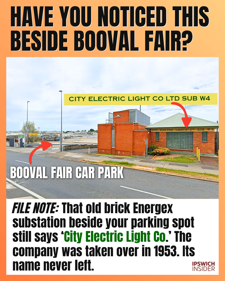
11. Have you noticed this beside Booval Fair?
Details
FILE NOTE: That old brick Energex substation beside your parking spot still says ‘City Electric Light Co.’ The company was taken over in 1953. Its name never left.
- Read the building: The old brick front still carries the words “CITY ELECTRIC LIGHT Co LTD SUB W4”. It is sitting right beside the shopping centre parking area.
- An old company name: City Electric Light was taken over by the Southern Electricity Authority in 1953. The lettering has outlasted the company.
- Still part of the network: Energex’s Raceview network report identifies Booval as one of its connected substations. The oddity is how easily this old electrical building disappears into an ordinary shopping trip.
Ever noticed the building and substation yard behind it?
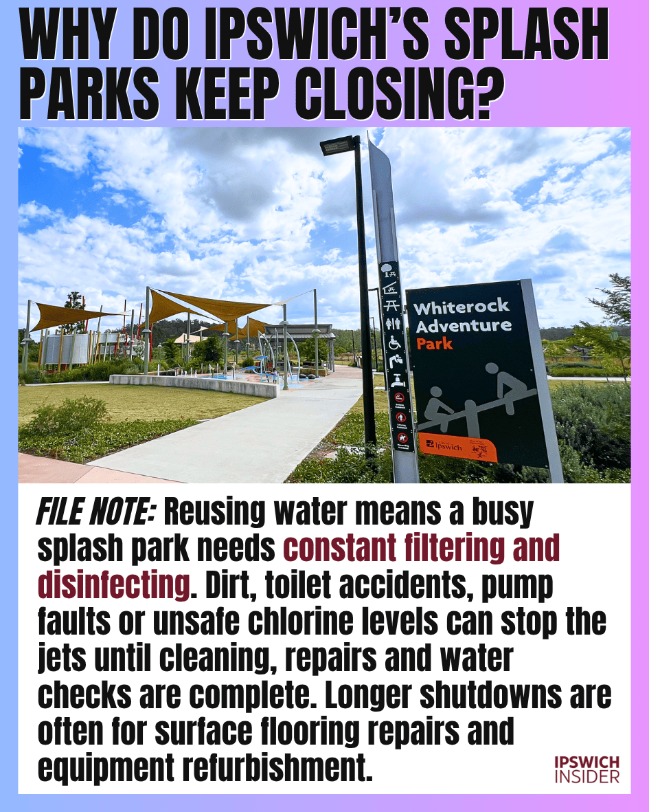
12. Why do Ipswich’s splash parks keep closing?
Details
FILE NOTE: Reusing water means a busy splash park needs constant filtering and disinfecting. Dirt, toilet accidents, pump faults or unsafe chlorine levels can stop the jets until cleaning, repairs and water checks are complete. Longer shutdowns are often for surface flooring repairs and equipment refurbishment.
- Busy water, busy machinery: In recirculating splash parks, water drains back into a tank to be filtered, disinfected and pumped out again. Dirt, leaves and heavy use add to the load on that system.
- The shorter shutdowns: Contamination, blocked equipment, pump faults or chlorine problems can mean stopping the water while staff clean, repair and check it. A toilet accident is one possible cause, not the explanation for every closure.
- When the floor needs replacing: Robelle Domain scheduled about 4 weeks to remove silicone tiles in February 2023. South Ripley’s Splash ’n’ Play stopped its water for surface repairs in January 2025. Bob Gamble Park’s October 2026 closure followed a failed wet play surface.
- Why surfaces can fail: Robelle’s earlier rubber surface was lifting and draining poorly before its 2019 replacement. Drainage, material choice and wear all matter, but the closure notices do not identify one shared cause across Ipswich’s parks.
- Some repairs are bigger: Bob Gamble Park also needed new pumping machinery and water-jet equipment after the 2022 floods. Whiterock announced four weeks of maintenance in November 2024 without specifying the fault.
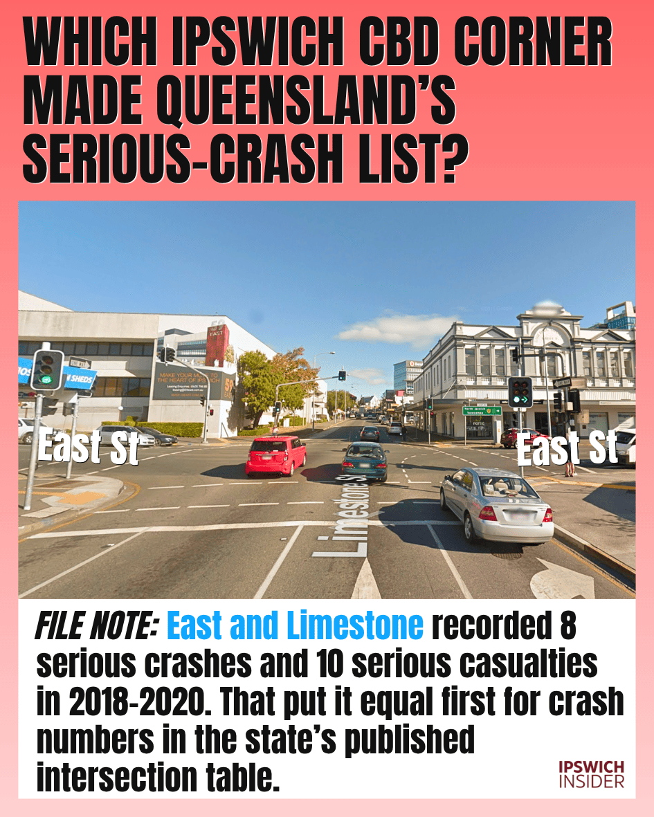
13. Which Ipswich CBD corner made Queensland’s serious-crash list?
Details
FILE NOTE: East and Limestone recorded 8 serious crashes and 10 serious casualties in 2018–2020. That put it equal first for crash numbers in the state’s published intersection table.
- The corner: East Street and Limestone Street. The Department of Transport and Main Roads table records 8 serious crashes and 10 serious casualties there from 1 January 2018 to 31 December 2020.
- What serious means: The sourced data table counts crashes involving a death or hospitalisation. “Ten casualties” does not mean ten deaths.
- How it ranked: Its 8 serious crashes tied with 6 other intersections at the top of the published table. These are historical crash numbers, rather than a current ranking of how risky each intersection is.
Be careful around this intersection, folks.
14. How much did Swanbank’s CleanCo/Tesla battery cost?

Details
FILE NOTE: The project had a $330 million budget, covering batteries, construction and grid connection. Enough juice to power more than 2/3 of Ipswich for 2 hours at peak demand.
- The hardware: 138 Tesla Megapacks at the former coal-fired power station site. The battery is rated at 250 megawatts, with 500 megawatt-hours of storage. (Also see: Ipswich Solar Report).
- In everyday terms: At full output, that storage lasts 2 hours. The project’s local comparison is enough electricity for more than 2/3 of Ipswich through a 2-hour evening peak.
- The money: The Queensland Government announced a $330 million budget in February 2024. It is a very different use for a site locals long associated with power stations.
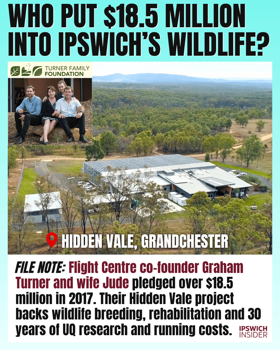
15. Who put $18.5 million into Ipswich’s wildlife?
Details
FILE NOTE: Flight Centre co-founder Graham Turner and wife Jude pledged over $18.5 million in 2017. Their Hidden Vale project backs wildlife breeding, rehabilitation and 30 years of UQ research and running costs.
- The people: Graham and Jude Turner made the commitment through the Turner Family Foundation. Graham co-founded Flight Centre and trained as a vet.
- What the pledge covered: More than $18.5 million for building costs, research grants and UQ operations over 30 years. The commitment was announced in March 2017.
- The work: Wildlife breeding, rehabilitation and research to help threatened species. The centre sits within Hidden Vale’s 3,100-hectare nature refuge.
16. Where is Ipswich’s tallest structure hiding?

Details
FILE NOTE: Our Skyline Standings winner is the 68.6m telecommunications tower behind the Redbank Plains Recreation Reserve. That’s 20.7 metres taller than Oaks Aspire. Swanbank’s old 137-metre chimneys came down in 2015.
- The winner: The telecommunications tower at 90 Willow Road, Redbank Plains, tops our Skyline Standings survey at 68.6 metres.
- The city-centre comparison: Oaks Aspire is 47.9 metres tall. The tower beats it by 20.7 metres, despite being far less prominent in most people’s mental picture of Ipswich.
- The old champions: Swanbank’s 137-metre chimneys were almost twice as tall. They were demolished in 2015, changing the answer to this question.
See Ipswich’s full Skyline Standings →
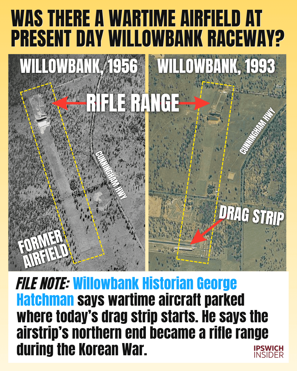
17. Was there a wartime airfield at present day Willowbank Raceway?
Details
FILE NOTE: Willowbank Historian George Hatchman says wartime aircraft parked where today’s drag strip starts. He says the airstrip’s northern end became a rifle range during the Korean War.
- George’s recollection: He identifies the site as RAAF Amberley A-8 Warrill Creek Emergency Landing Ground, with a north–south strip used for emergencies and training.
- The raceway connection: In his account, wartime aircraft parked at the southern end, where today’s drag strip starts. He says the northern end became a 300-yard military rifle range during the Korean War, 1950–1953.
- The aerial comparison: The 1956 and 1993 aerial photographs show the long clearing and rifle-range features surviving as the surrounding land changed. The later image also shows the drag strip.
- A personal link: George says he and his wife bought the former rifle range around 1988.
Thanks for the tip, George!
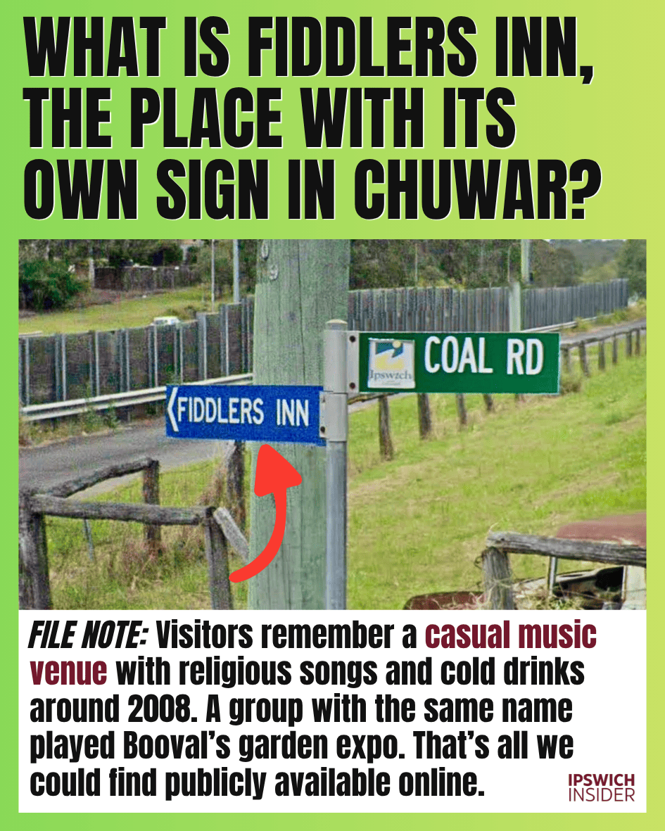
18. What is Fiddlers Inn, the place with its own sign in Chuwar?
Details
FILE NOTE: Visitors remember a casual music venue with religious songs and cold drinks around 2008. A group with the same name played Booval’s garden expo. That’s all we could find publicly available online.
- The sign: Look for the blue “FIDDLERS INN” direction sign beneath the green Coal Road sign in Chuwar.
- What visitors remember: The Reddit discussion recalls informal music gatherings, including a visit around 2008, religious songs and cold drinks. These are visitors’ memories of the place.
- The same name elsewhere: Glebe Garden Club lists The Fiddler’s Inn as musical entertainment at its Ipswich Home Gardener’s Expo in Booval. A matching name alone does not establish that it was the same operation.
Been here?
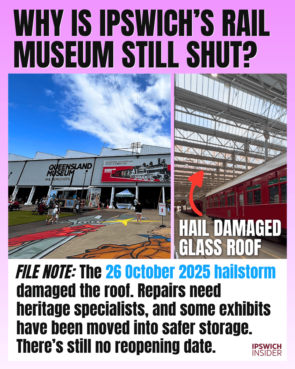
19. Why is Ipswich’s rail museum still shut?
Details
FILE NOTE: The 26 October 2025 hailstorm damaged the roof. Repairs need heritage specialists, and some exhibits have been moved into safer storage. There’s still no reopening date.
- The storm: The 26 October 2025 hailstorm severely damaged the roof at Queensland Museum Rail Workshops in North Ipswich.
- Why repairs are complicated: The heritage-listed buildings need specialised work that protects their historic fabric. Significant collection items have been moved to safer locations during repairs.
- For annual pass holders: Passes are being extended for the closure period. The museum’s official closure page carries the latest reopening updates. Check the museum’s latest update.
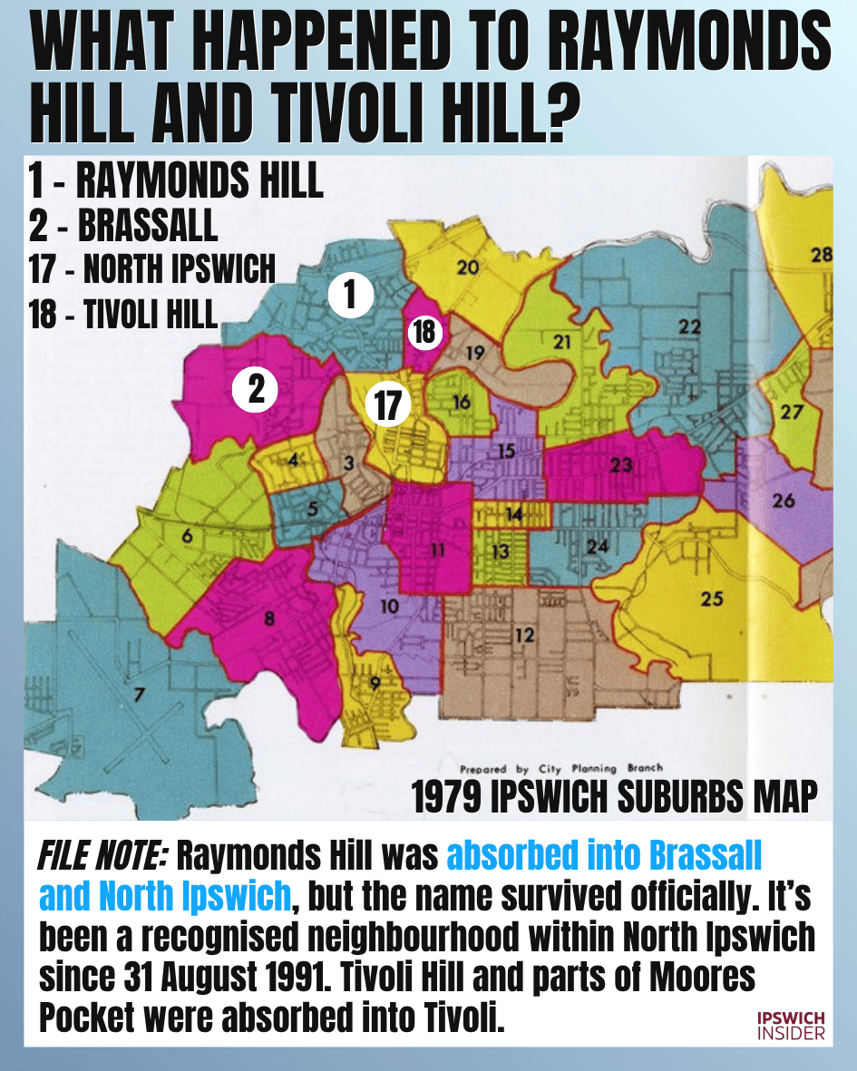
20. What happened to Raymonds Hill and Tivoli Hill?
Details
FILE NOTE: Raymonds Hill was absorbed into Brassall and North Ipswich, but the name survived officially. It’s been a recognised neighbourhood within North Ipswich since 31 August 1991. Tivoli Hill and parts of Moores Pocket were absorbed into Tivoli.
- Where Raymonds Hill went: Queensland Places records part of the old suburb being absorbed into Brassall west of Waterworks Road, with another part becoming North Ipswich.
- The name survived: Queensland’s place-name register still lists Raymonds Hill as an official neighbourhood within North Ipswich, approved on 31 August 1991.
- Tivoli Hill changed too: Tivoli Hill was once a separate suburb. It is now a neighbourhood within Tivoli, so the old name survives there as well.
- Read the old map: The City Planning Branch map in the 1979 Ipswich yearbook marks Raymonds Hill as 1, Brassall as 2, North Ipswich as 17 and Tivoli Hill as 18. Its outlines show how the suburbs were divided then.
Sources
- Cattle under the Warrego: Council’s November 2018 stock-route lease report and map.
- Ipswich’s highest house: Ipswich Insider’s highest-house trivia answer.
- Box Flat mine fires: Queensland Health’s Swanbank and New Chum public health inquiry (2025). APA’s 2015 pipeline integrity plan, published with its regulatory submission.
- Ipswich in New South Wales: Robert Dixon’s 1842 map, National Library of Australia.
- Ripley’s small blocks: Ripley Valley Development Scheme, amendment 3. Providence aerial image and house count by Ipswich Insider.
- Drones in Ipswich CBD: CASA’s rules for flying near airports.
- Street names for living people: Council’s December 2020 street-name announcement.
- Booval Fair’s substation: Brisbane City Council’s City Electric Light company history.
- Splash park shutdowns: Neverstop Water’s splash-park maintenance guide.
- East and Limestone streets: Transport and Main Roads intersection crash table, page 111.
- Swanbank’s Tesla battery: Queensland Government’s February 2024 battery announcement.
- Hidden Vale’s wildlife pledge: University of Queensland’s March 2017 Turner family announcement.
- Fiddlers Inn in Chuwar: Visitors’ recollections on Reddit.
- The rail museum closure: Queensland Museum Rail Workshops’ official closure updates.
- Raymonds Hill and Tivoli Hill: Queensland’s Raymonds Hill neighbourhood record.
Willowbank: George Hatchman’s account, supplied in August 2026, and Queensland Government QImagery aerial photographs from 1956 and 1993.
Raymonds Hill map: City Planning Branch, Ipswich Suburbs, from the 1979 Ipswich yearbook.