Also check out:
- Case #2: 16 Ipswich Peculiarities →
- Case #3: 19 Ipswich Intrigues →
17 Ipswich Curiosities at a Glance
- Legacy land – Many of Ipswich’s oddest-looking sites trace back to old industry, waste, or infrastructure that shaped what the land can and can’t become today.
- Hidden logic – The white domes, sealed sheds, and fortress walls all have practical explanations. Once you know the “why”, they stop looking strange.
- Stuck, not forgotten – Vacant blocks, closed railways, and retired cottages aren’t mysteries. They’re waiting on money, compliance, or an owner’s long-term plan to shift.
🔢 By The Numbers

- 40,000 – birds packed into a single sealed broiler shed west of Ipswich
- ~3,000 m² – visible retaining wall face holding up Bremer State High’s campus
- 186 hectares – size of the proposed HQ masterplanned community at Hardrock Quarry
- ~$3.2–$4.0m – estimated value of the vacant Limestone St block sitting idle since 2018
- 907 kW – solar system still generating on the closed Churchill abattoir site
- 1,800 homes – planned across the quarry-to-suburb conversion at Redbank Plains
- 80 billboards – the equivalent face area of Bremer High’s retaining walls
- 1974 – earliest satellite evidence of a car yard at 27 Limestone Street
- 11,157 m² – land dedicated to solar panels on the former abattoir footprint
- 2023 – year the “Marburg” radar got its dual-pol Doppler upgrade
Every local has a list:
- That weird white sphere on the hill.
- The massive retaining wall on Warwick Road.
- The empty block that never gets built on.
You think you know everything you need to – but do you really?
(I had fun with this one.)
Some of these are popular Facebook threads. Some are just personal curiosities. Regardless, let’s dig in and have some good ol’ Ipswich fun.
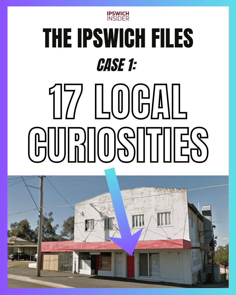
This is The Ipswich Files — 17 local oddities, explained.
More Ipswich Gold
Jump to
- What’s That White Sphere on the Hill?
- Wah’s Still Standing
- The Ute Back Boneyard
- Crop Circles at Mount Mort
- 40,000 Birds Per Shed
- The Great Wall of Bremer
- The Bottom of Briggs Rd
- Where Coal Barges Once Sailed
- Stalled on Limestone
- Hardrock’s Soft Landing
- Why Ripley Won the Badge
- Wait, the Marburg Radar Isn’t in Marburg?
- The Abattoir’s Million-Watt Legacy
- Raceview’s Unmovable Neighbour
- Raceview’s Holy Land Bank
- Last Stop: Rosewood Rail Museum
- The Cottage That Retired
What’s That White Sphere on the Hill?
Details
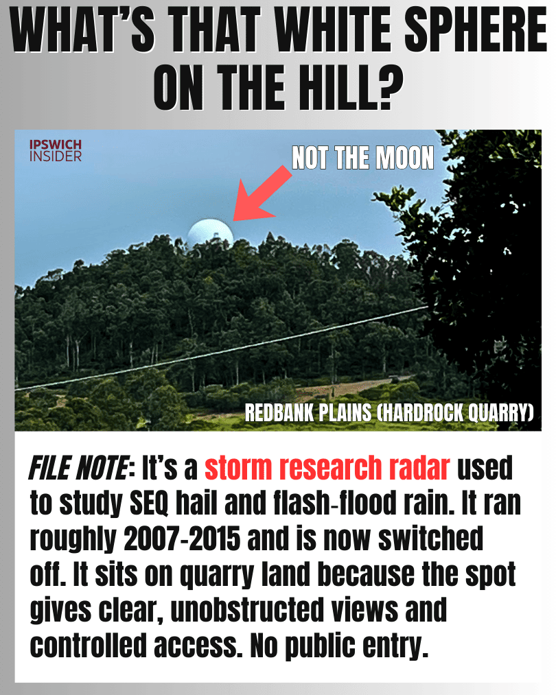
You’ve probably seen the white sphere on the hill from somewhere around Ipswich and wondered what’s up. Well, it’s a decommissioned storm research radar dome. It was used to study hail and flash-flood rain and is now switched off, but still sits there as a landmark.
- Purpose: It was built for storm research, especially hail and heavy-rain events that drive flash flooding.
- How: It worked alongside Mt Stapylton so storms could be viewed from two angles, improving how researchers read what was happening inside a cell.
- Why Here: Hilltop quarry land gives clear line-of-sight and controlled access, which suits sensitive equipment.
- Myths: It’s not military or a “weather weapon”, just weather hardware inside a protective dome.
Wah’s Still Standing
Details
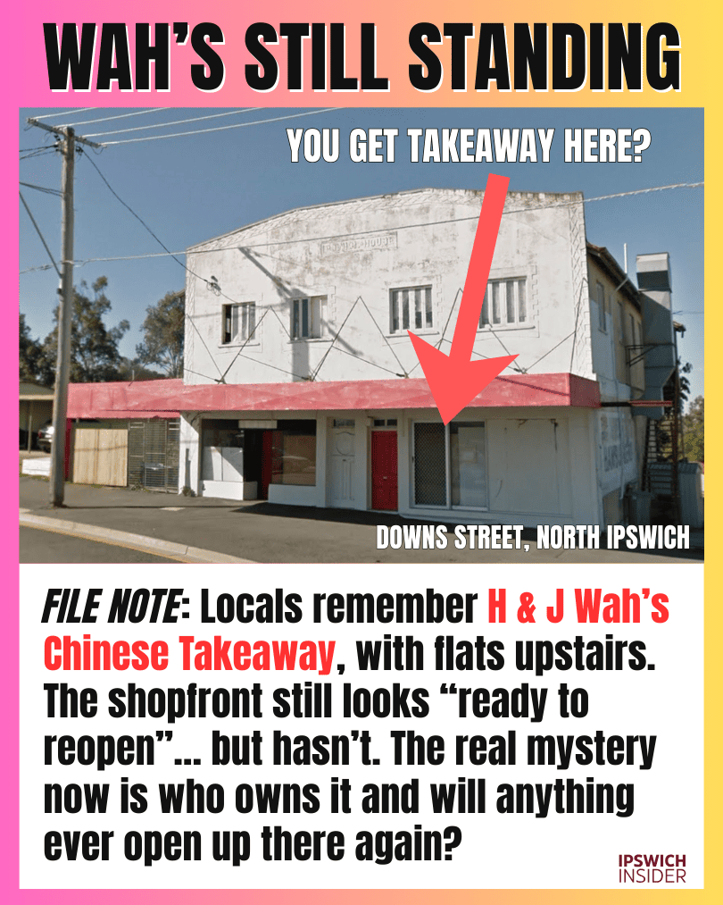
The faded shopfront on Downs Street is one of those Ipswich “time capsule” buildings. Locals remember it as H & J Wah’s Chinese Takeaway, with flats upstairs, but the big curiosity is what’s happening there now and planned for the future.
- History: A family comment in a recent local thread on Facebook confirms details that locals already knew. It is the building that housed H & J Wah’s Chinese Takeaway with flats above and various other shops operating out of the north (left-side) shopfront over the years.
- Mixed-use: Shop-plus-flats buildings can be hard to restart because you’re juggling access, safety, and two different types of tenants.
- Costs: Bringing an old takeaway back to life usually means expensive upgrades for extraction, grease, fire safety, and accessibility.
- Unanswered: The one detail locals can’t help with is whether the upstairs is still occupied and whether the shopfront is currently for lease or “shutdown” indefinitely.
The Ute Back Boneyard

Details
This one is in Borallon, but quite literally on the Ipswich border, so we’ll include it. It shows up on maps as “Ute Backs”. And the phone number on the signage links it to a permanently closed Redbank Plains location with the same Ute Backs naming. Seems to be nothing more than a business lay-down yard for its ute-back inventory. It looks chaotic from above, and when driving by. But is just inventory in a paddock instead of a shed.
- Signage: The on-site sign makes it clear it’s “pickup at yard” and not a walk-up business.
- Stock: Ute tubs pile up after tray conversions, fleet upgrades, and the constant churn of work vehicles.
- Move: The matching phone number with a Redbank Plains listing suggests that operation likely relocated here rather than disappeared.
- Border: This property borders Ipswich, but is in Borallon of the Somerset region.
Crop Circles at Mount Mort
Details
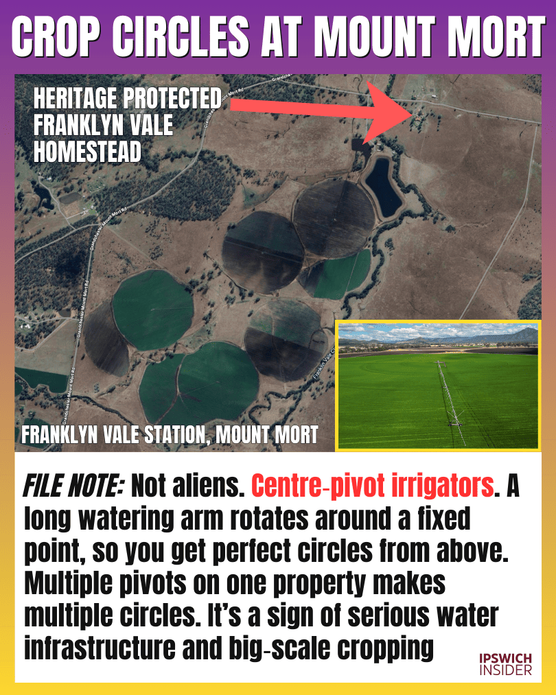
The perfect circles near Mount Mort look unreal on satellite. They’re centre-pivot irrigators, which create circles because the watering arm rotates around a fixed pivot point.
- Mechanism: One pivot makes one circle, and multiple pivots create the patchwork of circles people love screenshotting.
- Scale: These systems usually signal serious cropping, because you need dams, bores, pumps, and power to run them.
- Crops: Irrigated setups like this often support high-value crops such as corn and beans when water is available.
- Visual: A single satellite screenshot explains it instantly, especially when you can see the “spokes” of the pivot arms.
40,000 Birds Per Shed
Details
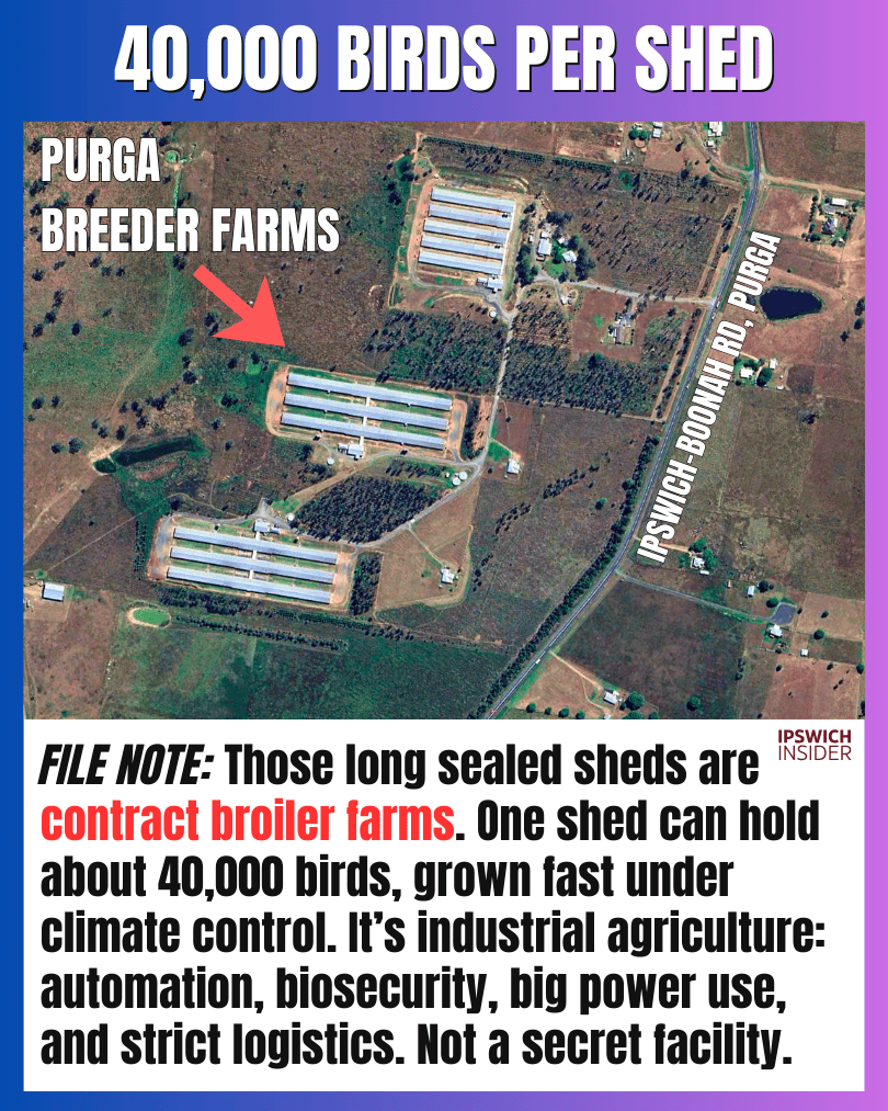
Those long sealed sheds west and south of Ipswich Central aren’t secret facilities. They’re usually contract broiler sheds designed for biosecurity, automation, and controlled growing conditions.
- Capacity: One shed can hold roughly 40,000 birds, which is why the scale feels confronting when you learn the number.
- Biosecurity: Sealed buildings and restricted access reduce disease risk when you’re growing birds at high density.
- Contracts: Growers typically build sheds while processors supply chicks, feed, and vet support, then buy back the birds.
- Logistics: These farms cluster near arterial roads because feed deliveries and bird pickups are constant and time-critical.
The Great Wall of Bremer

Details
Bremer State High’s “fortress” retaining walls are the visible price of levelling a sloped site into a flat school campus. They look extreme because they’re holding up a huge cut-and-fill earthworks job.
- Earthworks: The site needed major cut-and-fill to create large flat pads for buildings, ovals, and circulation.
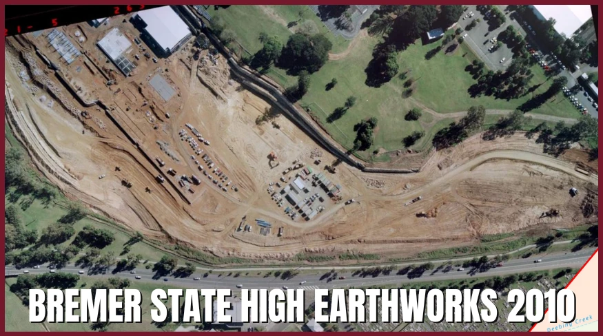
- Estimate: Rough map maths puts the visible wall face around ~3,000 m², which is why it reads as “massive” from the road. This includes the Warwick Rd visible retaining wall and also the one at the north-side separating it from the USQ Campus.
- Compare: ~3,000 m² is roughly the face area of ~80 standard highway billboards standing upright.
- Before: If you have “before” shots from the golf course days, the scale of the change becomes obvious instantly.
The Bottom of Briggs Rd

Details
This part of Briggs Road is “quiet land” with a loud backstory. It hosted Ipswich’s sanitary depot and waste pits, which helps explain why large nearby parcels can stay stuck and undeveloped for long stretches.
- Nightsoil: Before sewerage, collected human waste was disposed of here in burial pits, a practice that shaped the land’s long-term risk profile.
- Timeline: The sanitary depot era ran for decades, which is why its footprint still matters to modern land use.
- Legacy: Contamination history can cap what’s practical, often steering land toward industrial or storage uses rather than housing.
- Memory: Long-time locals may remember the “nightsoil” days and can add context that no map layer captures.
Where Coal Barges Once Sailed

Details
Tivoli’s Bremer riverbank wasn’t always a “quiet edge of town”. This area sits in Ipswich’s coal history, where coal was brought down to the river and loaded for transport, and it still feels like legacy land use today.
- Industry: Tivoli’s river edge was part of Ipswich’s coal logistics story, tied to tramways, loading points, and river transport.
- Tramway: Coal was hauled down to the Bremer via tramway from nearby mines in the late 1800s era.
- Today: The area still reads as “old coal land” with big open stretches and sports fields close to town.
- Limits: Flood risk and old industrial/mine land history can quietly restrict what’s viable near the river flats.
Stalled on Limestone
Details
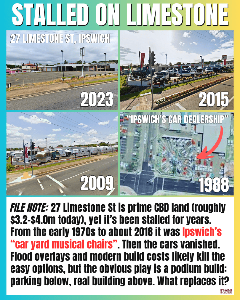
27 Limestone St was Ipswich’s “car yard musical chairs” from the early 1970s through to about 2018. Then the cars vanished and the block has sat idle ever since, despite being prime CBD land (although it floods on the north-western edges).
- Timeline: QImagery shows a dealership-style yard as far back as 1974 (1969 shows a regular car park, not a dealership looking setup). And the site stayed in car-yard rotation until it went quiet around 2018.
- Value: A rough present-day value of ~$3.2–$4.0m makes the long vacancy stand out even more.
- Flood: Flood overlays don’t stop development, but they push up costs and narrow the “easy” options.
- Podium: A common workaround is a podium build with parking/storage at ground level, with habitable/useable floors above flood levels.
Hardrock’s Soft Landing

Details
“HQ” is the branding for Atrio’s proposal to turn the Hardrock Quarry footprint into a masterplanned community. The pitch is a quarry-to-suburb transformation with staged precincts and a large share of rehabilitated green space.
- Brand “HQ” refers to the quarry redevelopment project, not the Rheinmetall site that also gets called “HQ” in other contexts.
- Scale The concept is ~186 hectares with up to ~1,800 homes and around half the site proposed as open space.
- Villages The plan is framed as multiple precincts or “villages” to stage development across the former quarry.
- Transport It’s being positioned around future connectivity, including possible rail corridor links near Keidges Road.
- Timing The biggest unknown is the quarry timeline and rehabilitation requirements, which will dictate when housing can actually start.
Why Ripley Won the Badge
Details
The new Ripley Police Station (Ipswich District HQ) wins on strategy: growth, access, and room to scale. It’s positioned in the heart of the corridor that Ipswich is expanding into fastest.
- HQ: This is the Ripley Police Station being built to operate as the new Ipswich District HQ.
- Coverage: The location improves response geometry across Ripley, South Ripley, Deebing Heights, White Rock, and surrounding growth areas.
- Access: Ripley Road provides fast runs to both the Cunningham and Centenary corridors, which matters more than any “north/south” label.
- Space: A purpose-built HQ site can handle fleet, specialist units, secure functions, and future expansion as the district grows.
Wait, the Marburg Radar Isn’t in Marburg?
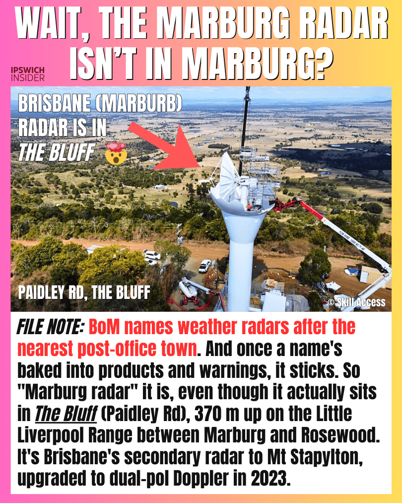
Image source: Skill Access
Details
The curiosity is the name: Brisbane’s “Marburg” radar sits in The Bluff, not in Marburg township. It’s on the range between Marburg and Rosewood, where hilltop line-of-sight gives better storm coverage.
- Location: The radar is in The Bluff area on the Little Liverpool Range, closer to multiple small localities than Marburg’s main drag.
- Naming: The most likely reason for “Marburg” is a Bureau convention of using the nearest recognised post-office-town-name for public-facing radar labels. Marburg had the closest official post office when it went in… hard to verify this as fact.
- Upgrade: The 2023 dual-pol Doppler upgrade improves how the radar interprets what’s in the sky, especially during severe weather.
- Install: The dome upgrade required serious access engineering to handle heavy components at height, which shows how large the structure really is.
- Mix-up: Locals sometimes confuse it with Amberley, but this one is the civilian weather radar site.
The Abattoir’s Million-Watt Legacy

Details
A near‑1MW solar installation was built for the Churchill abattoir site and it stayed put even after the abattoir closed. It’s a rare case of infrastructure outliving the business that justified it.
- Footprint: The solar yard covers 11,157 m² (about 1.12 ha), which is a serious chunk of land dedicated to panels.
- Purpose: It was installed to offset massive electricity loads like refrigeration and processing, plus the “go green” branding abattoirs love.
- Value: A ~907kW system can generate roughly ~1.4 GWh/year, worth about ~$100k/year exported or far more if offsetting on-site power.
- Ownership: Best guess is it’s still controlled by the landowner entity, though some sites sell systems to solar investors under lease/PPA arrangements.
- Today: If the site has tenants now, the solar can be the difference between “too expensive to run” and “viable”.
Raceview’s Unmovable Neighbour
Details
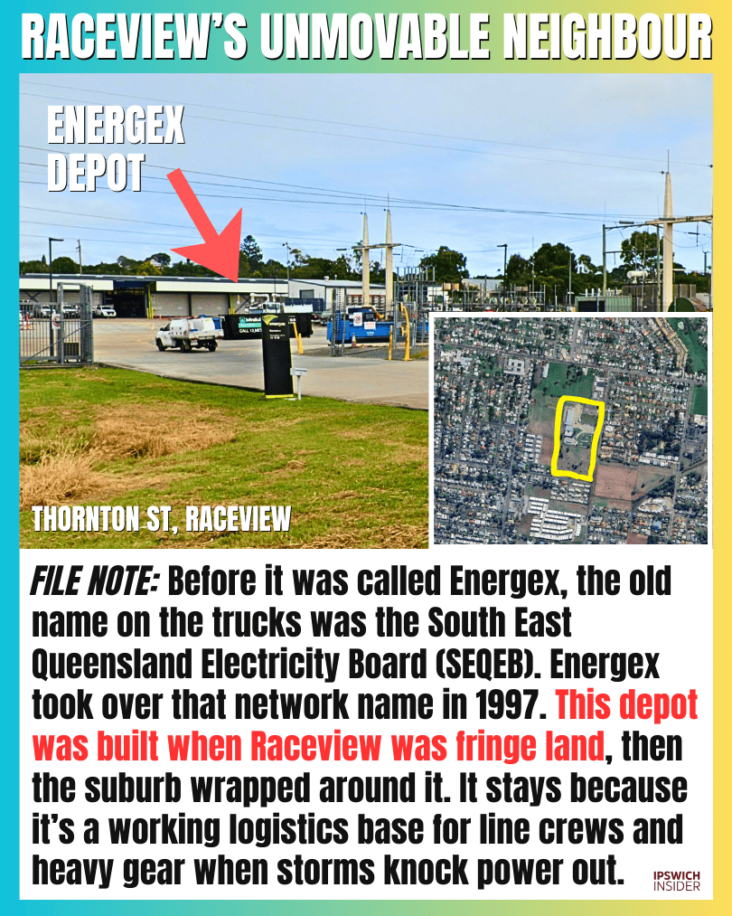
This depot looks “stuck in the middle of houses” because it came first. Raceview expanded around a working power depot, and once a site like this is embedded, it rarely moves.
- SEQEB: Before “Energex”, older locals remember the network as the South East Queensland Electricity Board era, so the depot feels older than the branding.
- First: Utilities put depots on cheap fringe land, and suburbs eventually wrap around them and make them look “oddly placed”.
- Gear: These sites support line crews with heavy vehicles and equipment, not just utes, which is why they need yard space.
- Storms: When severe weather hits, depots like this become the local launch point for crews and materials.
- Move: Relocating means rebuilding workshops, storage, security, and access, so it’s usually cheaper to live with it than shift it.
Raceview’s Holy Land Bank
Details
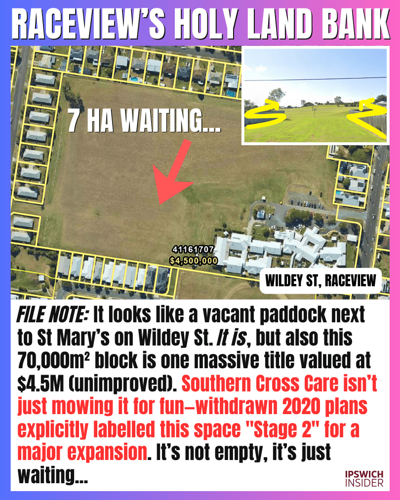
A surprisingly big empty patch in Raceview that locals keep waiting to be built on. The owner is Southern Cross Care – St Mary’s who operate the aged-care on-site (or an affiliated entity). They even lodged a Development Application to expand into this vacant land in 2019. But withdrew in 2020 and nothing has happened since.
- Blank: It’s rare to see a large undeveloped block in a fully built-out suburb, which is why it stands out.
- Neighbours: The aged-care facility operates on-site and nearly expanded into a portion of this land in 2019, before withdrawing the Development Application.
 Render of proposed St Mary’s aged-care expansion at Wildey St, Raceview.
- Landbank: Churches and community groups often hold adjacent land for future expansion, overflow parking, or eventual sale.
- Trigger: Blocks like this usually move when the owner’s long-term plan changes, not when the market gets impatient.
Last Stop: Rosewood Rail Museum

Details
Rosewood’s heritage railway is one of those places that feels like it should be open every weekend, but it’s not that simple. The line is closed to the public while volunteers try to bring passenger rides back in a sustainable way.
- Status: It’s officially closed while a volunteer-led group works on reopening.
- Barrier: Heritage rail depends on governance, insurance, and safety compliance, which is why “reopening” can take years.
- Campaign: The “From Rust to Revival” push is the latest attempt to reset funding, management, and momentum.
- Local: Even closed, it’s a rare reminder that the district’s rail history isn’t just museum glass, it’s physical track.
Read about ‘Rust to Revival’ →
The Cottage That Retired
Details
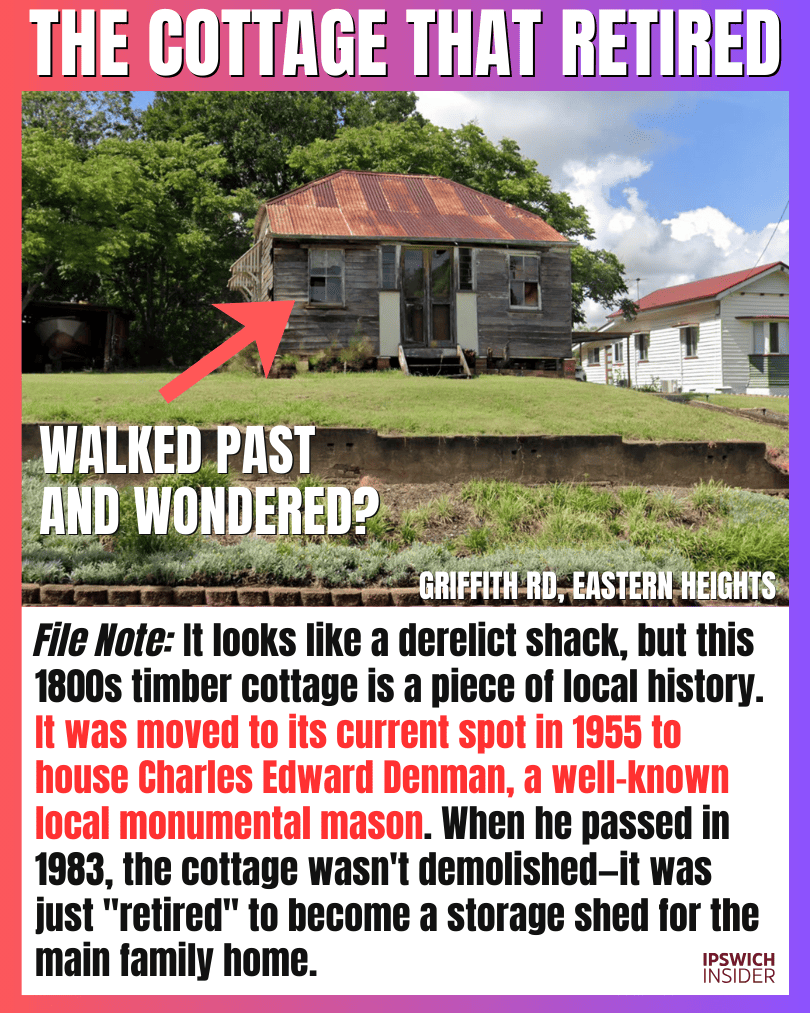
That little “dumpy cabin” on Griffith Road isn’t abandoned so much as retired. It’s a small historic cottage with a local working-life story attached, now sitting quietly as storage.
- Origin: It’s an old timber cottage that was relocated onto the block around the mid‑1950s rather than demolished.
- Trade: It’s tied to a local monumental mason, linking it to Ipswich’s stonework and cemetery history.
- Survival: After the resident passed away, the cottage shifted into “shed mode” instead of being redeveloped.
- Pattern: Ipswich has plenty of “retired buildings” that stay because families don’t need to squeeze every dollar from the land.