Edition #02 at a Glance
- Locations: Today we fly over Lake Moogerah, Swanbank, Spring Mountain, Springfield Central, Ripley, South Ripley, Karalee, Bundamba, Grandchester, Redbank, Carole Park, New Chum, North Booval and Moores Pocket.
- Images: 23 drone photos of interesting Ipswich things. From water reservoirs to shopping malls to massive distribution centres.
- How to enjoy: Come on in, sit back, relax, grab a cuppa and scroll through the images.
Drone Photos by Me
Jump to:
CleanCo Battery|
Swanbank Lake|
Spring Mountain Reservoir|
Orion|
Mater Springfield|
Robelle Domain|
The Circle|
Ripley Police Station|
Providence|
Ripley Town Centre|
Bremer River Bridge|
Bells / Kholo Bridge|
Victoria Tunnel|
Redbank Motorway Estate|
Carole Park|
Citiswich|
BrisWest|
New Chum|
North Booval|
Moores Pocket|
Bundamba STP|
Bundamba Racecourse|
Drone Used
Moogerah Lake House
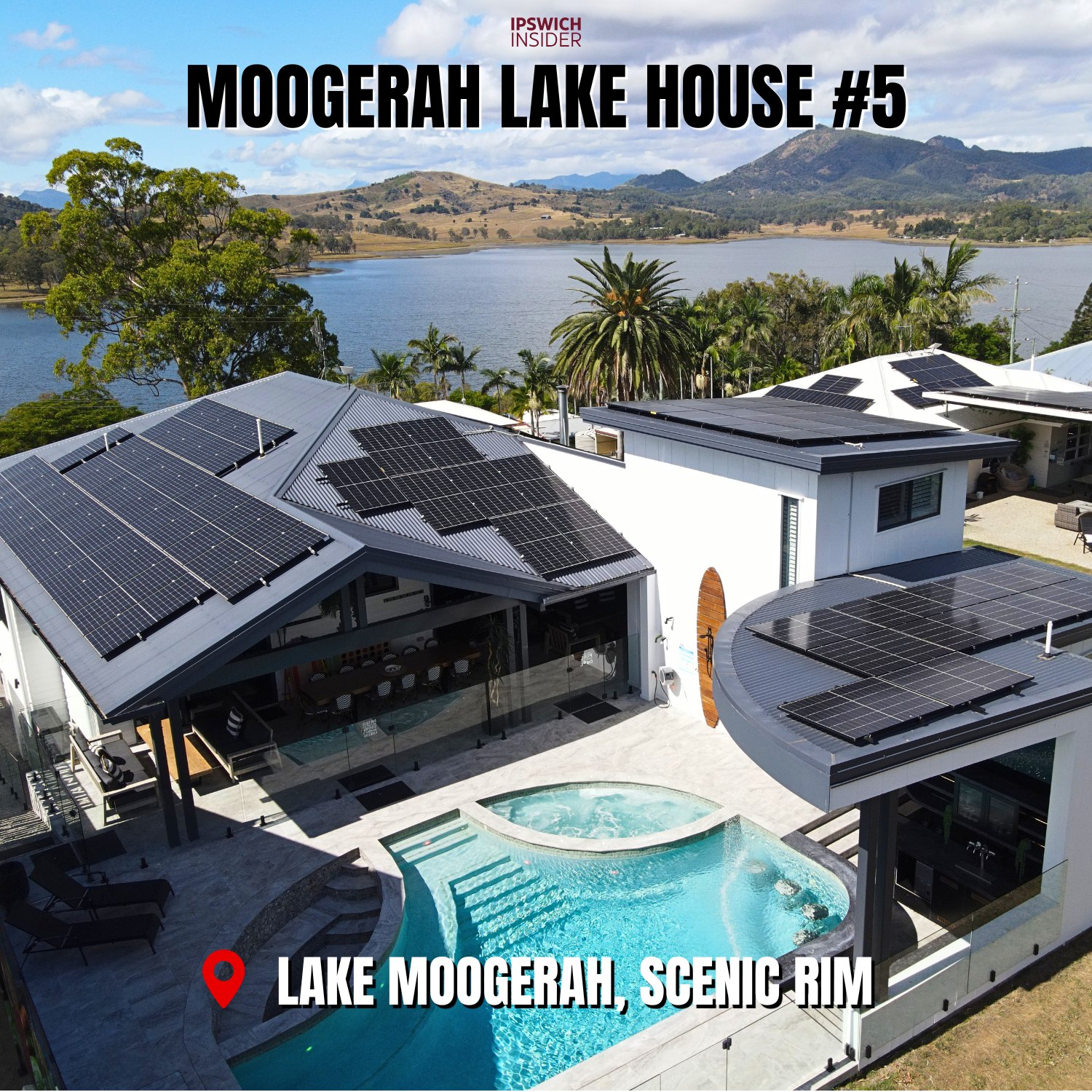
Did you know there are 5 Airbnbs behind Lake Moogerah dam wall? Yep. All owned by PowerCruise Gup. This is House #5.
CleanCo Tesla Megapack Battery
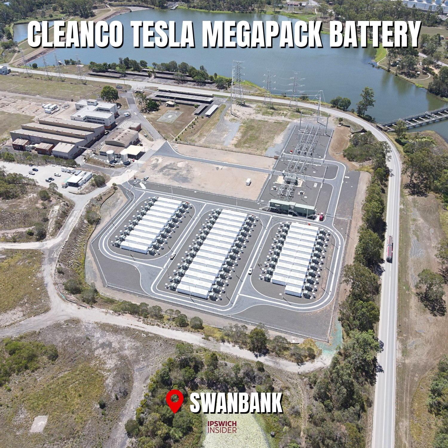
There’s a grid-scale battery at Swanbank. It’s 138 Tesla Megapack units connected to a new 275/33 kV substation. It cost CleanCo Queensland $330m and is 250MW. It sponges surplus daytime solar and releases it during night-time peak.
Swanbank Cooling Lake
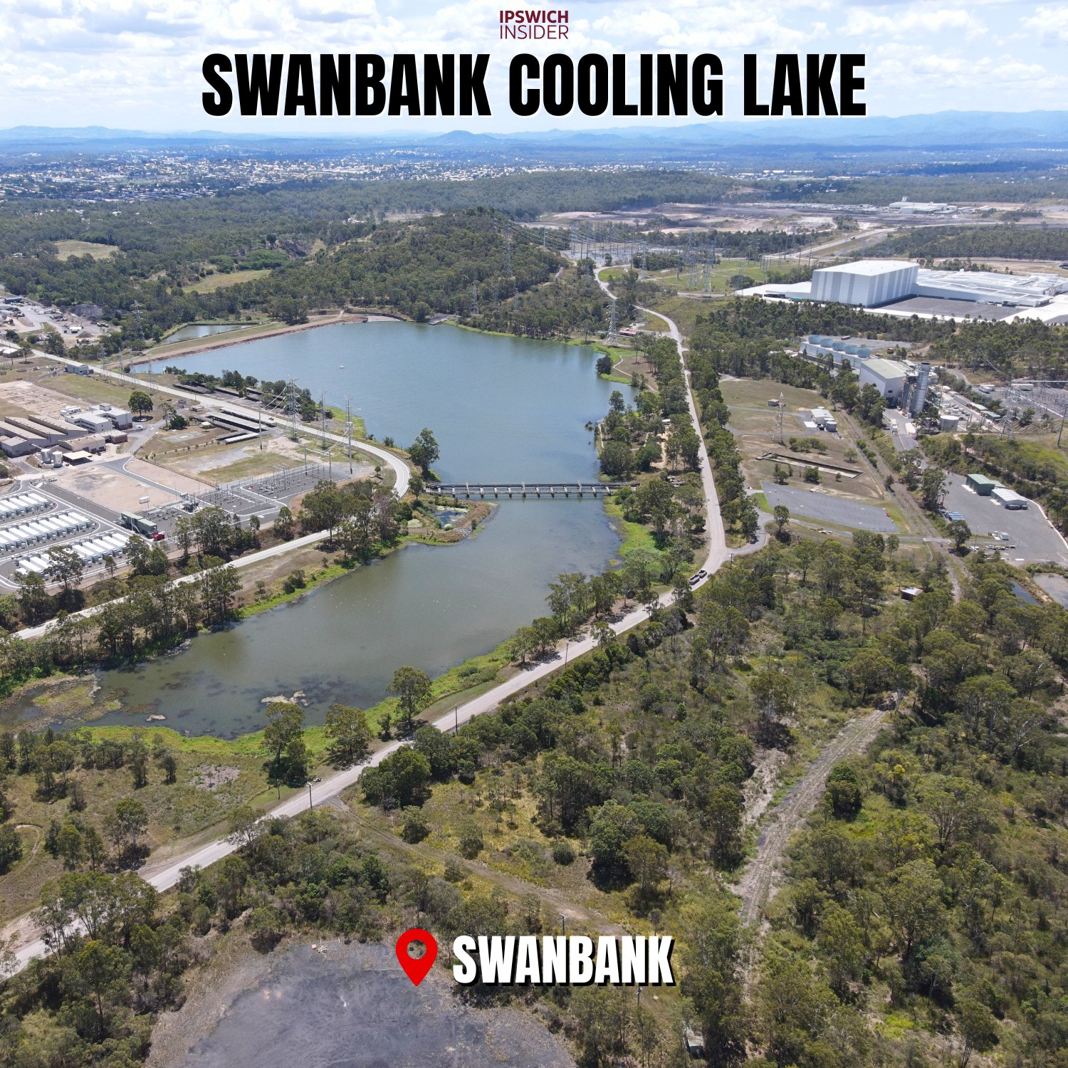
Swanbank Cooling Lake, part of the former Swanbank power station landscape beside Swanbank Road. There’s a pumping station at Yamanto (Berrys Weir) on the Bremer River to pipe water here (It’s true!).
Spring Mountain 30ML Water Reservoir

A 30ML potable water reservoir serving the Spring Mountain and Springfield growth area. It is the biggest single water reservoir concrete tank in Ipswich.
Orion Springfield Central
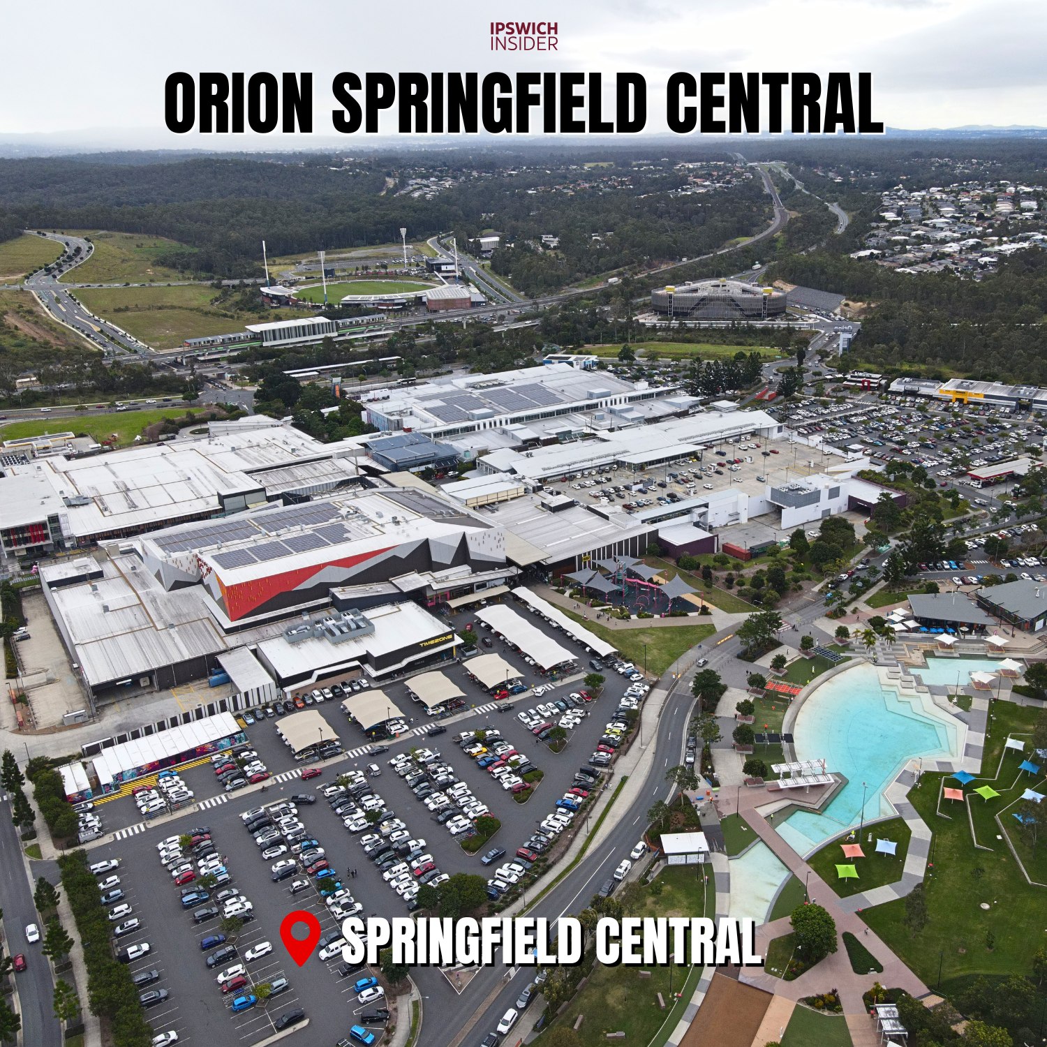
Orion Springfield Central, the major shopping and town centre precinct for Springfield Central. With Orion Lagoon shown in the foreground. The new Officeworks distribution centre at Redbank Motorway Estate has more floor area than all of Orion combined.
Mater Hospital Springfield

Mater Hospital Springfield, part of the growing health precinct at Springfield Central. It is Springfield’s first hospital with a maternity and emergency department. See the full drone video tour →
Robelle Domain Parklands

Robelle Domain Parklands is between Springfield Orion and the USQ Springfield Campus. It features Mountain Creek, 11km of boardwalks/walking pathways, and plenty of picnic and BBQ areas.
The Circle, Robelle Domain

The Circle at Robelle Domain, a circular amphitheatre and event space inside the parklands.
Ripley Police Station
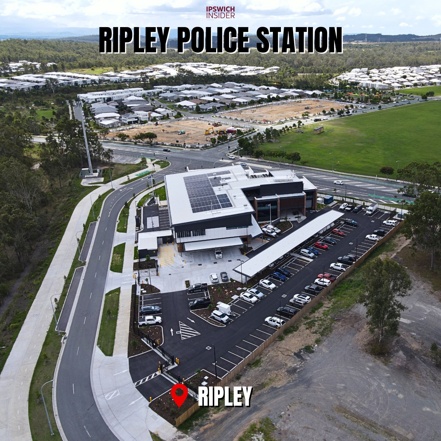
Ripley Police Station, a new police facility serving the Ripley and South Ripley growth area. It acts as the Ipswich District HQ, taking over from the crowded Yamanto Station.
Providence Town Centre
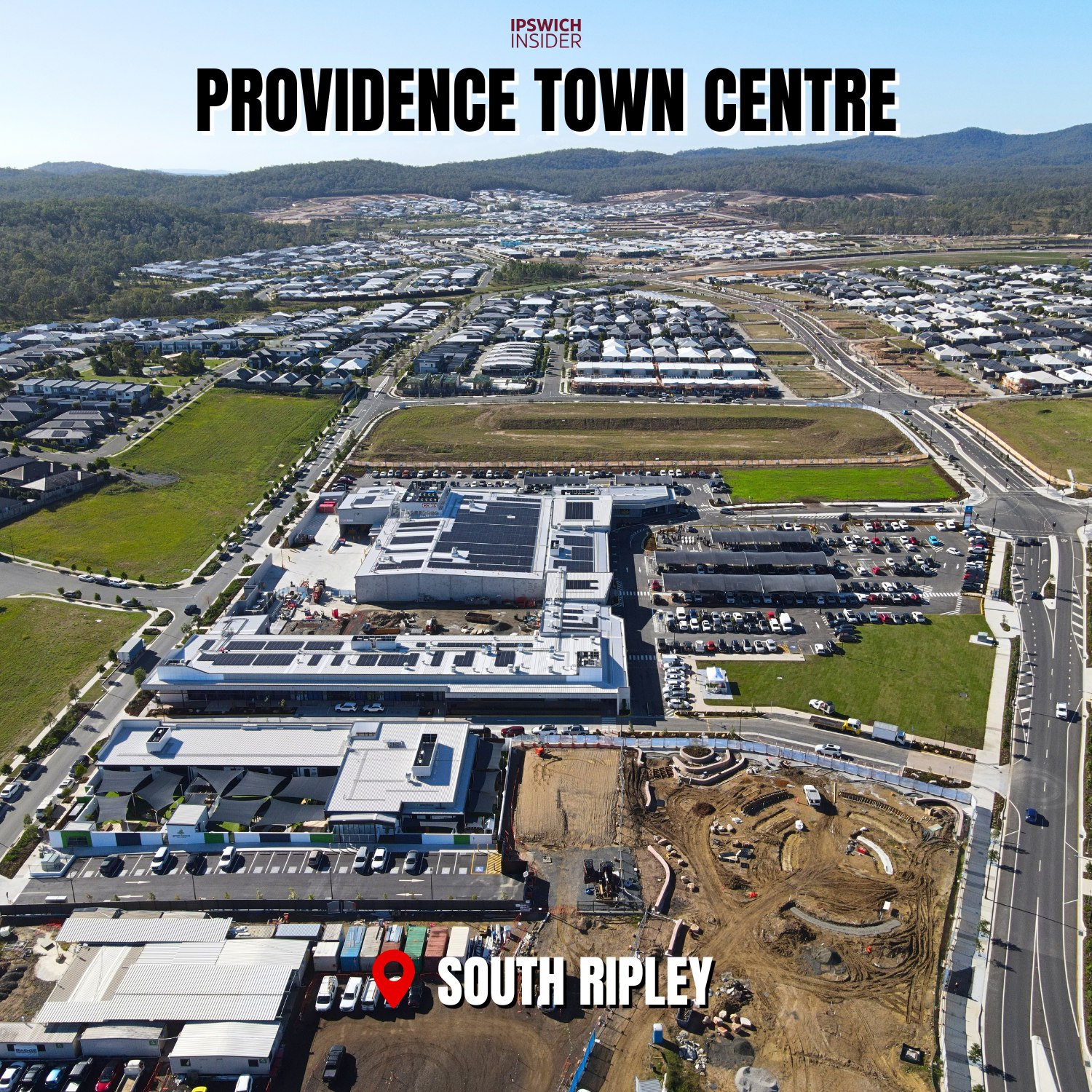
Providence Town Centre is the newly opened full-size shopping centre inside South Ripley. Residents no longer have to cross the Centenary to get some shopping done.
Ripley Town Centre

Ripley Town Centre, the main shopping centre and future commercial core for Ripley Valley.
Bremer River Bridge
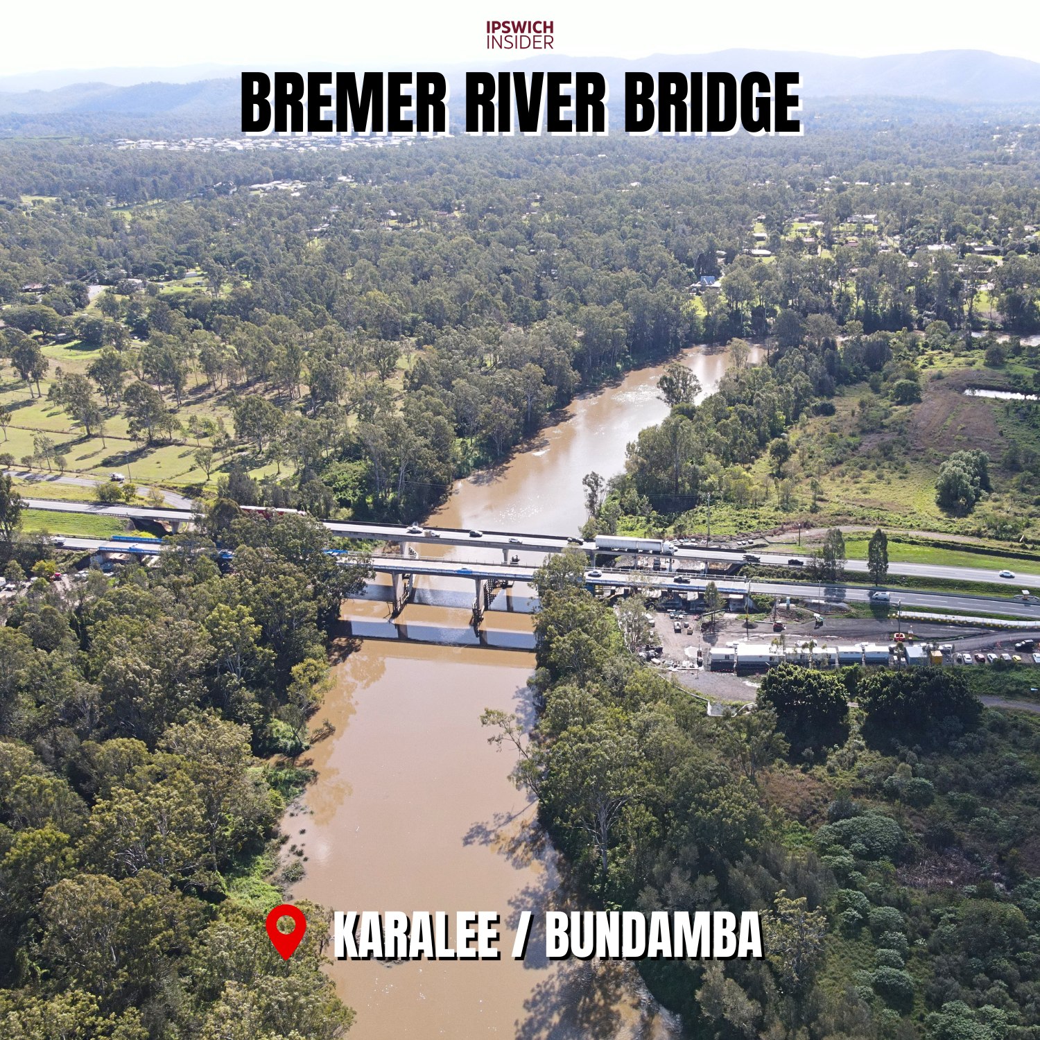
Bremer River Bridge, carrying the Warrego Highway across the Bremer River between Karalee and Bundamba. Currently undergoing strengthening works.
Bells Bridge / Kholo Bridge

Bells Bridge / Kholo Bridge, a Brisbane River crossing between the Kholo and Muirlea area. Brisbane Council calls it Bells Bridge while Ipswich Council calls it Kholo Bridge.
Victoria Tunnel
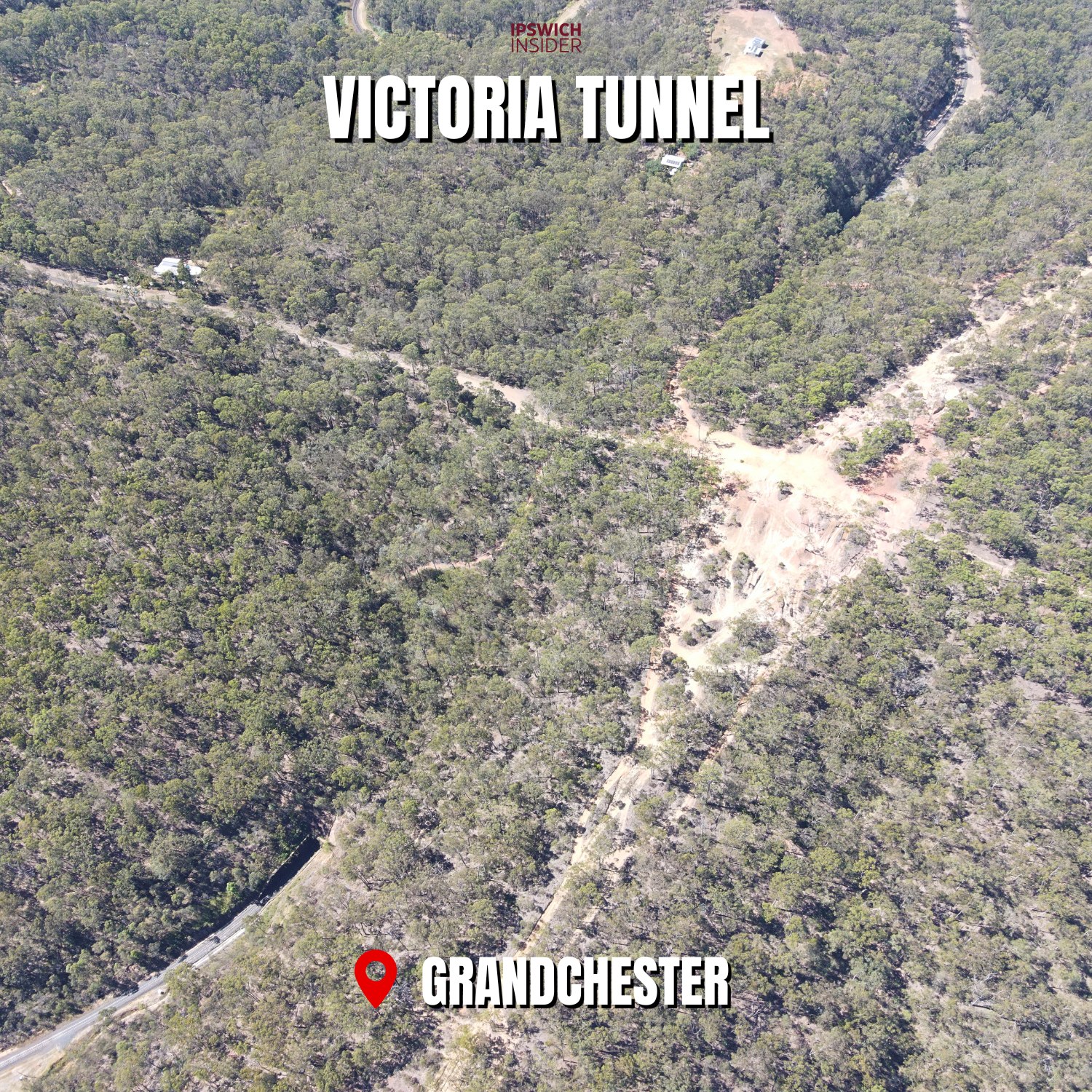
Victoria Tunnel is the oldest tunnel in Queensland. 537m through the Little Liverpool Range near Grandchester, built in 1866.
Redbank Motorway Estate

Redbank Motorway Estate, a major warehouse and logistics estate beside the Brisbane River at Redbank.
Carole Park Industrial Precinct
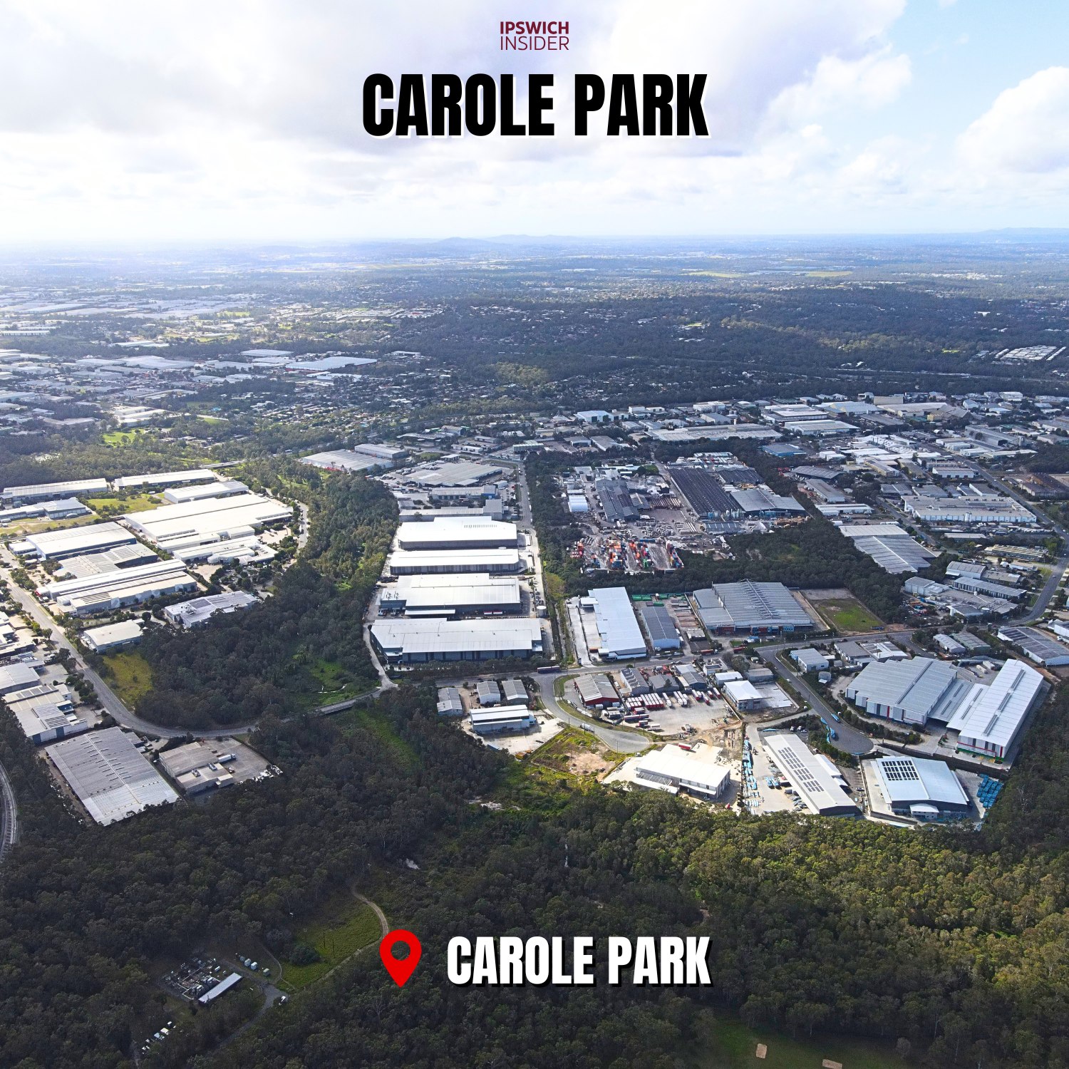
Carole Park Industrial Precinct, one of Ipswich’s established manufacturing and industrial areas.
Citiswich Business Park

Citiswich Business Park, a large industrial and logistics estate in Bundamba.
BrisWest Industrial Estate Earthworks

BrisWest Industrial Estate, currently in the earthworks stage near Redbank Plains Road and the Cunningham Highway.
New Chum Waste & Resource Recovery Precinct
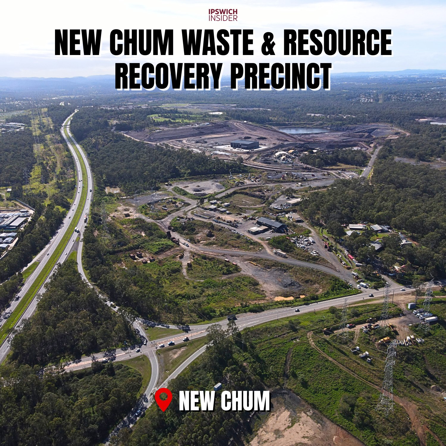
New Chum Waste & Resource Recovery Precinct, part of Ipswich’s waste, landfill and resource recovery corridor.
North Booval Riverfront
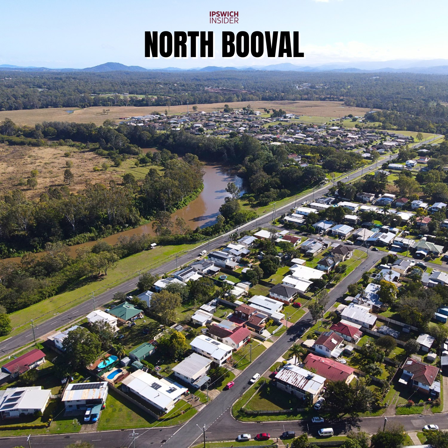
North Booval riverfront homes beside the Bremer River.
Moores Pocket River Bend
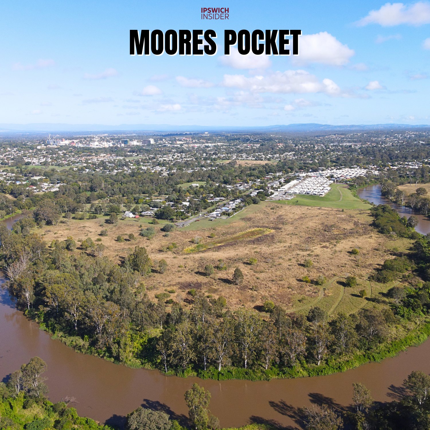
Moores Pocket, a Bremer River bend north-east of Ipswich Central.
Bundamba Sewage Treatment Plant

Bundamba STP, the sewage treatment plant serving part of the Ipswich area.
Bundamba Racecourse

Bundamba Racecourse, home of the Ipswich Turf Club and the Ipswich Cup.