

Ipswich Riverport History at a Glance:
- Why here: Ipswich grew at the furthest point larger riverboats could reach from Brisbane. Rocks blocked the way upstream. Just downstream of today’s Bob Gamble Park, the wider part of the river called The Basin gave paddle steamers room to turn around.
- Rail changed trade: Ipswich’s port made it the start point for the railway inland. Trains brought Darling Downs wool through Victoria Tunnel to Ipswich. Riverboats took it on to Brisbane for shipping overseas. When rail reached Brissy in 1875, goods could skip that boat trip.
- Coal carried on: Coal barges kept using the Bremer long after the paddle steamers. They carried coal from Tivoli to export facilities at the Port of Brisbane. That trade ended in April 1998.
🔢 By The Numbers
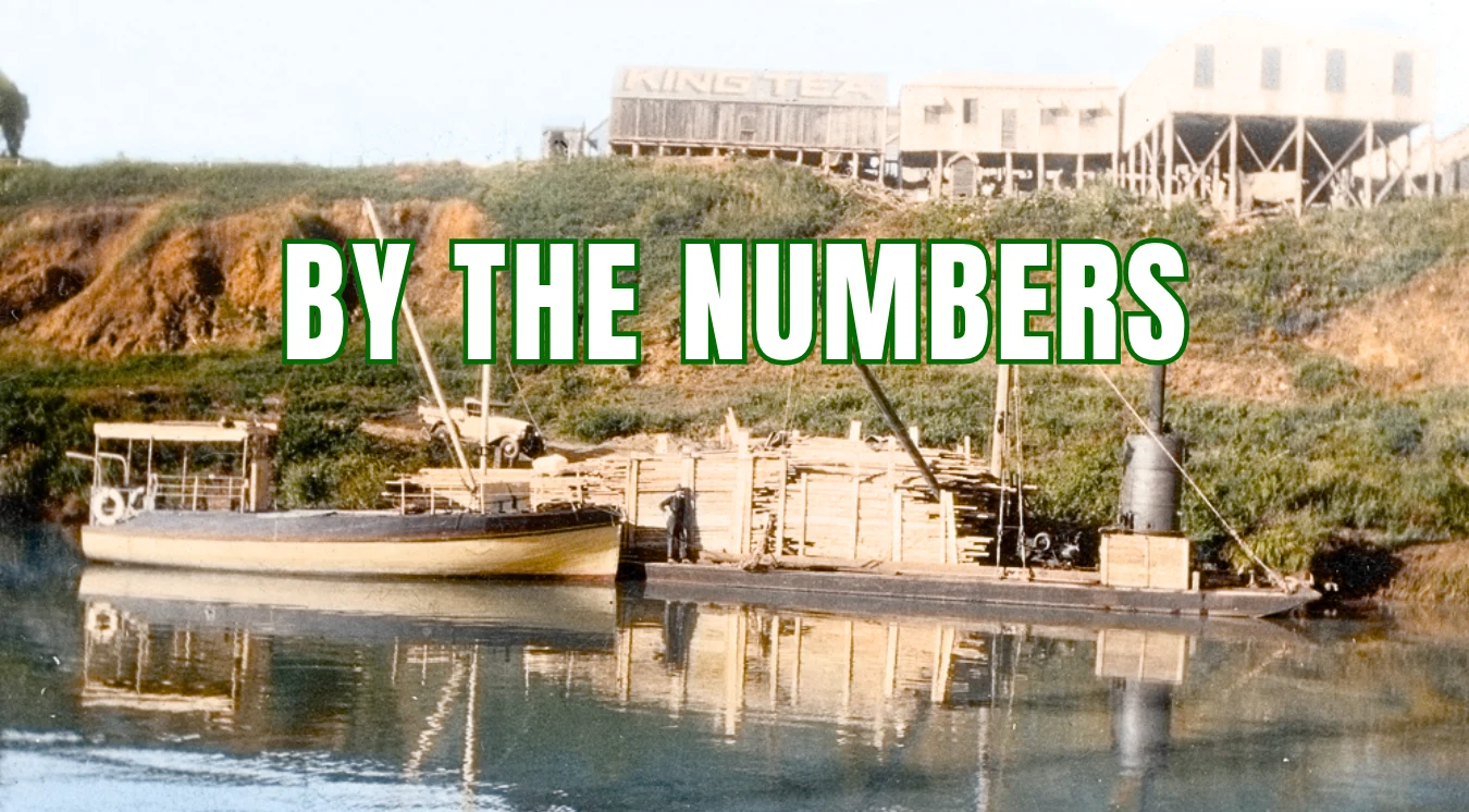
- 1827 – Ipswich’s convict lime-burning outpost begins operating
- 1865 – Queensland’s first railway opens from Ipswich to Grandchester
- 25+ – different steamers serving Ipswich across the full 1846–1875 period
- ~7 hours – average Brisbane–Ipswich journey aboard the steamboat Experiment
- ~10,000 – wool bundles reaching Ipswich each season, early 1860s
- 110 workers – North Ipswich woollen mill workforce by 1885
- 274 workers – Hancock’s workforce, including wagon drivers and loaders, in 1885
- ~30 metres – Bell Street swimming pool’s length when opened in 1921
- 70 metres – length of later coal barges pushed along the Bremer
- 1998 – coal barging on the Bremer ends in April
You ever wonder why Ipswich is where it is?
Next time you cross the David Trumpy Bridge, look down at the Bremer. That was once a busy route for people, wool and supplies.
These colourised old photos take you back to that time. The time when Ipswich was a thriving river port linking the Darling Downs with Brisbane and the sea.
Let’s jump right in.
Jump To:
- Town Wharves
- River & Rail Route
- The Basin
- The 1842 Town Plan
- Bremer–Brisbane Junction
- Experiment’s First Trip
- Paddle Steamer Ipswich
- Tides & Eclipse
- Emu & Wool
- Railway Wharf
- The Brisbane Railway
- Hancock’s Sawmill
- The Woollen Mill
- Essex Deliveries
- Timber Boats
- Bell Street Baths
- Dinmore Coal Boats
- Ford’s Coal Boat
- The Last Coal Barges
- Find the Port Today
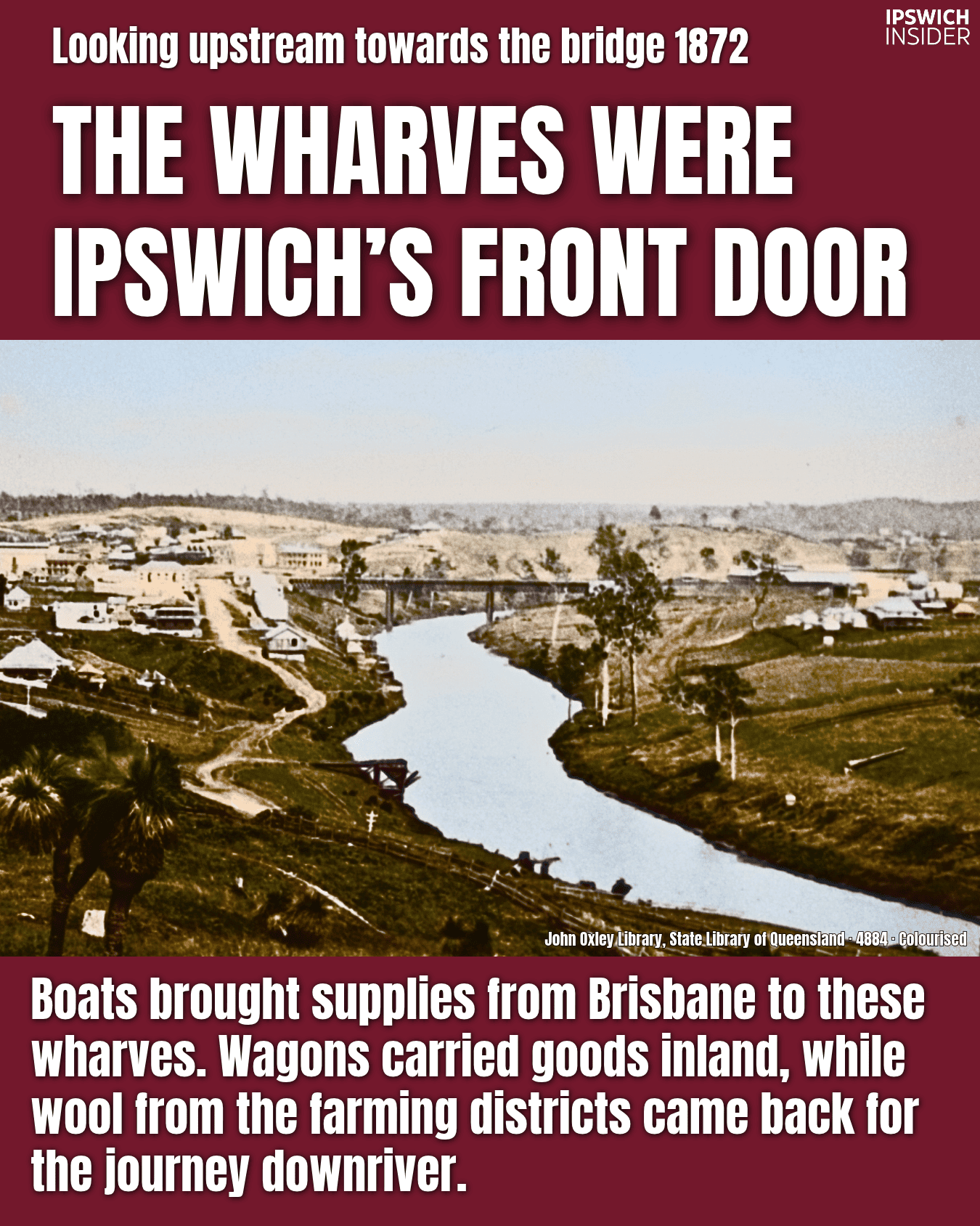
The wharves were Ipswich’s front door
More details
Did you know Ipswich had its own customs house?
Goods from overseas came through here, with tax to pay before they could leave the warehouse. [1]
Ipswich was officially part of the Port of Moreton Bay
- On the books: The Port of Moreton Bay was extended to Ipswich on 29 September 1860. Approved boats could bring goods here before the import tax was paid.
- A customs house: Plans went out to builders in 1863. The building stood near the railway bridge on the town side. The customs officer lived next door (customs house was demolished in 1914).
- The town side: Look to the left of this 1872 photo. The wharves and warehouses stood on that bank, across from today’s Riverlink.
You can walk along all this area at Riverheart Parklands (when its not closed for flood repairs).
The inland’s way to the coast
More details
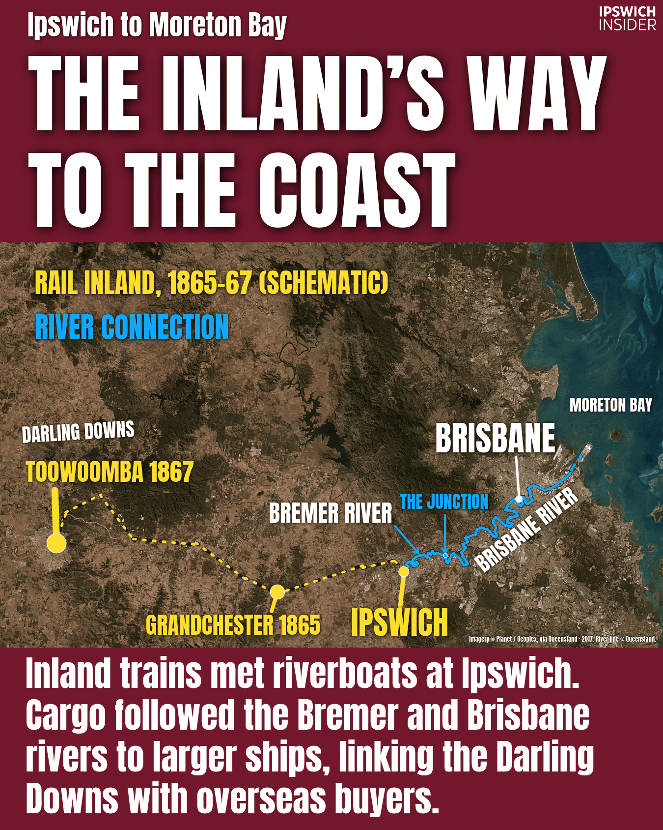
You ever wonder why Queensland’s first railway started in Ipswich?
Boats already linked us with Brisbane. The harder trip was between Ipswich and the farms inland. So the first railway headed west, reaching Grandchester in 1865.
Ipswich became the place where goods switched between boats and trains and trains and boats. [2]
Why goods changed hands here
- Two-way trade: Boats brought supplies to Ipswich for the farms inland. Wool and other farm goods came back through Ipswich, then went by boat towards Brisbane and the coast.
- Grandchester first: The first line opened on 31 July 1865. You could travel from Ipswich to Bigge’s Camp, now Grandchester in an hour.
- Toowoomba second: A wagon load of wool could take around 7 days from Toowoomba to Ipswich. When rail reached Toowoomba in 1867, the trip took around 5 hours.
Ipswich was (is?) the linchpin between the coast and the rich farming lands of the Darling Downs.
It began with lime boats
More details
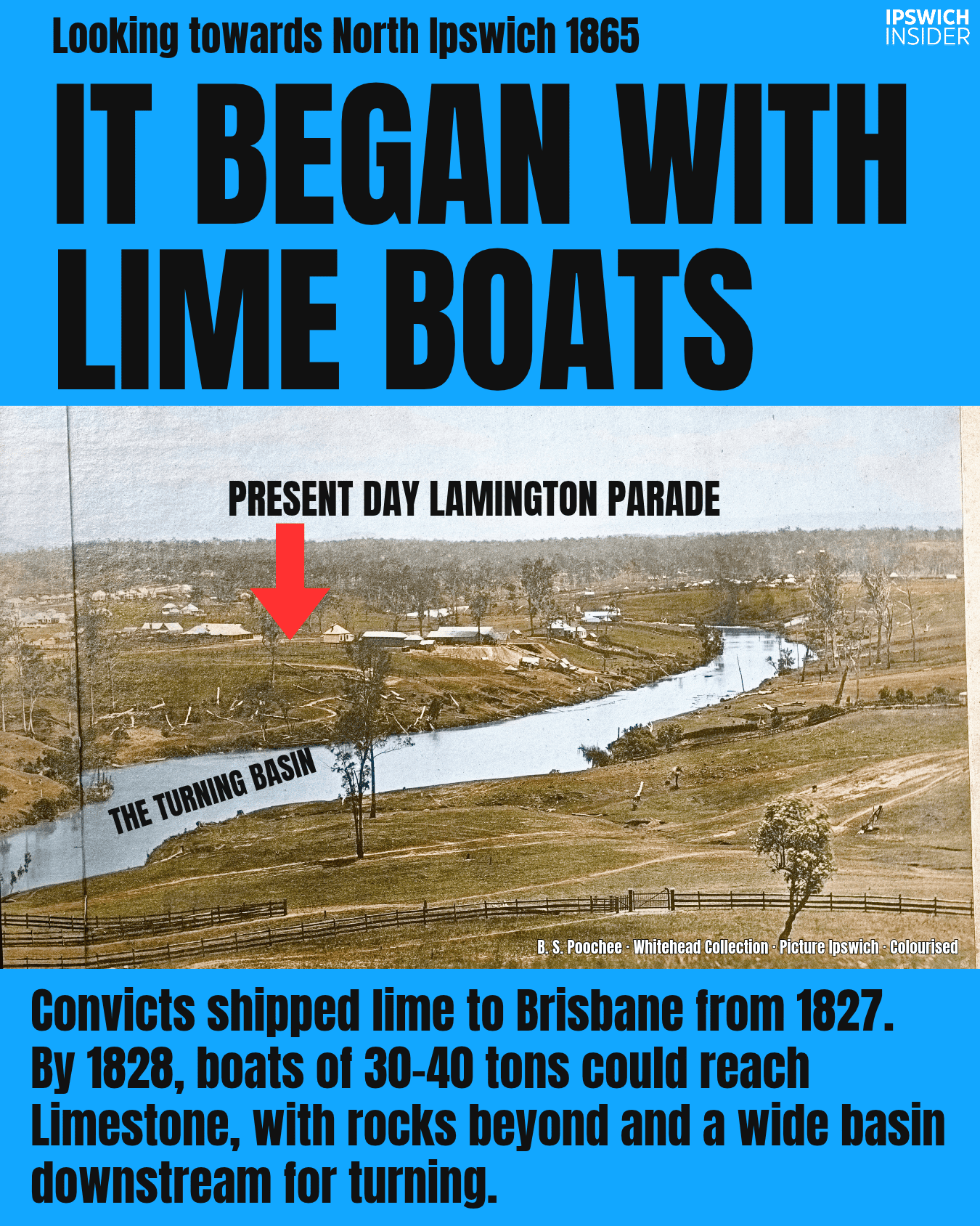
The lime boats were here long before the trains. Look near Claremont (a heritage house) today and you’re close to where that first trade began. [3]
Lime boats and the river
- Lime for building: Convicts dug up limestone and heated it in a kiln to make lime for mortar. The kiln stood just inside what became the Claremont property, with a small wharf below for boats heading to Brisbane.
- Rocks ahead: In 1828, Allan Cunningham said boats of 30–40 tons could reach Limestone. Rock ledges lay just beyond it. For those bigger boats, this was as far as they could go.
- Room to turn: Cunningham described The Basin downstream (near Bob Gamble park) as more than 100 yards wide. Boats could turn or anchor in that wider stretch of river.
A town took shape around the wharves

More details
Why put the town on this bend? The people choosing the site had to think about boats, roads, drinking water and floods. [4]
Finding the right spot
- Floods already mattered: George Thorn’s cottage had nearly flooded in 1841. Surveyor Henry Wade needed land close to the river but high enough to build on.
- The CBD: Wade laid out the street grid where the CBD sits today. He also marked out garden blocks at Little Ipswich, now West Ipswich, beside the road inland.
- The first buyers: Ipswich’s first land sale took place in Brisbane in October 1843. By the end of 1844, the town had hotels, a wool warehouse and a blacksmith.
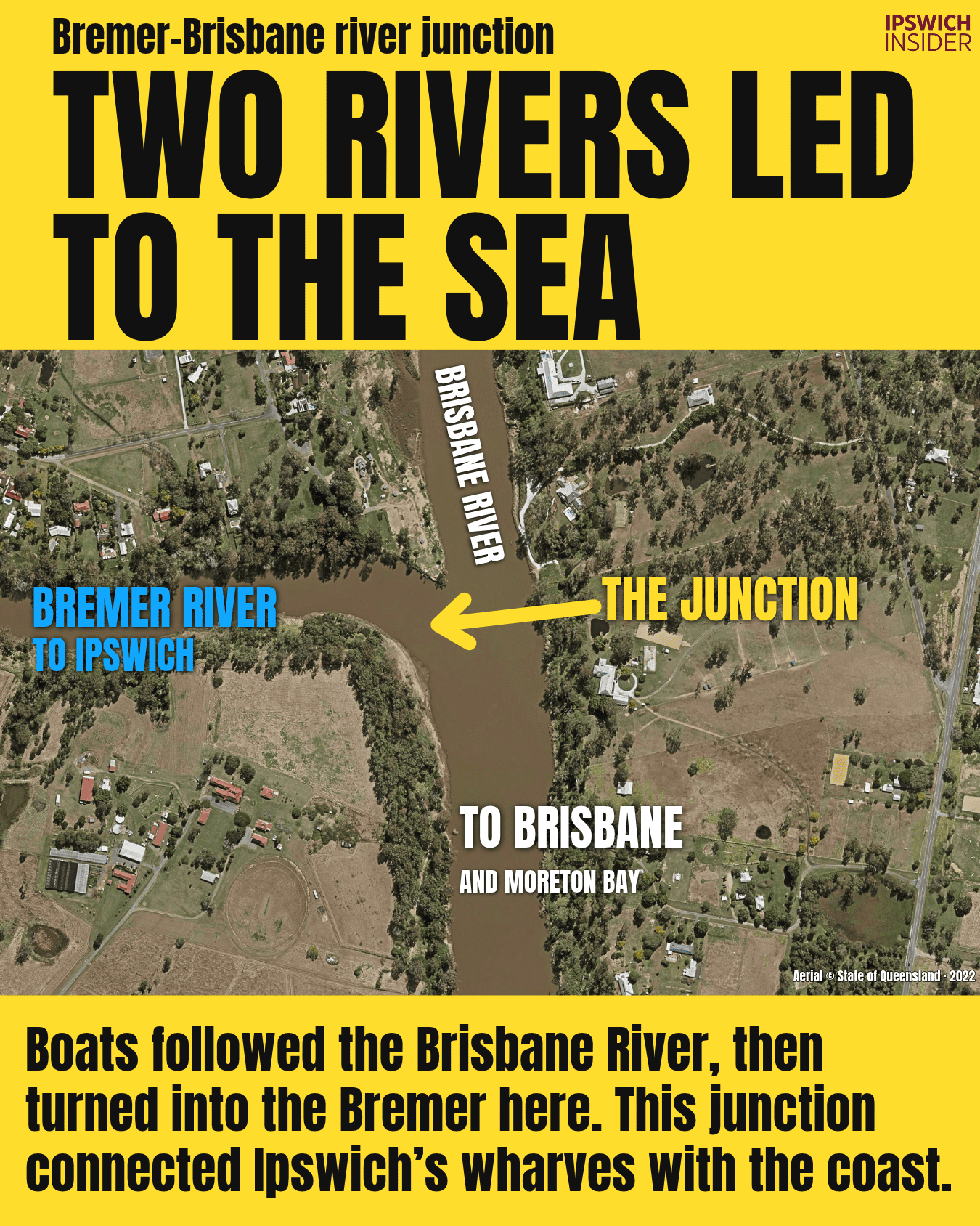
Two rivers linked Ipswich with the coast
More details
Follow the Bremer downstream on this map. This is where your boat would turn into the Brisbane River for the trip to the coast. [5]
How goods reached the sea
- Two rivers: Boats left Ipswich along the Bremer, then followed the Brisbane River towards Brisbane and Moreton Bay.
- Changing boats: Goods moved between small riverboats and larger ships. Ipswich traders wanted fewer stops to unload goods and deal with customs on the way to town.
- Digging out mud: In 1904, crews cleared the shallow water at the junction. This helped the barges get through. Many were carrying coal.
Head to Joseph Brady Park to check out The River Junction today.
Steam turned days into hours
More details
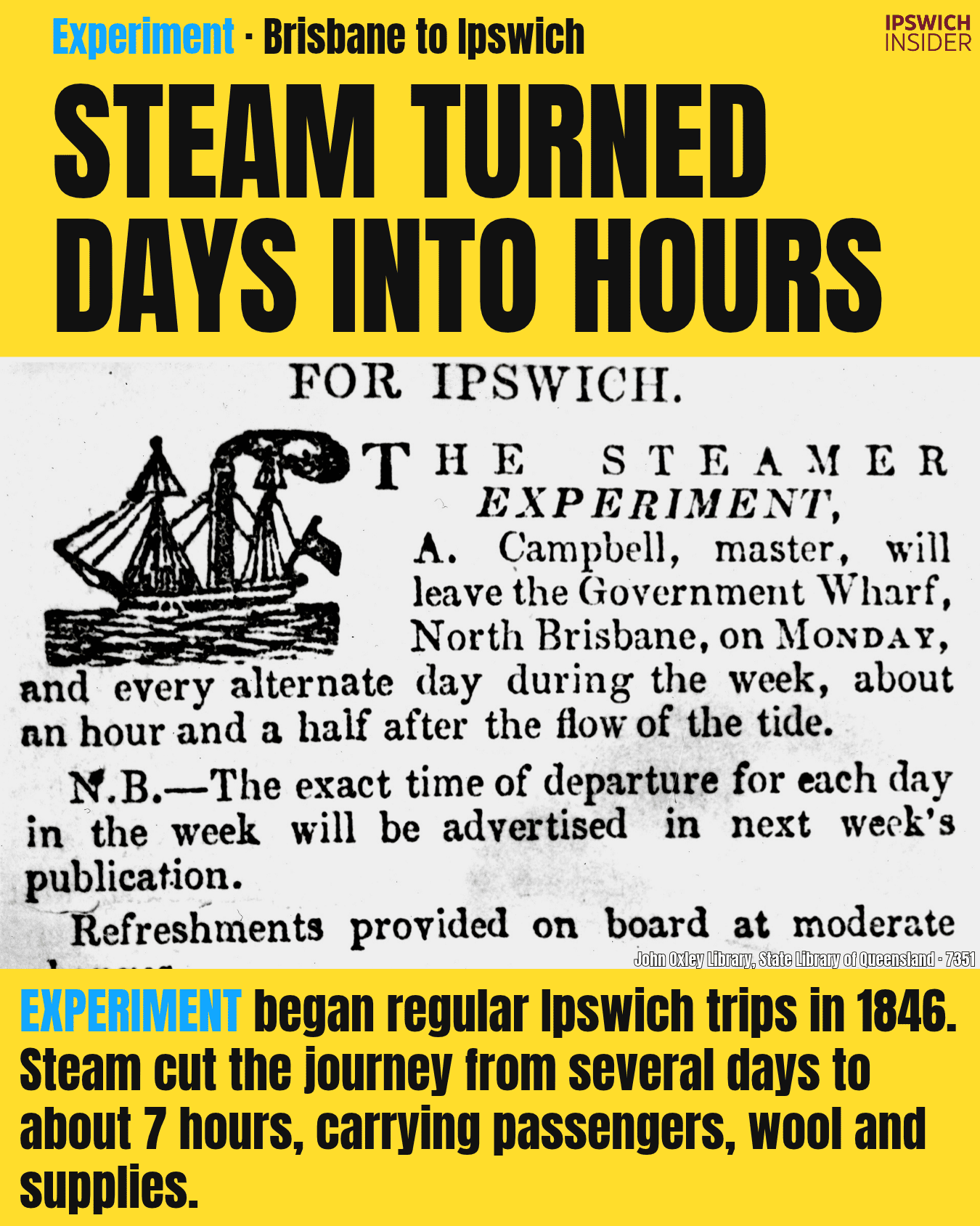
You ever heard about Experiment’s first trip to Ipswich? It got stuck near Goodna and spent the night waiting for the tide. [6]
The first trip ran late
- 17 June 1846: Experiment ran onto a mudbank. Its pilot didn’t know the river well enough, so the boat had to wait until it could float free.
- A noisy welcome: It reached Ipswich at 1pm the next day. A crowd was waiting, and someone played the bagpipes to welcome it.
- Around 7 hours: That became Experiment’s average trip between Brisbane and Ipswich. The old boats without engines could take several days.
7 hours beats 2 days!
The boats adapted to the Bremer
More details
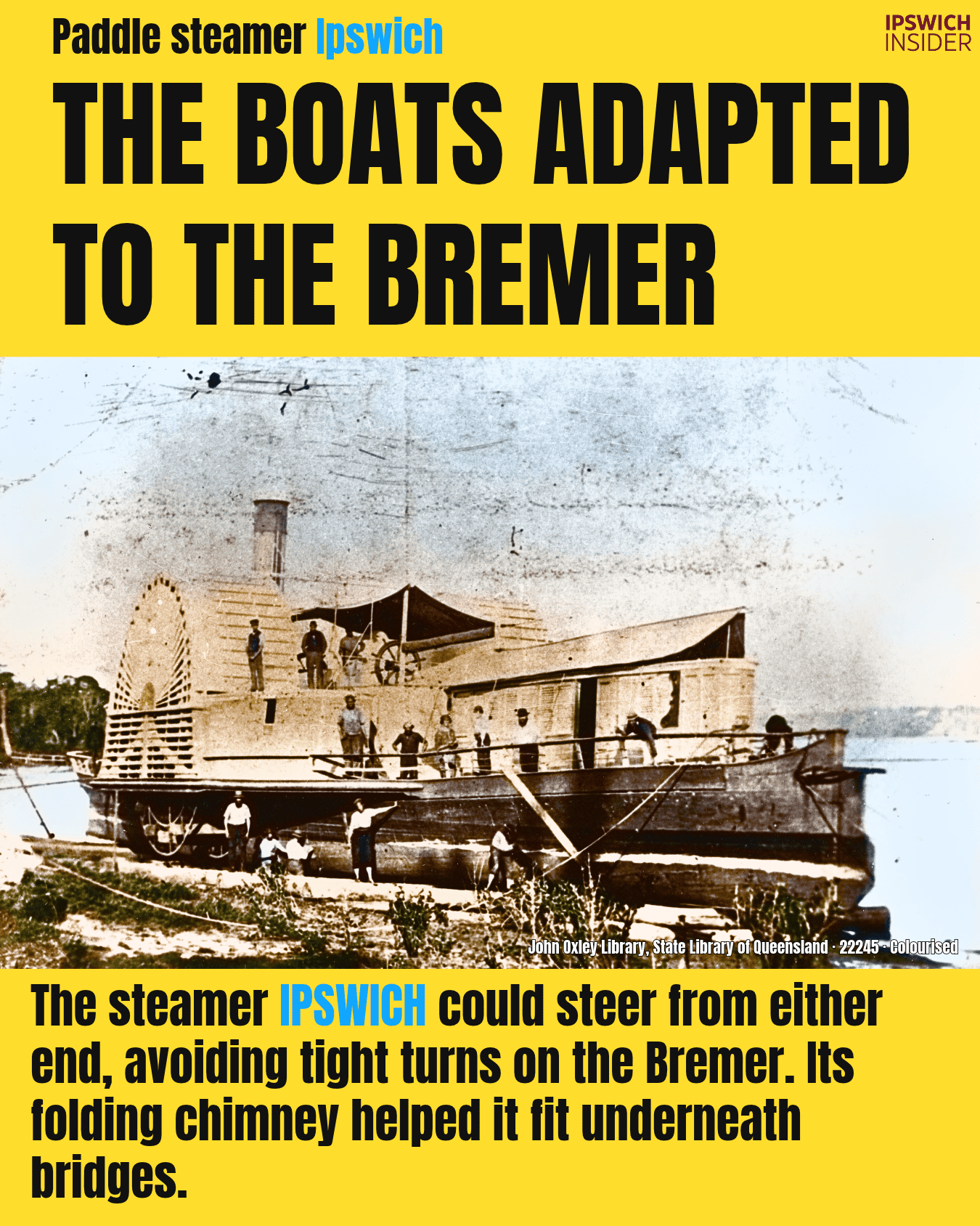
How do you turn a 45-metre boat in a narrow river? The paddle steamer Ipswich had a simple answer: steer it from either end. [7]
A boat made for this river
- Two rudders: Ipswich could change direction without turning its full length around. The steamers Brisbane and Emu could do the same.
- A folding chimney: Ipswich got one in 1865, after the idea worked on Brisbane. The crew lowered it to fit under bridges.
- A fast race: Ipswich once beat Breadalbane from Brisbane in 3 hours and 12 minutes. That was a race, so don’t read it as the normal trip time.
What a great idea!
But the tide still set the pace
More details
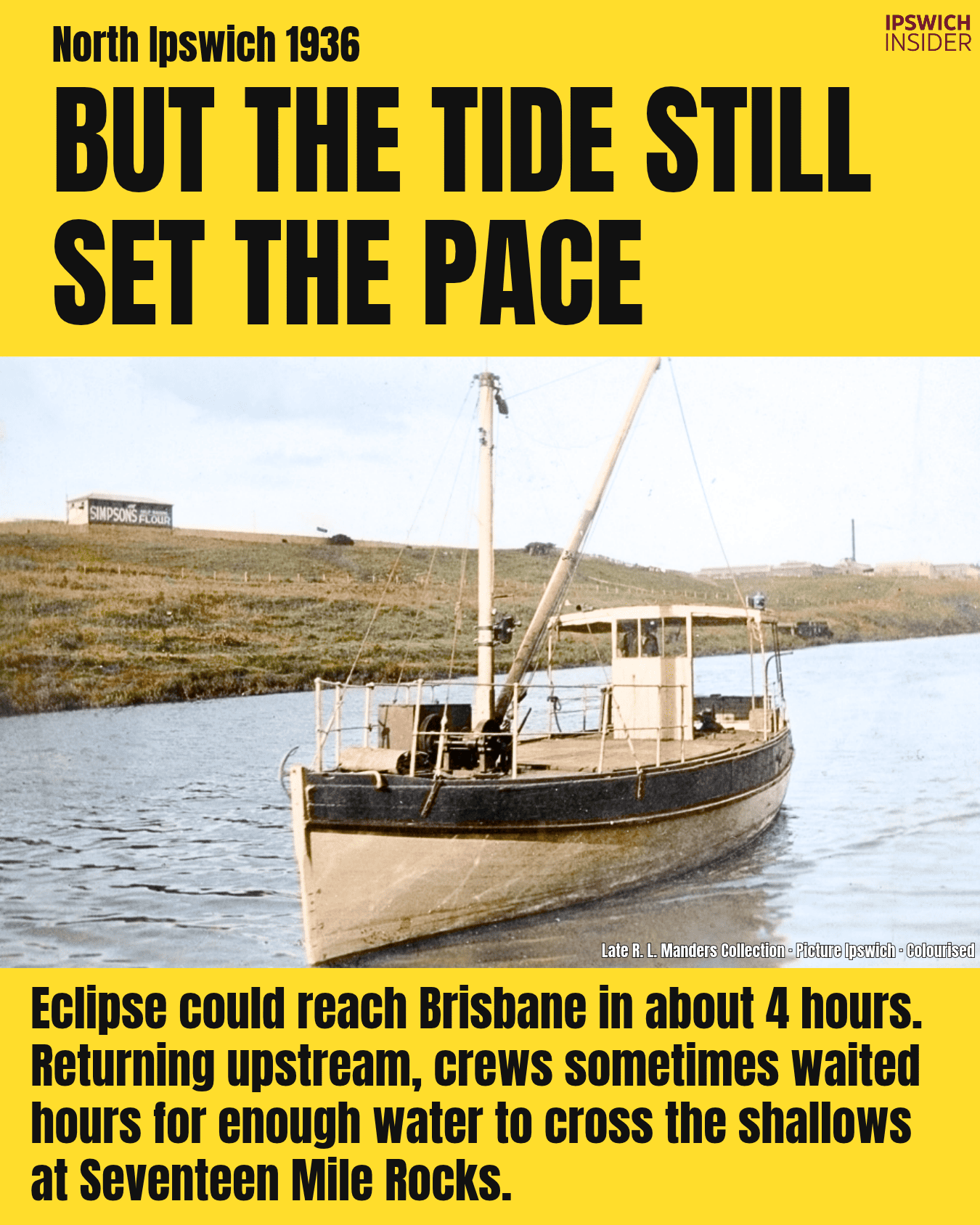
Your trip back from Brisbane could start with a long wait. On Eclipse, being ready to leave didn’t mean the river was deep enough. [8]
A day on the boats
- A crew of two: Eclipse and Percy Manders’ boat Bremer left Ipswich early on alternate days. They reached Brisbane’s Short Street wharf around four hours later.
- Waiting for water: The crew was usually ready to head back by 4pm. Sometimes they waited hours for enough water over Seventeen Mile Rocks.
- Follow that tree: Manders wrote directions using trees and rocks. One told skippers to look for a board nailed to a gum tree, with a large rock at its base.
Would you want to do a river cruise from Hamilton to Ipswich?
Wool left for the world

More details
Look behind Emu at the warehouses up the bank. Those buildings held wool heading overseas, while the boat had room for passengers too. [9]
Wool and passengers
- 10,000 bundles: Around that many packed bundles of wool reached the wharves each season in the early 1860s. They came from farms inland.
- Down the ramps: Some traders had a shed near the wharf and a bigger warehouse uphill. Machines pressed the wool into tight bundles. Wooden ramps took it down to the boats.
- A comfortable trip: You could book first or second class. There were dining rooms and a deck to walk along. The first-class dining room had paintings on glass.
What a cool history Ipswich has!
Rail fed the port
More details
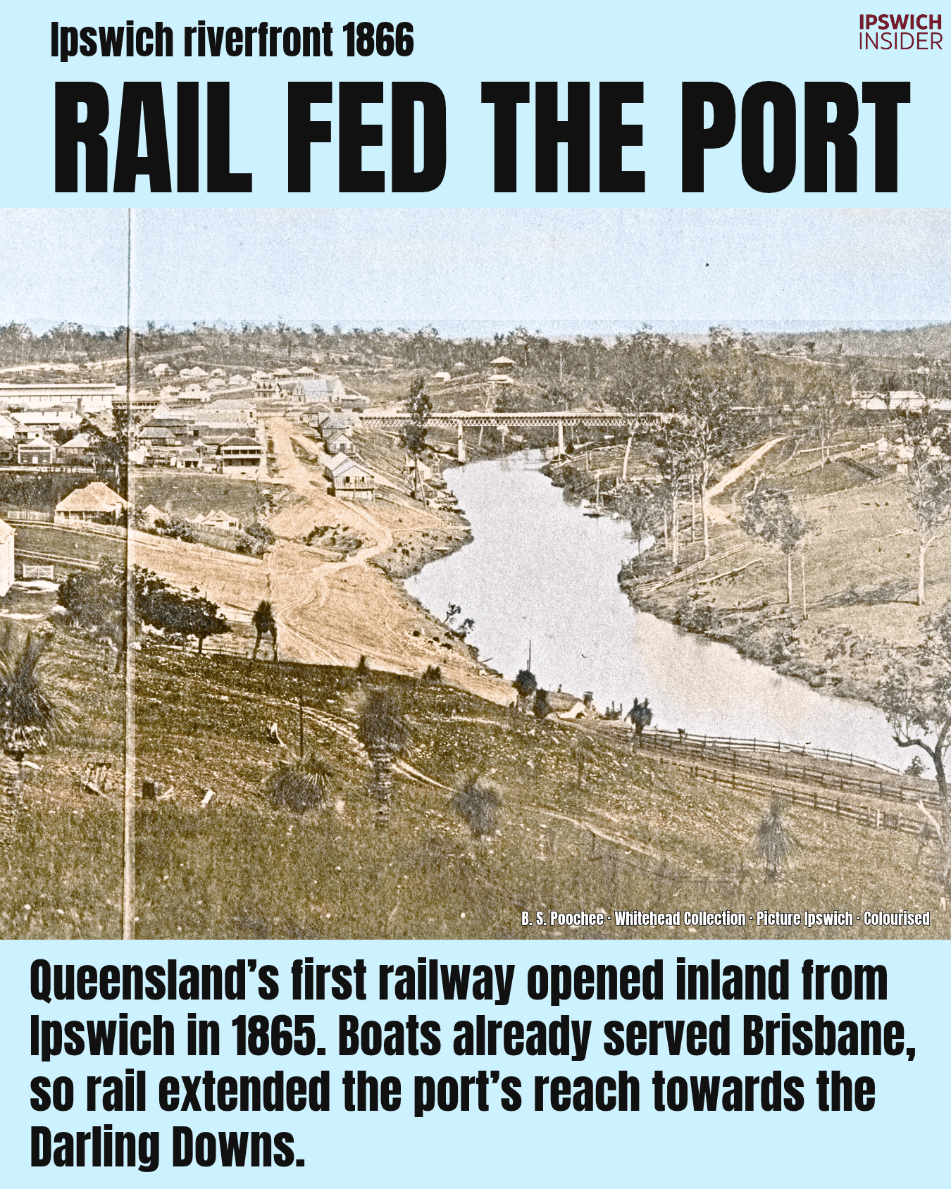
Before you could catch a train here, boats had to bring the train parts up the river. They brought the iron bridge parts too. [10]
The railway came by boat
- Train parts: Engines, carriages and building supplies came from Britain by ship. Steamers and barges brought them to Ipswich. Workers put them together at the workshops on today’s Riverlink site.
- Bridge parts: The first road and rail bridge was made in sections in England. Its iron parts came up the Bremer before the bridge was built in 1864–65.
- Straight to work: A wharf was built on the north bank in July 1864, below today’s sports fields. A short rail line took goods from there to the workshops.
Then rail took business away
More details
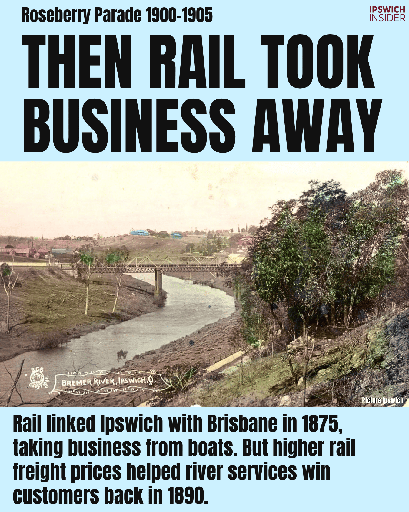
From 1875, you could send goods between Ipswich and Brisbane by rail. But higher train charges and a washed-away bridge would bring work back to the boats. [11]
What changed after 1875
- Trains to Brisbane: Goods no longer had to change between boat and train at Ipswich. Customs house funding was cut by 1878. It later closed and was pulled down in 1914.
- Cheaper by boat: Higher rail charges helped river freight in 1890. Cribb & Foote hired Louisa to bring flour, potatoes and groceries. It went back with corn.
- The 1893 flood: The Indooroopilly rail bridge washed away. Boats helped get goods to Ipswich for trains heading west. The new bridge opened in August 1895.
But industry still needed the river
More details
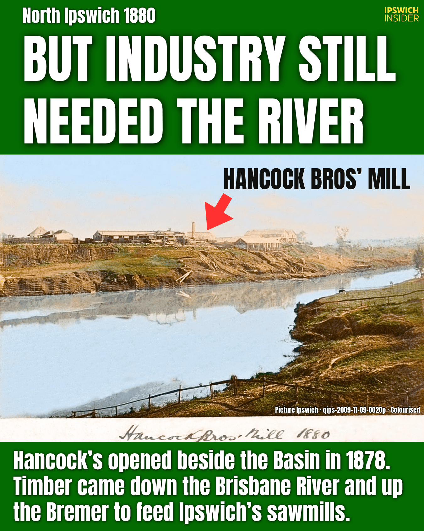
Hancock’s built railway wagons and carriages as well as cutting timber. Hundreds of people helped keep the North Ipswich business running. [12]
Work at Hancock’s
- 274 workers: The firm had 138 employees by 1885. Add the people driving the teams and loading goods, and the total reached 274.
- Floating rafts: Logs were chained together and guided down the Brisbane River, then up the Bremer. Rafts tied beside the mills could swing out and block passing boats.
- Trains as well: Hancock’s used a branch of the old wharf railway to move logs and timber. It stayed in use into the 1980s.
Did you know that huge abandoned concrete pad along the eastern shores of North Ipswich was Hancock Bros’ Sawmill?
Wool became cloth beside the Bremer

More details
You ever wonder what happened inside the woollen mill? Workers washed, dyed and dried the wool here before it became cloth for blankets and clothing. [13]
From wool to cloth
- Steam power: The mill started making cloth in October 1877. Its machines came from England and ran on steam. The saw-tooth roof let daylight into the building.
- 110 workers: That was the total by 1885. Many were women. Children also worked at the mill in its early years.
- Uniform orders: Police and railway uniforms brought in work. By 1890, the mill was making money. It bought more machines and added new brick buildings.
The Woollen Manufacturing Company building still stands beside North Ipswich Reserve. It is Queensland Heritage Register protected and not used for anything. What should they do with it?
And the boats kept delivering

More details
Even the sugar for Ipswich soft drinks came by boat. Essex was part of William Collin & Co’s service to local shops and factories. [14]
Deliveries and delays
- Soft drink supplies: Sugar and other goods for Livermore’s factory were common loads. A wooden crane lifted them from the boats.
- Too shallow: Essex got stuck for an hour in 1920. By 1922, it struggled to turn even at high tide. Crews kept digging mud from the riverbed.
- Road deliveries: More goods went by road while the boats struggled. In 1926, Essex could no longer get alongside the wharf. Collin & Co stopped serving Ipswich within another year.
Timber still came by water
More details
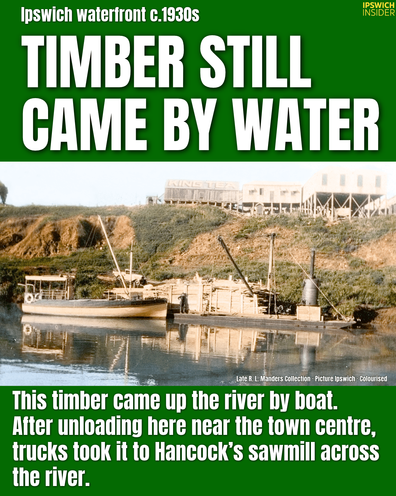
Getting timber to Hancock’s could mean using both a boat and truck. Percy Manders ran both, and some loads went straight from the river to the mill. [15]
Regular loads to Ipswich
- Unloading the timber: Timber was unloaded near the town centre, then taken across to Hancock’s by truck. Other loads went straight to Hancock’s using a flying fox, a cable system that lifted timber from the boat to the bank.
- Three trips: Manders bought Eclipse in 1932. His service made three trips each way every week, carrying 18–20 tons of goods. Boats towed hired barges for bigger loads.
- Another Bremer: A food-delivery boat called Cowslip joined as Bremer in 1936. Keep that name in mind. The Ford-built coal boat later in this story was a different Bremer.
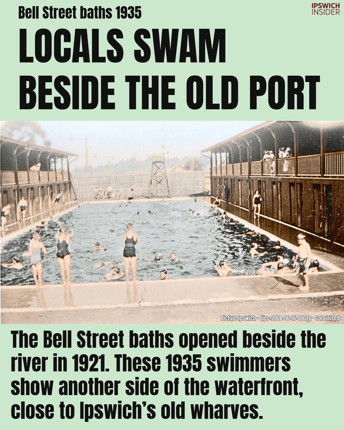
Locals swam beside the old port
More details
Can you picture a public pool at the river end of Bell Street? That’s where these swimmers were in 1935, close to the old town wharves. [16]
A swim in the middle of town
- Opened in 1921: The pool was built at Bremer Park beside the Bremer in January. It was around 30 metres long.
- Changing the water: The whole pool was emptied and refilled two or three times a week. Council later looked at cleaning the water after tests found high ammonia levels.
- Near St Mary’s: Council built baths there in 1865. They washed away in the 1887 flood and were rebuilt. The Bell Street pool later took their place.
Bring it back?
Coal kept the river working

More details
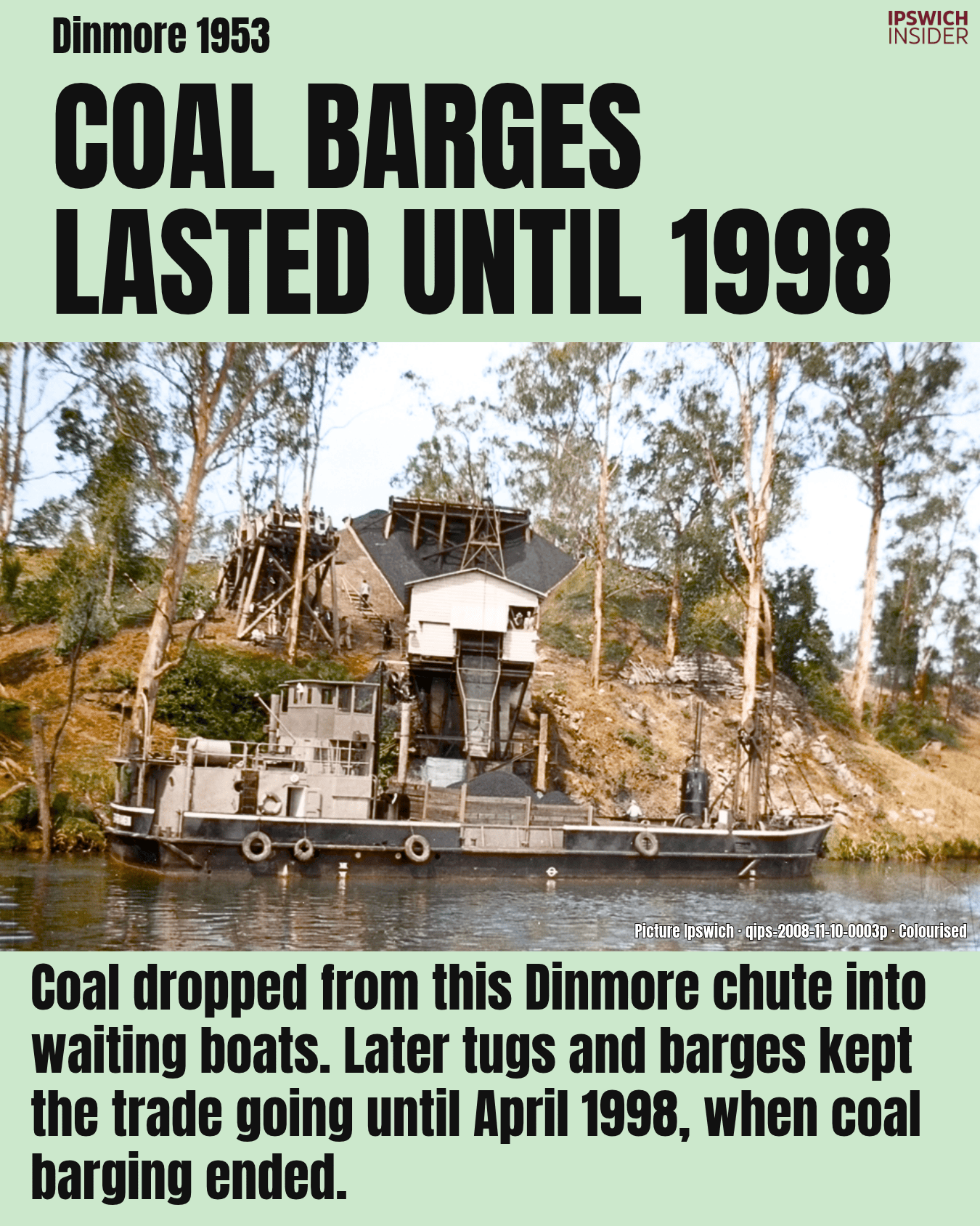
You’re looking at Dinmore in 1953. Coal boats were still working the Bremer long after the old paddle steamers had gone. [17]
The port story went beyond the CBD
- Dinmore and Tivoli: Westfalen loaded coal at Dinmore. Moreton and Rylance had loaders near the end of Church Street at Tivoli.
- Load and leave: A quick load helped the boat leave while the river was high. If you missed the tide, you could face a long wait.
- Rocks in the way: Seventeen Mile Rocks caused trouble for loaded coal boats too. The rocks were removed in 1965.
Can you still see the remnants of the old Church St loaders?
A Ford carried Ipswich coal

More details
A Ford on the Bremer? You’re looking at a boat built for the army during the Second World War, then put to work carrying coal. [18]
How it became a coal boat
- Built in Geelong: Ford built the boat to a General Steel design. It had its own engine and was made to carry army cargo.
- A new job: Riverside Coal Transport Company bought it after the war and named it Bremer. It started carrying coal in March 1951.
- Brisbane’s power stations: Riverside supplied coal to Bulimba and Tennyson power stations. Ipswich coal helped keep Brisbane’s lights on.
Coal barges lasted until 1998
More details
Why did coal boats last so long? Moving a heavy load by water stayed cheap, but the trips to and from the river added costs. [19]
Big boats on a small river
- 70 metres long: That was the length of the later coal barges, pushed by tugs. Picture trying to steer one around a Bremer bend in thick fog.
- Costs added up: The barge trip was cheaper than rail. But coal had to reach the Tivoli loader from Jeebropilly first. Unloading at the Brisbane River mouth was slow too.
- April 1998: That’s when coal barging ended. This photo was taken in 1953, so you’re seeing a trade that still had decades left to run.
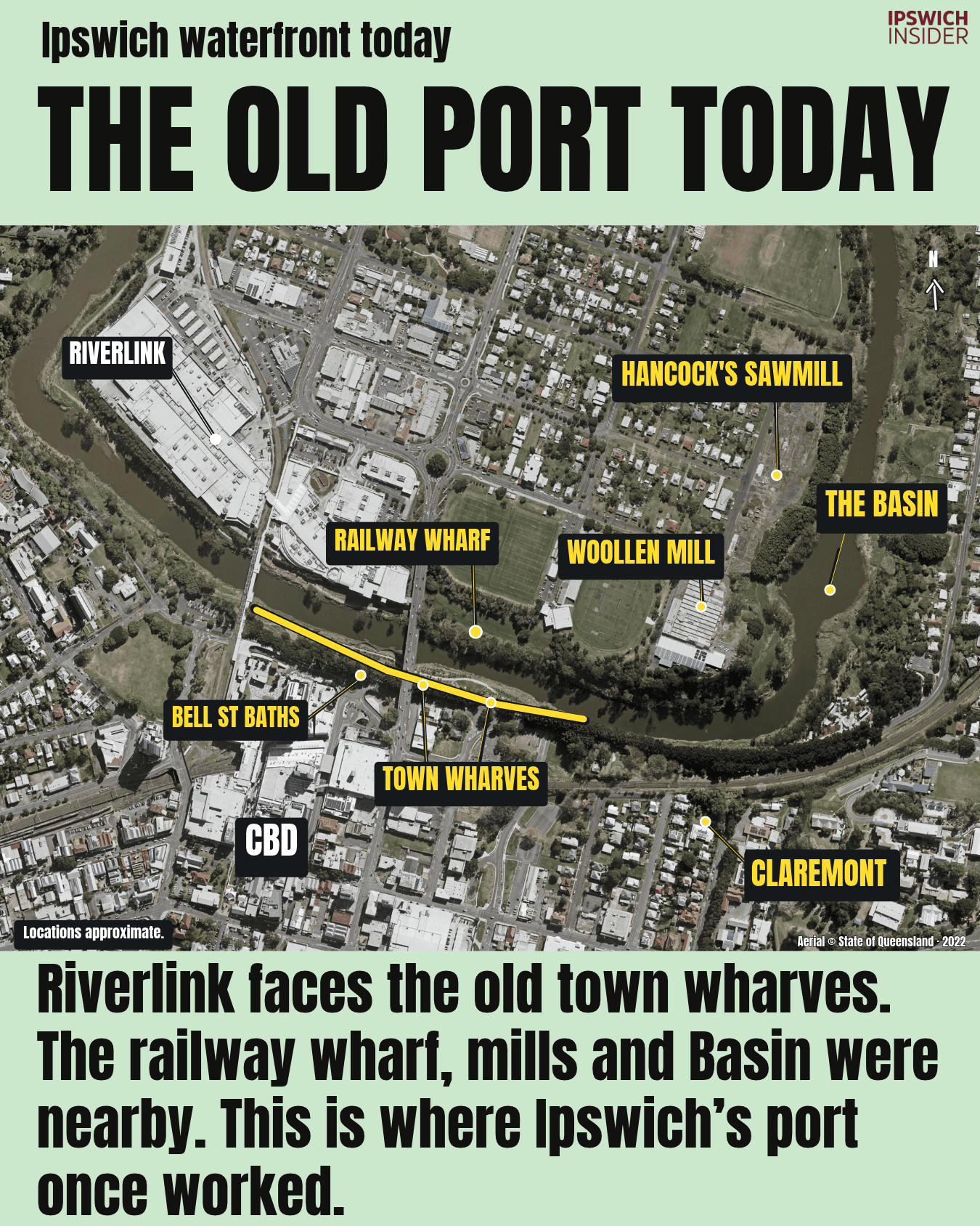
The old port today
More details
Next time you’re at Riverlink, look across the water. You’re facing some of the old town wharves, with the Basin and mill sites a little further downstream. [20]
Find your way around
- The town side: Look towards Bell and Wharf streets. That parking lot and Central Station area sits in places similar to where some of the old town wharves buildings and warehouses. The Bell Street pool was near there too.
- The Riverlink side: The railway wharf sat below what is now Len Johnson Oval, just downstream of today’s David Trumpy Bridge. A short rail line linked it to the workshops via that Heiner Road Overpass that is fenced off and preserved for your viewing pleasure at Riverlink.
- The Tarpaulin Shop: This Riverlink building opened as a railway warehouse in 1879. Workers later sewed and repaired wagon covers here. The heritage signs help you find these old sites.
Have you done the self-guided heritage walk at Riverlink recently?
About the colourised photos
Digital colour has been added to the original black-and-white photos. Their shapes and details have been kept. The colours show how the scenes might have looked. The Roseberry Parade postcard already had colour.
Sources and image credits
The history comes from Robyn Buchanan’s The Bremer River, written for Ipswich City Council in 2009. Riverlink’s heritage signs and the archive records below add more detail. Page numbers are the ones printed in her report. Map labels show rough locations. The inland rail route is simplified.
- Working waterfront, 1872. Buchanan, pp. 27, 36–38. Also Riverlink heritage marker 04, The Bremer River. John Oxley Library, State Library of Queensland, image 4884. Original photograph. ↩
- The inland’s way to the coast. Buchanan, pp. 7, 27, 64. Also State Library of Queensland’s first railway history. Map by Ipswich Insider. Regional imagery © Planet / Geoplex via State of Queensland, 2017. River line © State of Queensland. Map imagery source. ↩
- The Basin, 1865. Buchanan, pp. 13–14, 21, 23. B. S. Poochee, Whitehead Collection, Picture Ipswich. Original photograph. ↩
- Town plan, 1842. Buchanan, pp. 21–23. Henry Wade, Queensland State Archives, ITM714310, via Picture Ipswich. The plan includes later annotations. Original plan. ↩
- The river junction. Buchanan, pp. 21, 37–39. Map by Ipswich Insider. Aerial imagery © State of Queensland, 2022. Map imagery source. ↩
- Experiment advertisement. Buchanan, pp. 28–29, 101. John Oxley Library, State Library of Queensland, image 7351. The advertisement is undated. Original advertisement. ↩
- Paddle steamer Ipswich. Buchanan, pp. 29, 104. John Oxley Library, State Library of Queensland, image 22245. The photograph’s date and location are unrecorded. Original photograph. ↩
- Eclipse, 1936. Buchanan, pp. 40–41. Late R. L. Manders Collection, Picture Ipswich. Original photograph. ↩
- Emu at the town wharves, c.1870, also used on the cover. Buchanan, pp. 27, 29, 36–37. John Oxley Library, State Library of Queensland, image 18880. Original photograph. ↩
- Railway and riverfront, 1866. Buchanan, pp. 36–37, 64–65. Also Riverlink heritage markers 02, 05 and 06. B. S. Poochee, Whitehead Collection, Picture Ipswich. Original photograph. ↩
- Roseberry Parade, 1900–1905. Buchanan, pp. 38–39, 86. Picture Ipswich. Original hand-coloured postcard. ↩
- Hancock’s sawmill, 1880. Buchanan, pp. 59–60. Picture Ipswich, qips-2009-11-09-0020p. Original photograph. ↩
- Woollen mill, c.1897. Buchanan, pp. 63–64. Queensland State Archives, Digital Image 25331. Original photograph. ↩
- Essex at the town wharves, 1920s. Buchanan, pp. 39–40. Alison Smith, Robyn Buchanan Collection, Ipswich Genealogical Society, via Picture Ipswich. Original photograph. ↩
- Timber unloading, c.1930s. Buchanan, pp. 40–41, 60–61. Late R. L. Manders Collection, Picture Ipswich. Original photograph. ↩
- Bell Street baths, 1935. Buchanan, pp. 89–90. Picture Ipswich, qips-2008-06-16-0002p. Original photograph. ↩
- Barrambin at Dinmore, 1953. Buchanan, pp. 60–62. Picture Ipswich, qips-2008-11-10-0002p. Original photograph. ↩
- Ford-built Bremer at Dinmore, 1953. Buchanan, pp. 61–62. Picture Ipswich, qips-2008-11-06-0036p. Original photograph. ↩
- Dinmore coal chute, 1953. Buchanan, pp. 61–62. Also Ipswich City Council’s Coal Mining Then & Now for the Tivoli–Port of Brisbane route and April 1998 end date. Picture Ipswich, qips-2008-11-10-0003p. Original photograph. ↩
- The old port today. Buchanan, pp. 21, 34–37, 59–65, 90. Also Riverlink heritage markers 01, 02, 04, 05, 06 and 07, and the North Ipswich Railway Wharf Branch site study. Alister J Cameron — The North Ipswich Railway Wharf Branch. Map by Ipswich Insider. Aerial imagery © State of Queensland, 2022. Map imagery source. ↩
- By The Numbers. Buchanan, pp. 7, 13–14, 27–29, 60, 62–64 and 90. Also State Library of Queensland’s first railway history. The wool figure is an estimate for each season in the early 1860s. Hancock’s total includes wagon drivers and loaders. The 70-metre length refers to the later coal barges. ↩