
The Ipswich Visual Atlas at a Glance
- What it is: A growing collection of Ipswich maps, graphics and visual guides.
- What you’ll see: Mines, hills, waterways, water tanks, rail lines, power precincts and big future ideas.
- How to use it: Look at the visual. Read the short note. Hit the button for the full guide.
- The bigger plan: One day all of this lives between two covers on a coffee table.
- Bookmark this page: For now, we will keep adding maps and visuals to this page so be sure to check back.
One day the Ipswich Visual Atlas will sit on your coffee table as a printed book.
For now, it lives here…
…growing every week with the newsletter.
What’s here?
Below are 11 maps and visuals showing Ipswich like you’ve never seen it. Hidden coal mines, ridgelines, hilltop water tanks, rail corridors, freight tunnels, solar sites and the city’s must-know waterways.
Have a squiz.
The Land
Ipswich’s Hidden Mine Map

Ipswich was built on coal. Most old mine sites are now buried under streets, suburbs, parks and bushland. This map brings the city’s mining past back into view.
Ipswich Elevation Heat Map
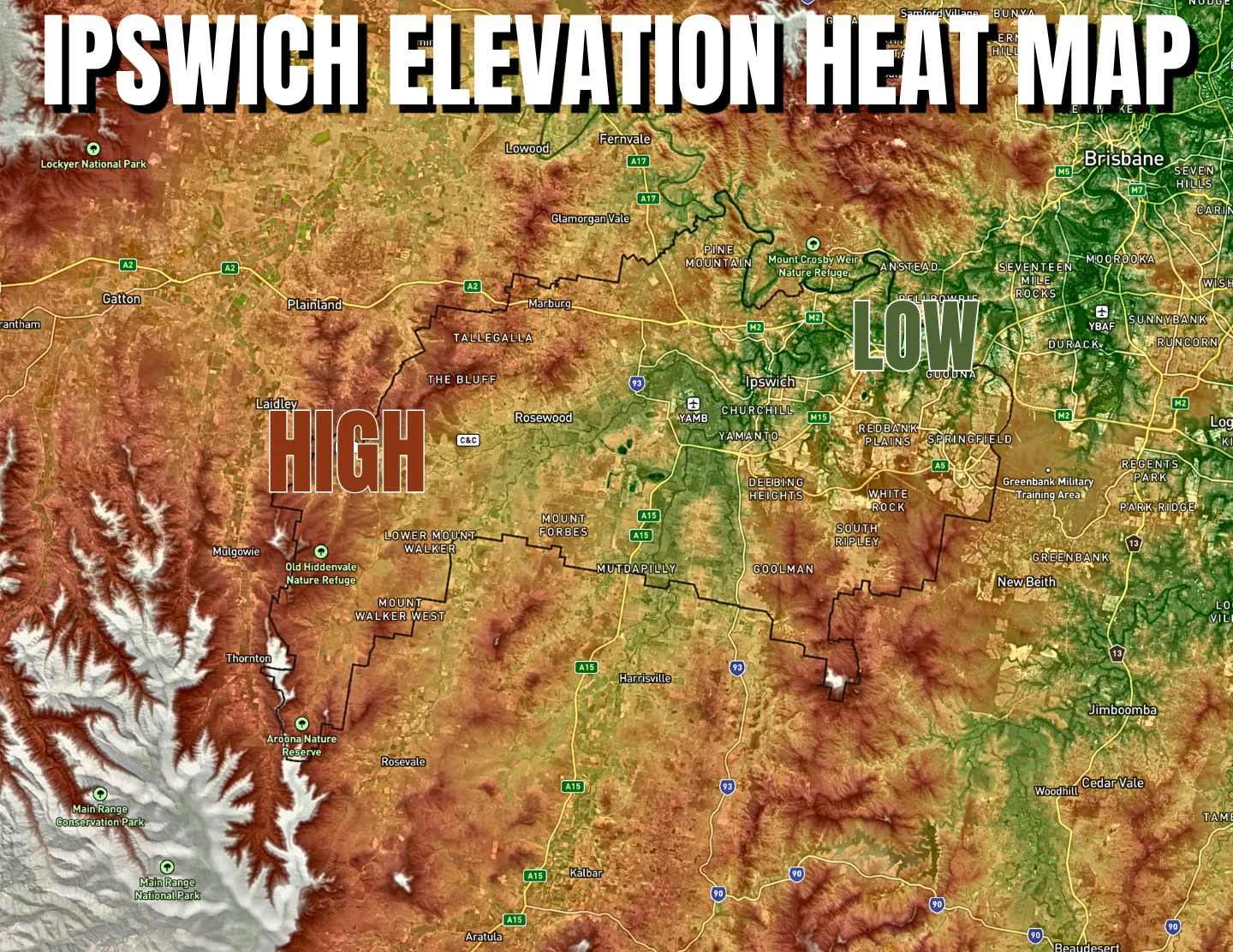
This heat map shows the shape of Ipswich. Ridges, valleys, river flats, the higher western country. Once you see it, you can never quite drive around the city the same way again.
Ipswich’s Must-Know Waterways
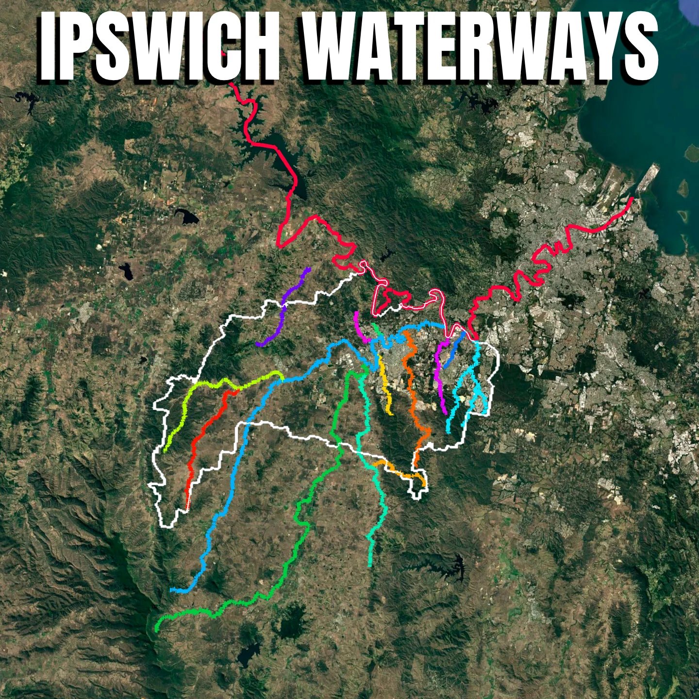
Ipswich is not just the Bremer River. This graphic maps the city’s key rivers and creeks. It shows the waterways that shape where Ipswich floods, drains, grows and gathers around water.
The Built City
Hilltop Hydrants

Ipswich’s drinking water tanks are hiding in plain sight. This graphic ranks the city’s hilltop reservoirs by volume and shows which tanks quietly store the most water above town.
Swanbank in a Nutshell

Swanbank is one of Ipswich’s most misunderstood industrial precincts. This graphic puts the big pieces in one place. Power, waste, old mining land, major roads and the suburbs that sit right next door.
Ipswich’s Economic Engines

Not every part of Ipswich carries the same economic weight. This visual ranks the city’s big precincts by local value-add. It shows where jobs, industry, health, defence, retail and logistics do the heavy lifting.
Ipswich’s Top 30 Solar Installs
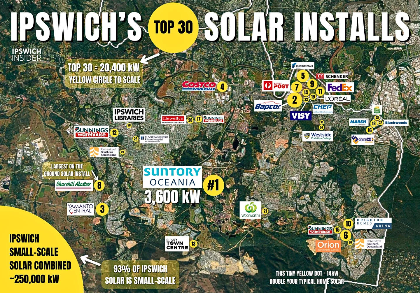
Drive past Woolies, Bunnings or a school and the panels are out of sight. This map of Ipswich’s top 30 solar sites shows you which roofs are doing the work.
Future Projects
Port Connex Tunnel Concept
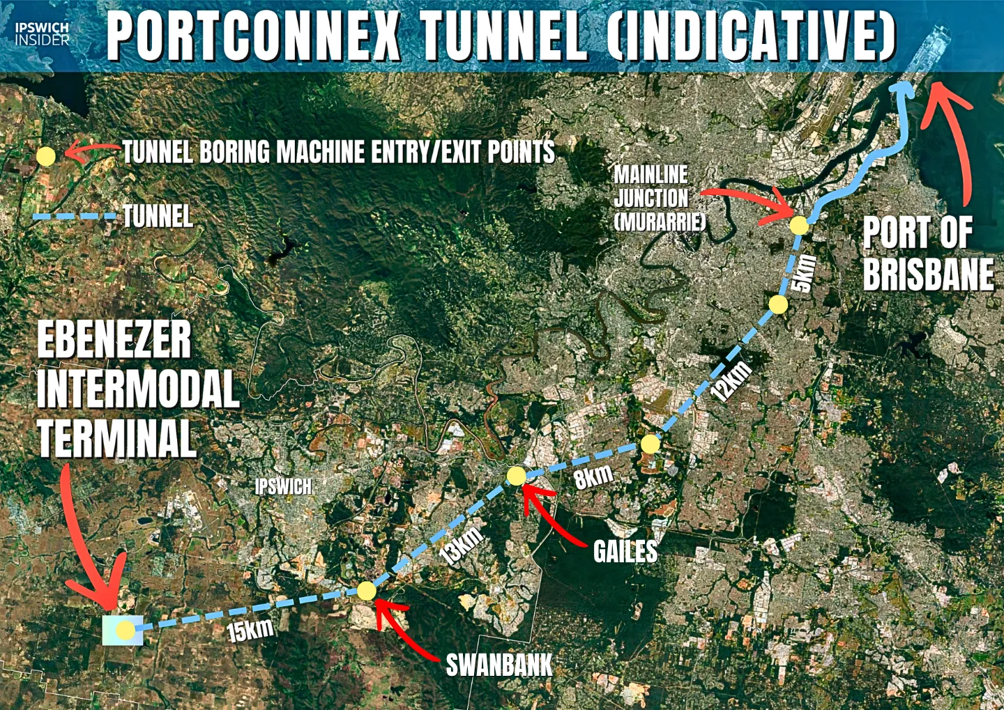
Port Connex is a proposed freight tunnel idea. It would link the Willowbank area straight to the Port of Brisbane. It is not built. But it shows just how big the Ipswich freight future could become.
Inland Rail: Calvert to Kagaru

The Calvert to Kagaru section is the Ipswich-region piece of Inland Rail. This map makes the route easy to place on the ground.
Follow the Inland Rail route →
I2S Rail Line Map
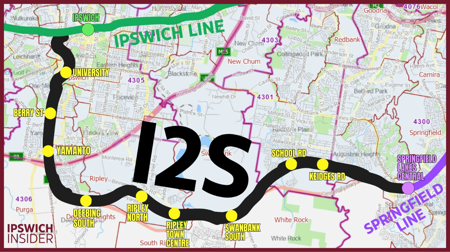
The Ipswich to Springfield corridor has been talked about for years. This visual shows the broad idea in plain form. It links Ipswich, Ripley and Springfield as one future transport spine.
The Wider Region
SEQ’s 17 Biggest Water Reservoirs
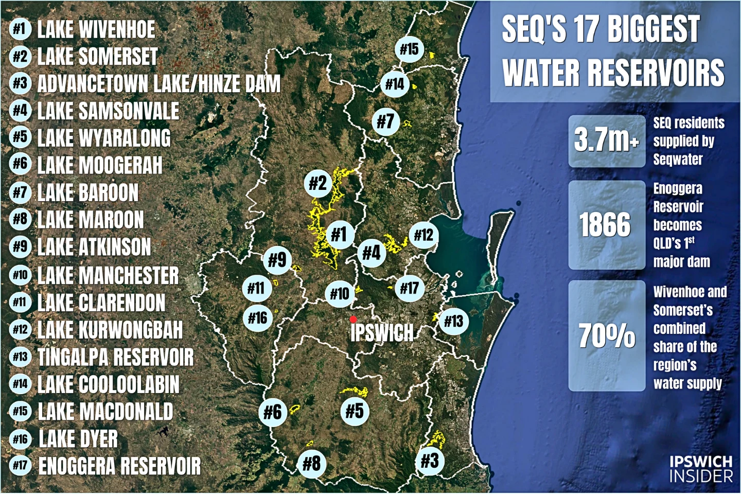
Ipswich sits inside a much larger water system. This graphic ranks SEQ’s biggest reservoirs/lakes and puts Wivenhoe, Somerset and the wider grid into one simple visual order.
See SEQ’s biggest reservoirs →
Got a Map or Visual Idea?
This atlas keeps growing. New maps land here as we make them.
If there is something about Ipswich you would like to see mapped, hit reply on any newsletter and tell us. The next entry on the wall could be yours.
One day all of this lives between two covers on a coffee table. Until then, this page is where the atlas lives.