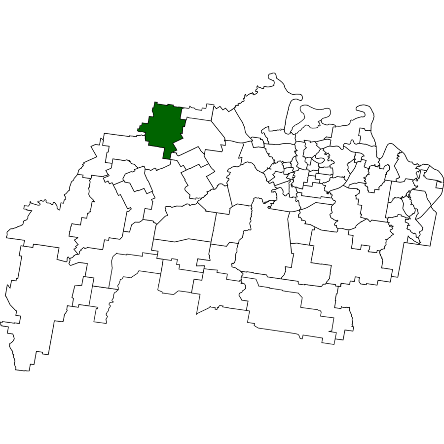
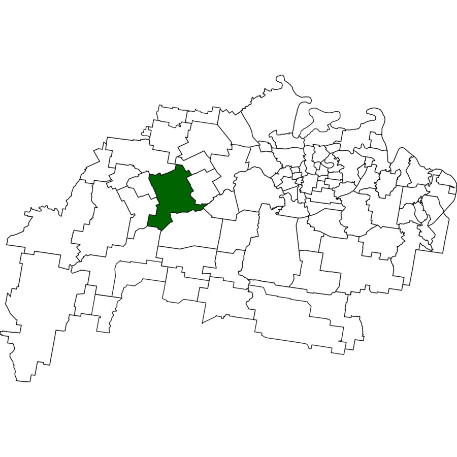
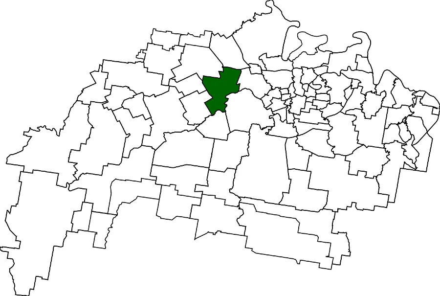
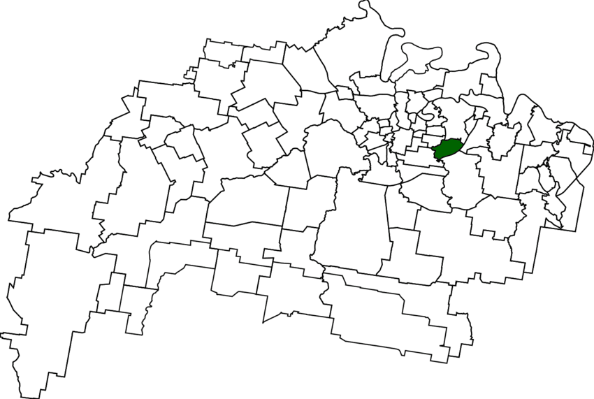
Discover Ipswich Suburb’s Founding Footprints
Neighbourhoods’ Snapshot:
Discover suburbs in their original form: from West Ipswich’s early days as “Little Ipswich” to Eastern Heights’ roots as “Irishtown,” explore each neighbourhood’s earliest identity.Watch Ipswich grow step-by-step: follow the city’s expansion, from riverside beginnings along the Bremer River to modern estates at Springfield Lakes.Gain instant insight: quickly see each suburb’s founding year, unique origin story, and current (2021 Census) population at a glance.
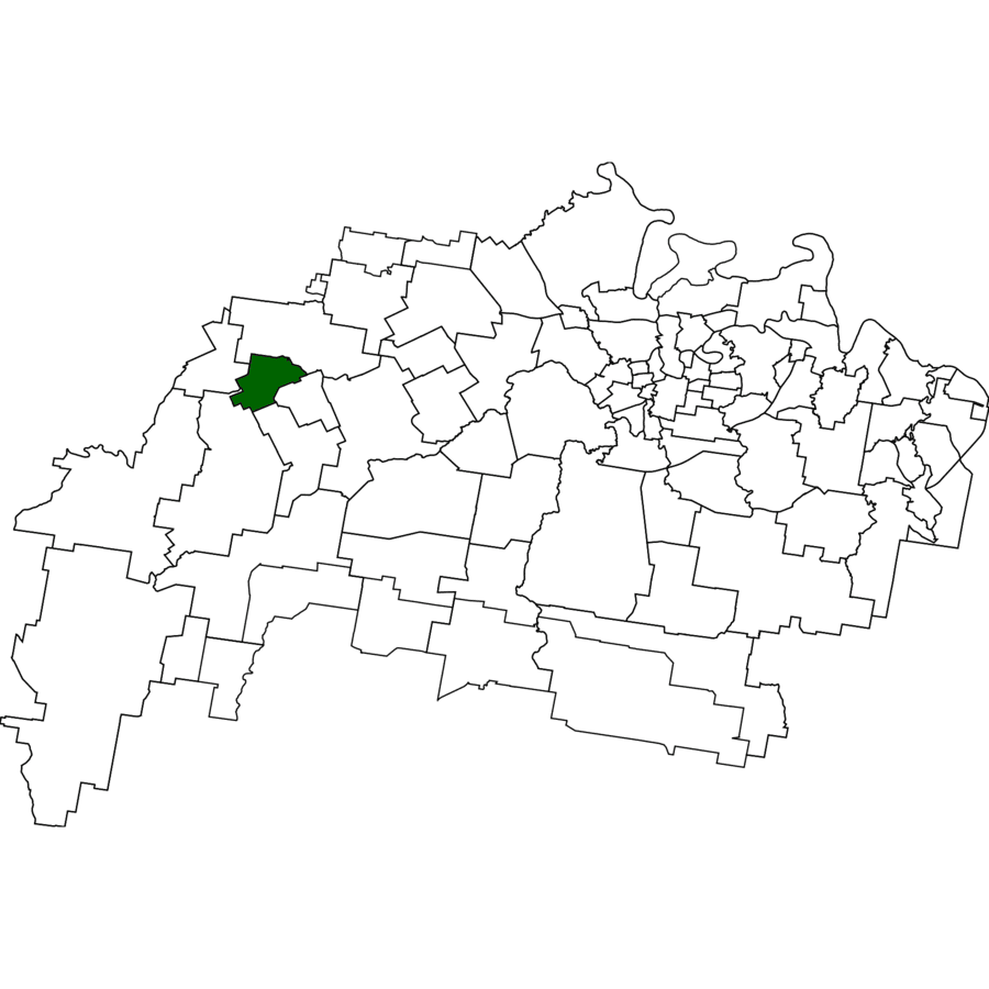
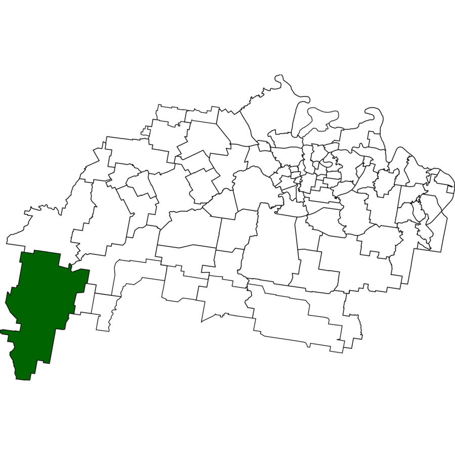
1823 – Mount Forbes (👥 262) Oxley named the peak on 4 Dec 1823; sheep and cattle still graze its ridges.
1823 – Oxley charts “Mt Forbes”
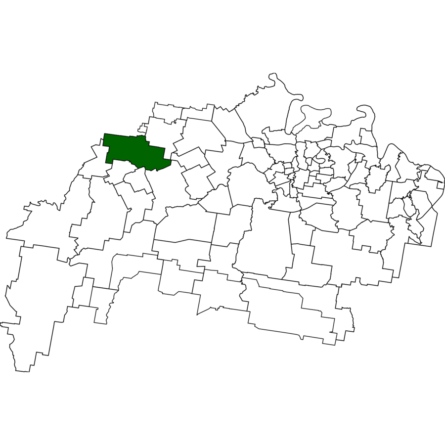
1860s – Franklyn Vale runs carved up
1938 – Short-lived national-park declaration
1999 – Locality bounded
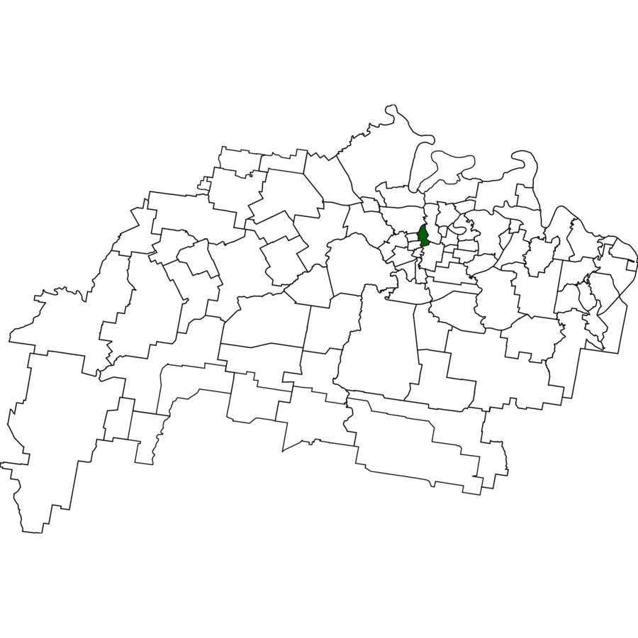
1827 – Ipswich (👥 2,468) Began 1827 as Limestone station; renamed Ipswich in 1843 for the Suffolk port.
1827 – Penal quarry opened
1843 – Town renamed
1858 – Municipality gazetted
1865 – Qld’s first railway
1827 – Goodna (👥 10,391) “Woogaroo” convict sheep station became Goodna river port; name on town plan 1856.
1827 – Station established
1856 – Township surveyed
1874 – Rail reached Goodna
1893 – Great flood
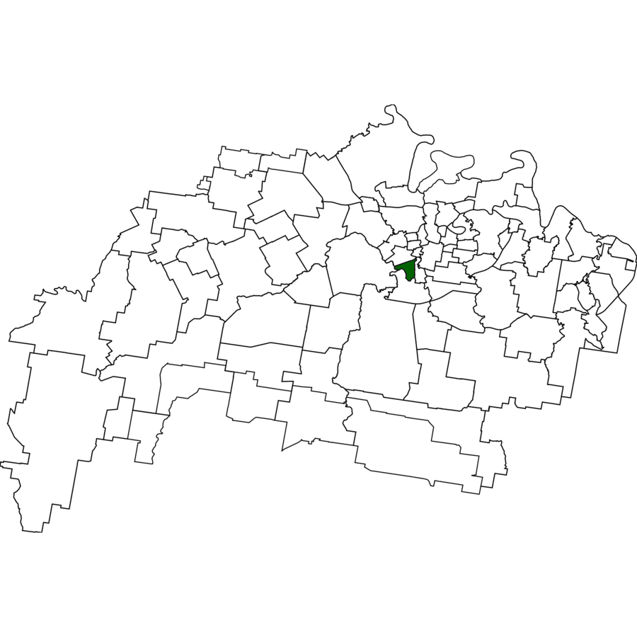
1828 – Basin Pocket (👥 931) Named for the Bremer “Basin” where steamers turned; leafy but flood-prone pocket.
1828 – Cunningham notes the Basin
1860s – Ferry to North Ipswich
1867 – Methodist chapel
1880s – Urban lots sold
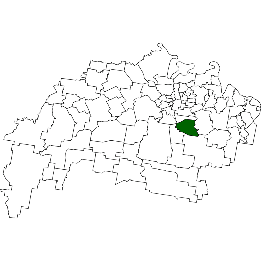
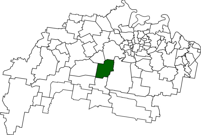
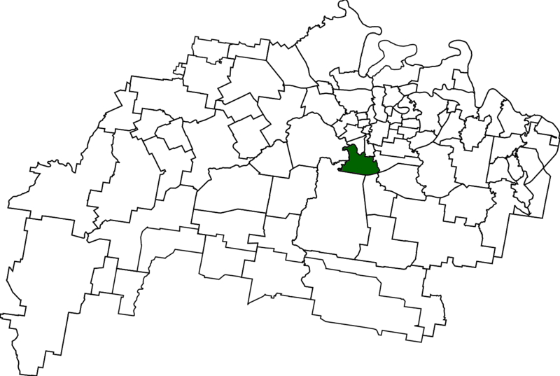
1828 – Raceview (👥 9,699) Dixon’s 1828 sketch labels “Race View paddock” overlooking future turf course.
1828 – Name on survey
1859 – Ipswich racecourse opens
1950 – “Raceview” on land ads
1971 – Primary school
1828 – The Bluff (👥 53) Cunningham sketched the sandstone bluff; still open paddocks above the Brisbane River.
1828 – Bluff mapped
1840s – Grazing on Fernvale run
1995 – Locality bounded
2000s – Remains rural
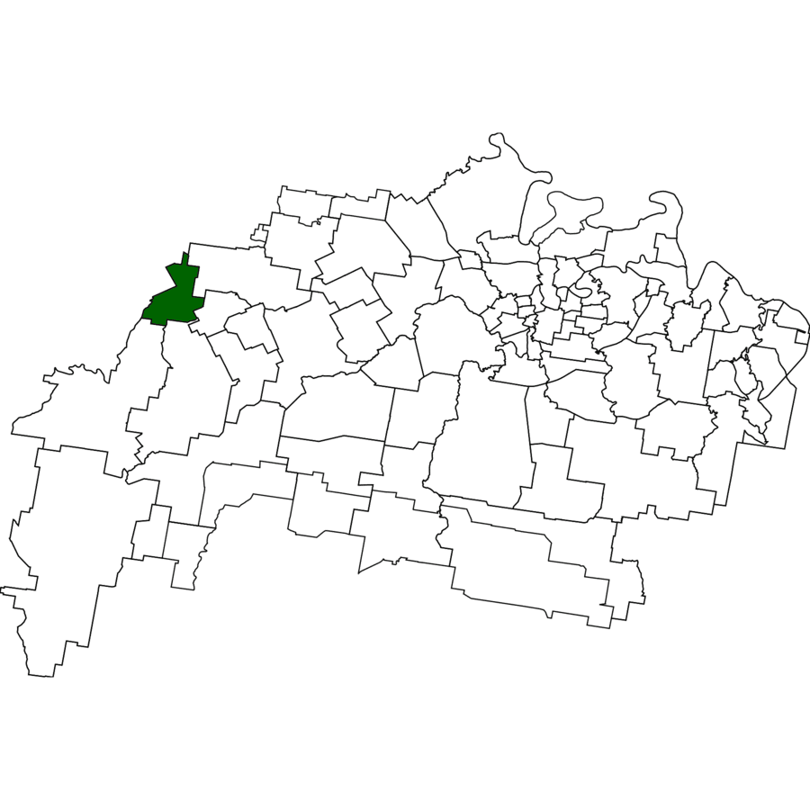
1830 – Redbank (👥 2,931) Convict map marks red-soil riverbank; later Queensland’s first rail workshops.
1830 – “Red Bank” on survey
1864 – Rail workshops open
1888 – Abattoir established
1914 – Woollen mill
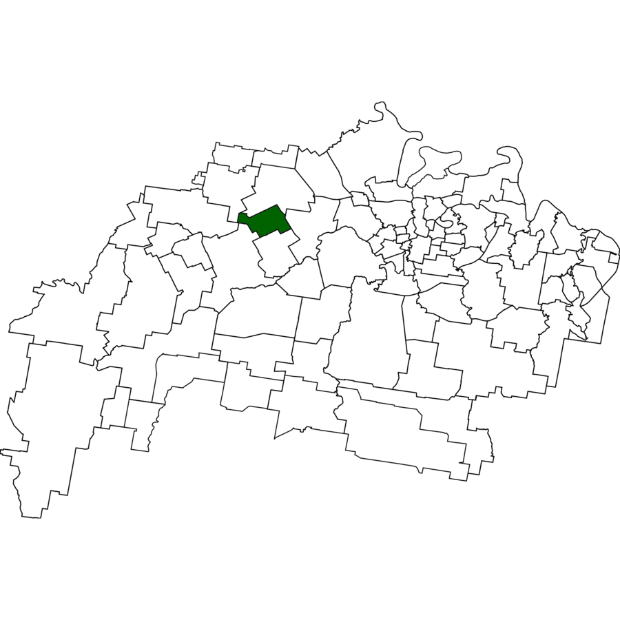
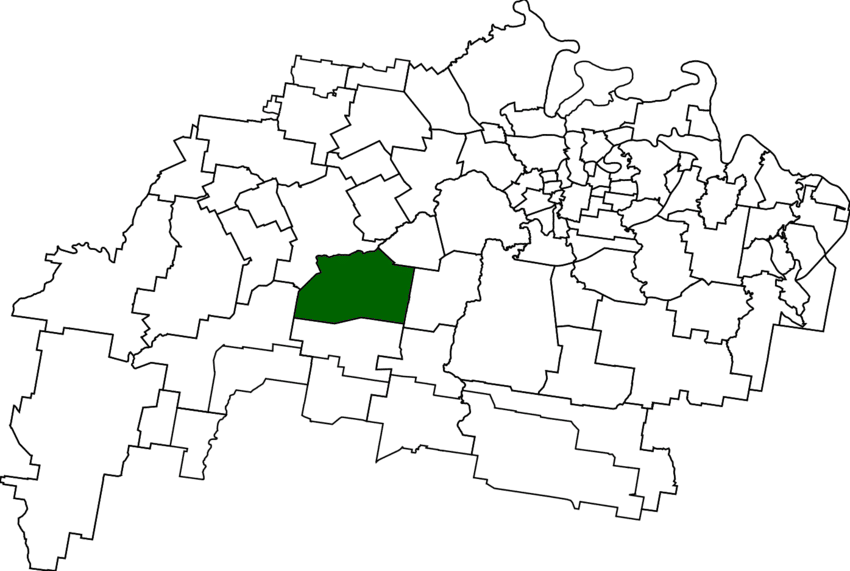
1840 – Mount Mort (👥 78) Franklyn Vale valley charted 1840; pastoral ever since.
1840 – Run surveyed
1890 – School opens
1905 – Small coal shafts
1930s – Population wanes
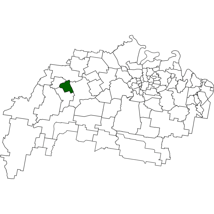
1842 – West Ipswich (👥 512) Laid out as “Little Ipswich” 1842; gasworks lit busy Brisbane Street.
1842 – Lots auctioned
1878 – Gasworks open
1902 – Electric tram terminus
1960s – Industry replaced by retail
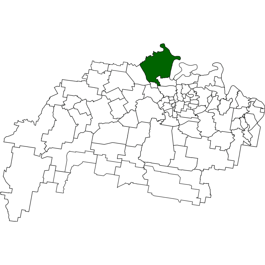
1843 – Pine Mountain (👥 1,695) Burnett’s 1843 notebook notes hoop-pine ridge; timber then orchards.
1843 – Name recorded
1870 – Gold “scare”
1880 – Methodist church
1936 – School closed
1843 – Woolshed (👥 8) 1840s sheep-shearing shed gave locality its enduring name; still grazing land.
1840s – Woolshed erected
1900 – Sheep replaced by cattle
2000 – Locality bounded
2021 – Population eight
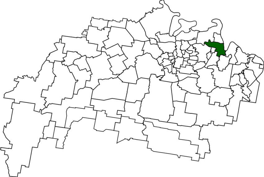
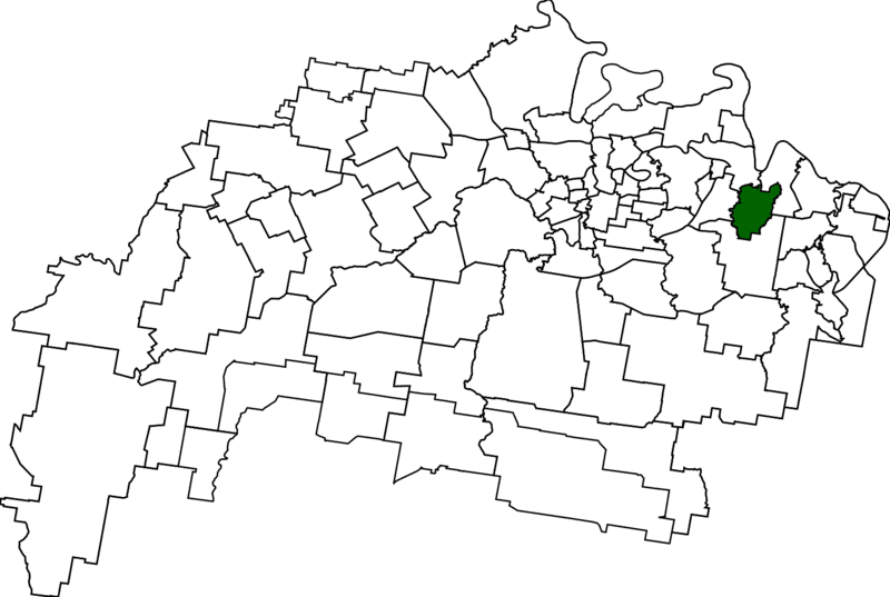
1847 – North Ipswich (👥 4,527) Lime-kilns then 1864 Railway Workshops forged industrial north bank.
1847 – Lime quarrying
1864 – Workshops open
1878 – First river bridge
1902 – Erecting shop built
1847 – Moores Pocket (👥 736) Thomas Moore’s 1847 farm hugged a Bremer bend; floods still test it.
1847 – Moore’s selection noted
1890 – Bremer bridge built
1930s – Market gardens peak
1974 – Major flood
1848 – Woodend (👥 1,483) Panton’s Woodend estate 1848; villas and Ipswich Grammar crown the ridge.
1848 – Estate mapped
1860 – Coal seam tapped
1863 – Grammar founded
1875 – Catholic precinct
1850 – One Mile (👥 2,038) Coaching inn one mile from post office; miners’ cottages linger.
1866 – Coal pit opens
1873 – Hancock pottery
1908 – Boundaries extend
1950 – Leichhardt name used
1850 – Blacksoil (👥 106) 1850 press notes “black-soil” bullock camp; highway and farms remain.
1850 – Name in press
1868 – Rail siding
1949 – Highway built
2011 – Warrego bypass
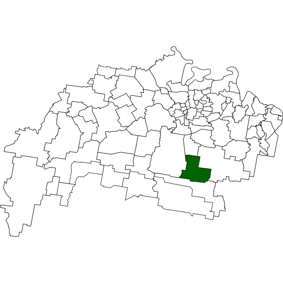
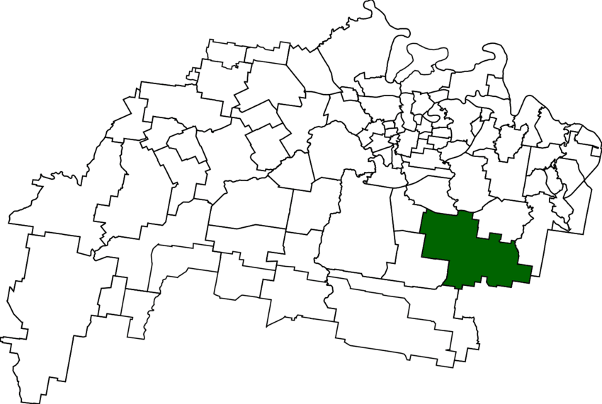
1850 – Ripley (👥 4,288) Ebenezer Ripley’s pastoral valley named c.1850; now booming Ecco Ripley.
1850 – Valley name on plan
1874 – Township reserve
2014 – Town centre starts
2017 – Retail heart opens
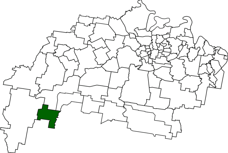
1850 – Lower Mount Walker (👥 192) Lower slopes surveyed mid-1850s; orchards and studs dot valley.
1860s – Wheat & dairying
1903 – Tarampa Shire
2000 – Locality named
2008 – Remains in Ipswich
1851 – Brassall (👥 12,115) Name on Warner’s 1851 plan; “Hungry Flats” became garden suburb.
1851 – Plan signed
1860 – Brassall Shire forms
1884 – Valley rail opens
1917 – Shire merges
1852 – Bundamba (👥 6,542) Ugarapul for “stone-axe place”; flour, racecourse then coal.
1852 – Parish name
1864 – Cotton boom
1872 – Racecourse
1880 – First mine
1893 – School opens
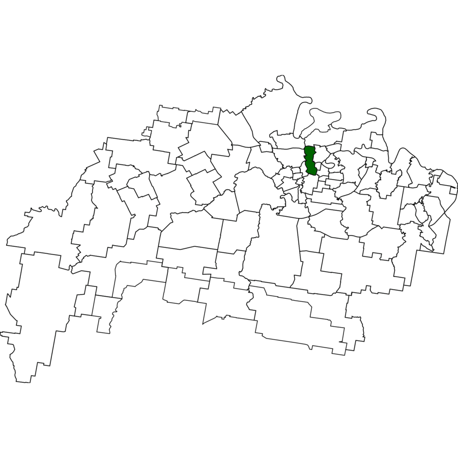
1856 – Newtown (👥 1,498) Rockton homestead, finished 1856, predates Macalister’s 1864 “New Town Estate” and still crowns the ridge.
1856 – Two-storey Rockton completed
1864 – First “New Town Estate” sale
1892 – Ipswich Girls’ Grammar opens
1914 – Newtown Park gazetted
1930s – Federation & Californian bungalows infill
1857 – Booval (👥 2,723) Ugarapul for “frilled lizard”; rail, woollen mills and bacon works followed.
1857 – Booval House
1876 – Station opens
1895 – Woollen mill
1916 – Bacon factory
1860 – Chuwar (👥 2,178) Yuggera for “honey”; riverfront farms now leafy acre blocks.
1860s – Farms settled
1878 – Temperance hall
1930s – Orchard boom
1990s – Acreage estates
1860 – Goolman (👥 47) Yuggera “stone”; hamlet beneath Mt Goolman, now conservation estate.
1860s – Runs surveyed
1874 – School opens
1914 – School closes
1994 – Flinders-Goolman park
1860 – Karalee (👥 5,521) Possibly “pretty hill”; river flats grazed till 1980s acreage estates.
1860 – Mount Marrow (👥 182) Hill named by 1860; cotton then 1885 coal mine.
1860 – Cotton grown
1885 – Mine opens
1909 – School opens
1916 – Rail siding
1860 – Muirlea (👥 174) John Muir’s “lea” on 1860s sale ads; still semi-rural.
1860s – Selections
1873 – Name in ads
1884 – Rail nearby
1949 – In city
1860 – Peak Crossing (👥 1,016) Village below Flinders Peak road crossing; service hub for farms.
1860s – Coach halt
1871 – School opens
1915 – Rail line
2008 – LGA split
1860 – Redbank Plains (👥 24,349) Grazing plains behind Redbank; huge suburban burst after 1980.
1860s – Cattle runs
1874 – Town reserve
1980s – First estates
2016 – Pop doubles
1860 – Springfield (👥 7,322) Name on 1860s pastoral plan; quiet until 1993 Greater Springfield project.
1860s – Pastoral paddocks
1930 – School reserve
1993 – New-town launched
1999 – First residents
1860 – Tallegalla (👥 351) Yuggera “big fig”; German farms ring Lutheran church (1876).
1860s – Selectors settle
1876 – Church built
1879 – School opens
1917 – Name survives
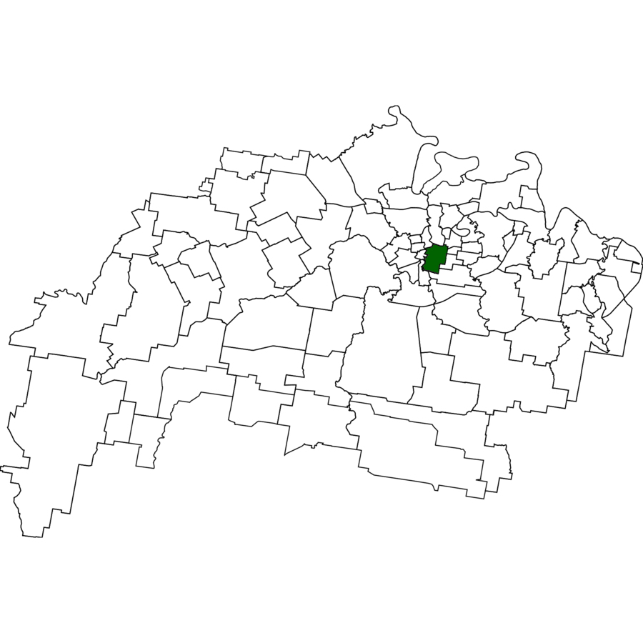
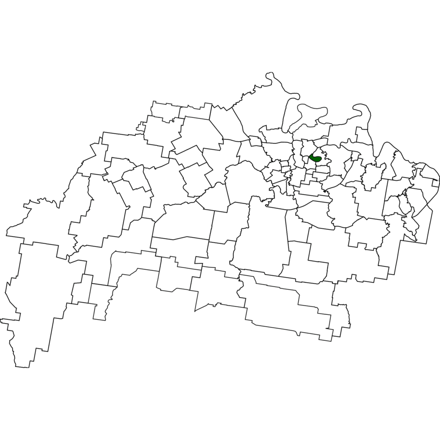
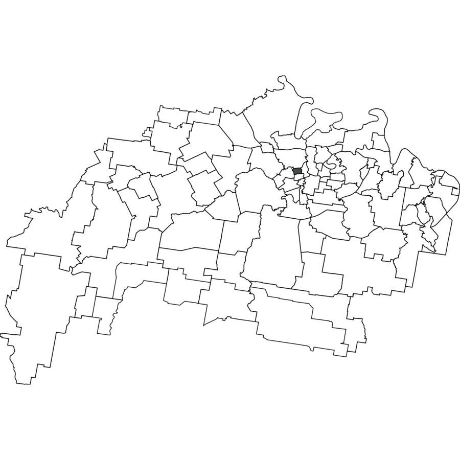
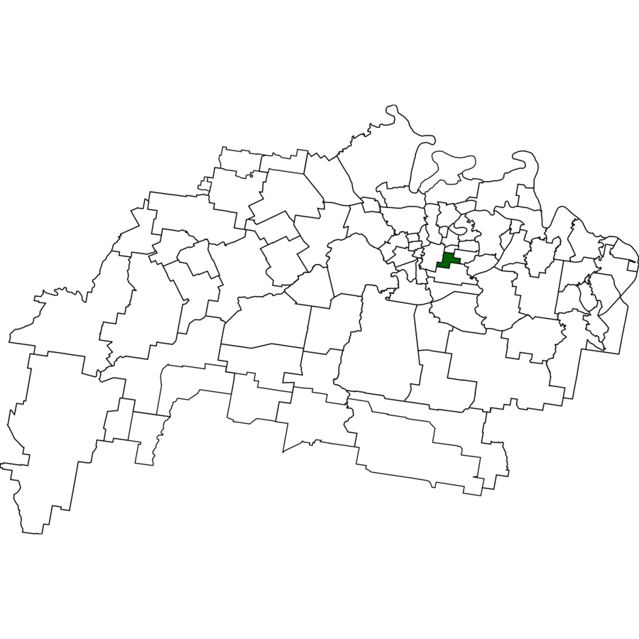
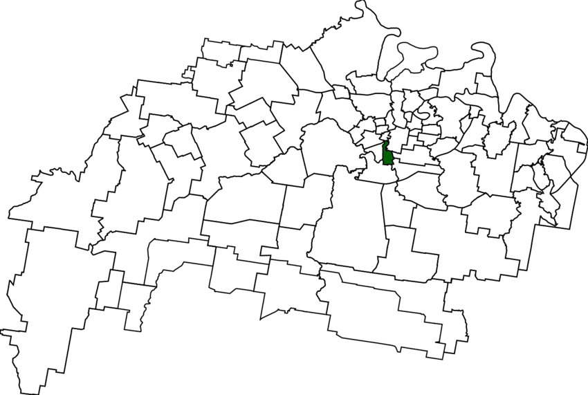
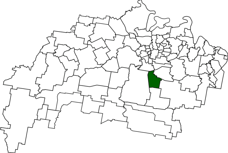
1862 – Coalfalls (👥 898) Coal seams outcropping on the Bremer were claimed 1862; the name “Coal Falls” described both the cliff and a small riverside selection.
1862 – Thomas Gall’s mineral selection advertised
1877 – Town map labels the cliff Coalfalls
1919 – Ipswich Grammar builds sports grounds
1926 – Soldiers’ Memorial gates erected
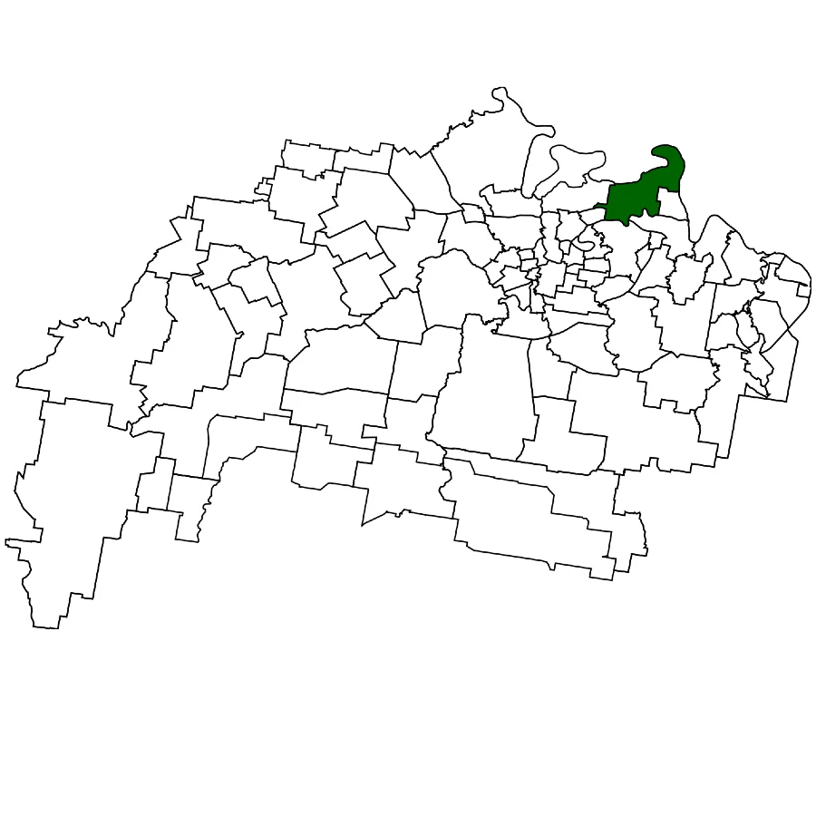
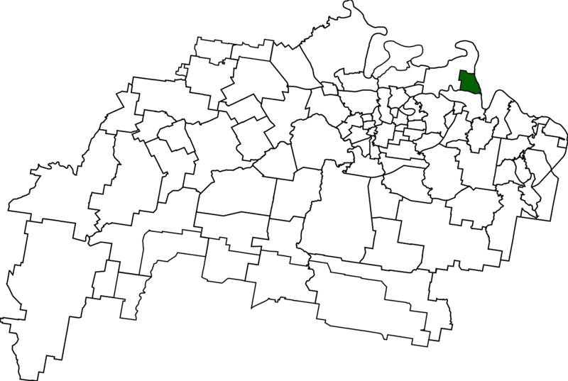
1862 – Amberley (👥 253) English namesake on 1862 roll; vast RAAF Base dominates since 1940.
1862 – Name in roll
1940 – Air base opens
1970s – School relocated
2010 – New school site
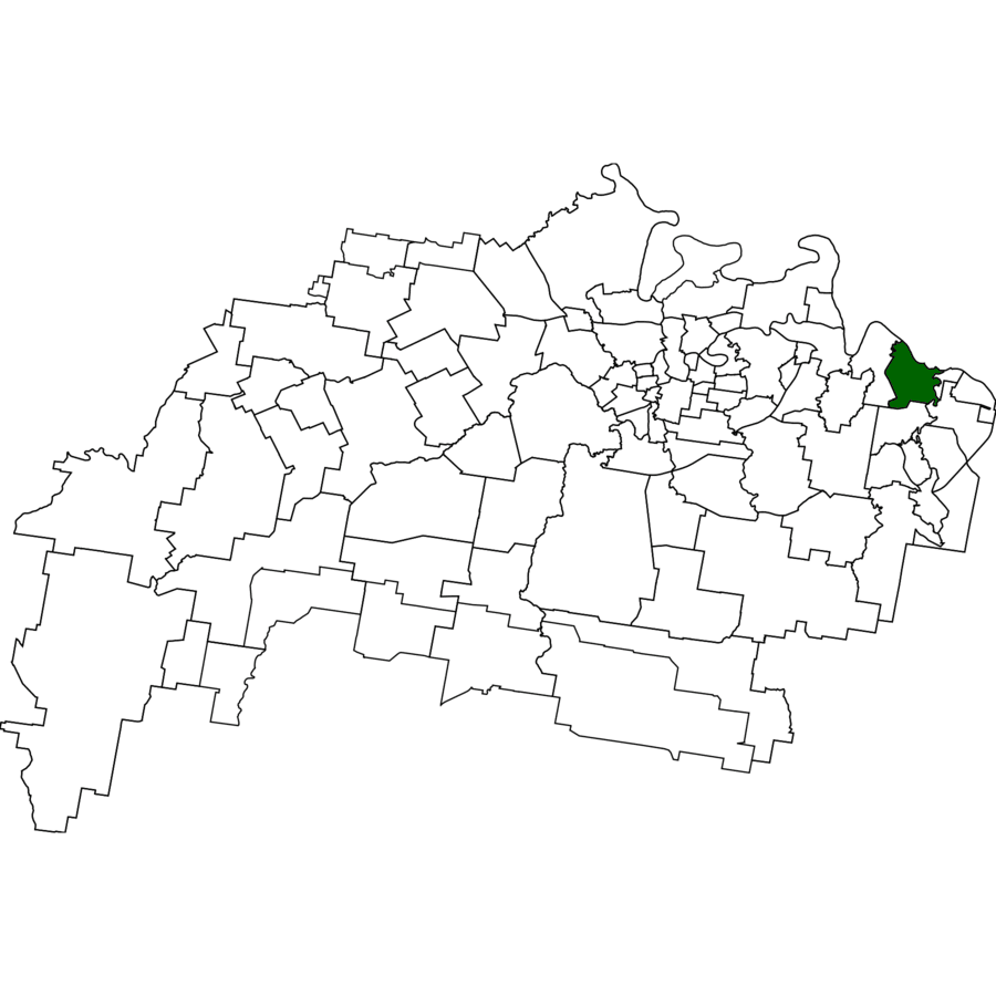
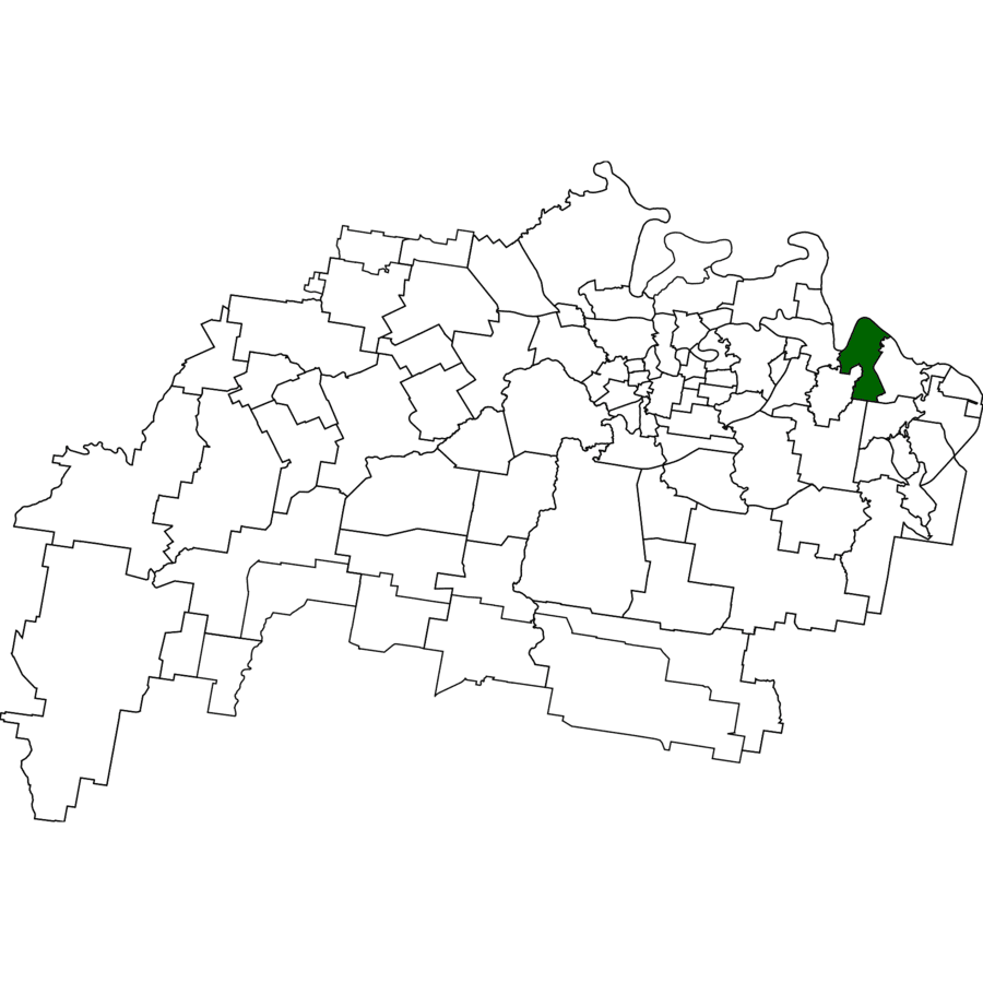
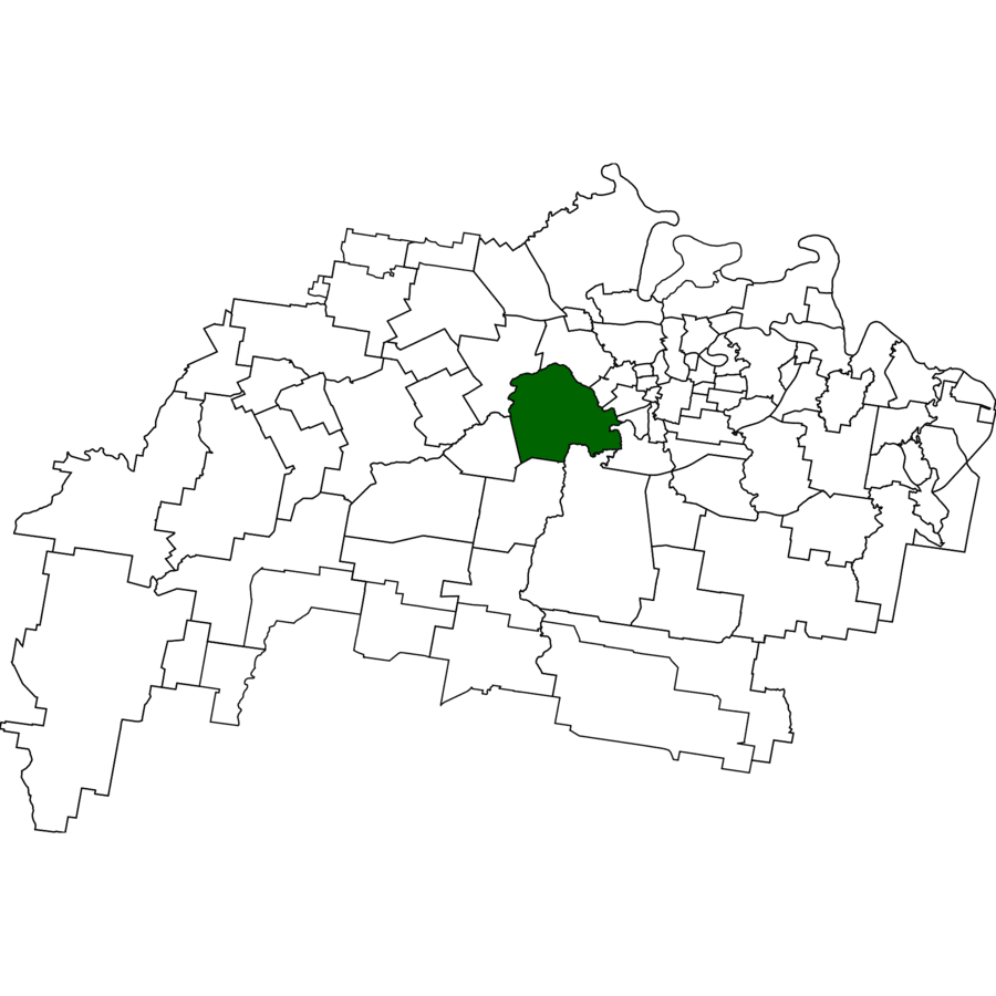
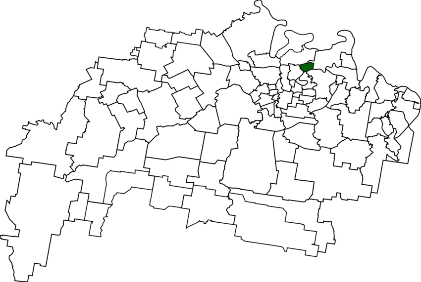
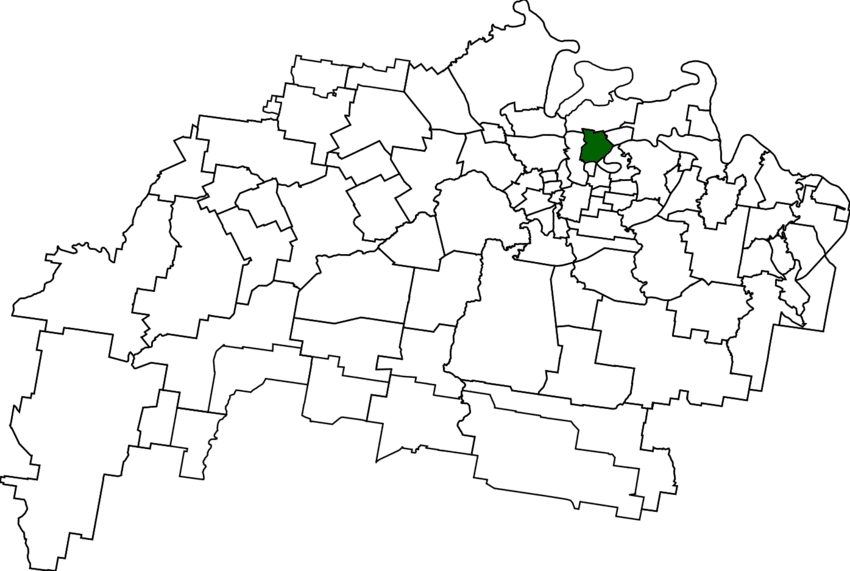
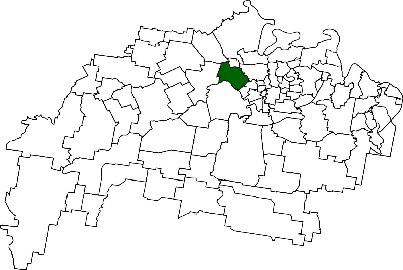
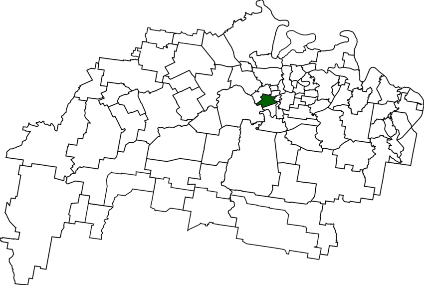
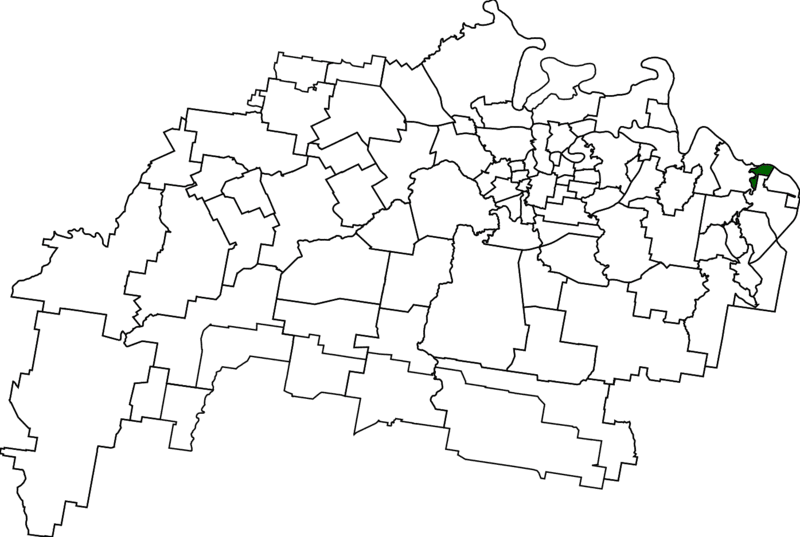
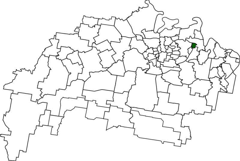
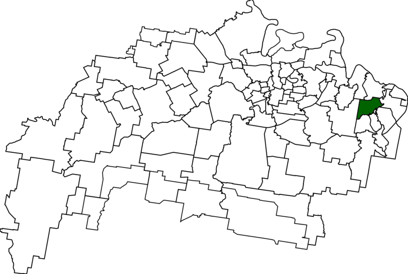
1862 – Eastern Heights (👥 3,631) Irish rail-and-mine families formed the ridge hamlet nicknamed Irishtown in the early 1860s; “Eastern Heights” surfaced decades later.
1862 – Irish labourers’ cottages cluster east of Queens Park
1874 – Crown orchard lots auctioned
1888 – Villa Garowie finished
1910 – Newspaper first captions “Eastern Heights”
1863 – Sadliers Crossing (👥 1,358) Named for Sadlier family’s 1863 bridge; rail suburb of gabled cottages.
1863 – Footbridge built
1875 – Western line
1886 – Rail bridge
1914 – Catholic church
1864 – Ashwell (👥 97) Loveday’s farm “Ashwell” cited 1864; tiny school still serves paddocks.
1864 – Name in press
1887 – School opens
1900s – Dairying hub
1996 – Locality bounded
1864 – Marburg (👥 1,013) German families settled the “First Plain” in 1864; sugar and timber trades shaped the village later surveyed as Marburg.
1864 – German selectors take up farms
1868 – Small sugar mill starts
1879 – Township officially surveyed
1911 – Marburg branch railway opens
1865 – Calvert (👥 374) Rail siding named for Robert Calvert; grain silos dominate skyline.
1865 – Station opens
1870s – Farms expand
1900 – School opens
1995 – Boundary shift
1865 – Grandchester (👥 467) “Bigge’s Camp” rail head renamed Grandchester on Qld’s first line.
1865 – Rail terminus
1875 – Post office
1890 – Laidley branch
1965 – Station heritage-listed
1865 – Rosewood (👥 3,263) Rosewood trees named town; rail, dairy then coal centre.
1865 – Rail reaches
1875 – Hotel & PO
1904 – Shire formed
1955 – Coal boom
1865 – Walloon (👥 2,305) Rail village; Lawson’s “Babies of Walloon” tragedy famed.
1865 – Station opens
1877 – Coal seams
1891 – Lawson poem
1988 – Mining ends
1866 – Blackstone (👥 1,144) Welsh coal town; Cambrian Choir founded 1886.
1866 – First pit
1886 – Choir forms
1887 – School opens
1910 – Coal peak
1866 – Ebenezer (👥 301) Scots biblical name on 1866 church; wool scour then rural quiet.
1866 – Church built
1877 – Wool scour
1900s – Grazing
2011 – Industry zoned
1867 – Mutdapilly (👥 308) Yuggera “sticky gully”; hotel and school on coach road.
1864 – Hotel opens
1874 – School
1906 – Rail bypass
2000 – Boundary split
1870 – Churchill (👥 1,842) Sugar mill then hill-top church perhaps coined the name.
1870 – Sugar mill
1873 – First Ipswich show event
1893 – St Bridget’s
1911 – School
1960s – Suburban infill
1870 – Ebbw Vale (👥 540) Welsh miners’ name; coal hamlet round St Helens pit.
1877 – Mine starts
1886 – Station renamed
1910 – School
1976 – Mine closes
1870 – Haigslea (👥 507) German Kirchheim renamed Haigslea in WWI.
1870s – Settlement
1873 – Lutheran church
1916 – Name change
1920 – School
1870 – Ironbark (👥 1,173) Dense ironbark forest cut for rail sleepers; now bush-acre lots.
1870s – Timber-getting
1895 – Shire formed
1901 – School
1995 – Joins Ipswich
1870 – North Tivoli (👥 84) North flank of Tivoli coalfield; pits then landfill.
1870s – Coal shafts
1900 – Aberdare mine
1927 – Disaster nearby
1990s – Industrial reuse
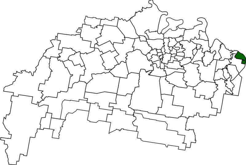
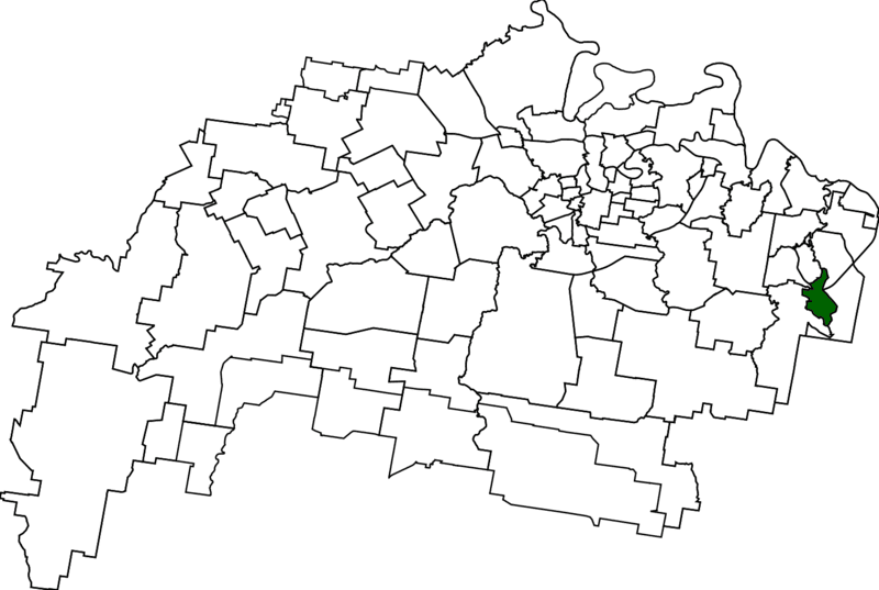
1870 – Riverview(👥 3,067) Devine’s Hill miners’ ridge evolved into Riverview after mid-20th-century housing spread.
1873 – Row-boat service across the reach
1881 – Rope punt replaces ferry
1911 – Aberdare Extended Colliery opens
1982 – Riverview railway station opens
1870 – Silkstone (👥 3,830) Yorkshire coal town’s name; Box Flat mine disaster haunts memory.
1870s – Pits open
1893 – Box Flat mine
1901 – School
1972 – Mine disaster
1870 – Tivoli (👥 1,460) Coal suburb named for European resort; 1932 drive-in icon.
1870 – First mine
1898 – Disaster
1932 – Drive-in
1986 – Last pit closes
1873 – Karrabin (👥 416) Yuggera “red gum”; rail stop served brickworks.
1875 – Station opens
1891 – Brickworks
1919 – Quarry
1950s – Farming wanes
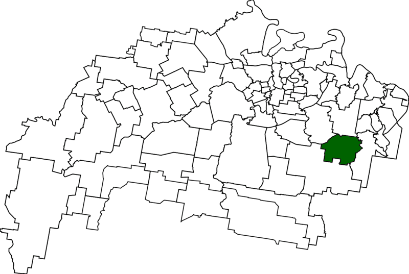
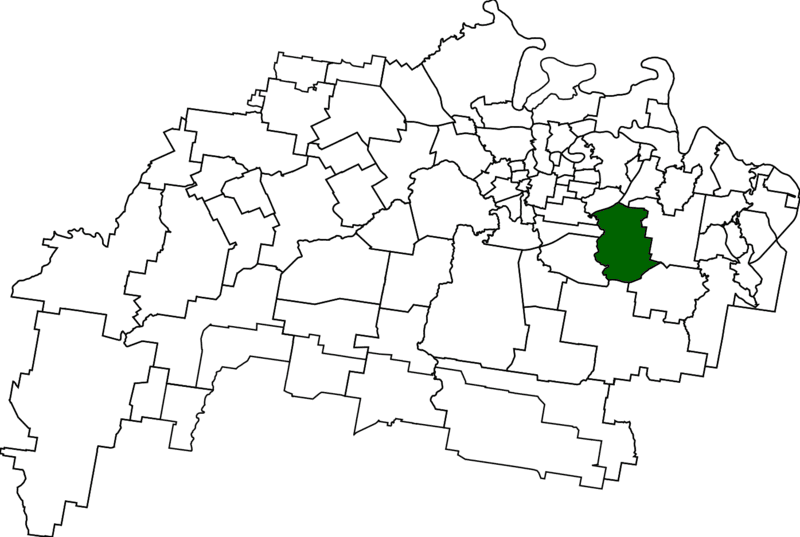
1874 – South Ripley (👥 4,069) First marked as Bundamba Upper School Reserve 1874; now Providence growth hub.
1874 – Bundamba Upper School opened
1909 – Renamed Ripley State School
1972 – Name “South Ripley” first on topo sheet
2015 – Providence estate launched
1874 – North Booval (👥 3,041) Rail-workers’ suburb across Bremer.
1887 – Name in directory
1902 – Rail bridge
1906 – School
1974 – Flood levee
1874 – Leichhardt (👥 4,471) Western One Mile paddocks first sold 1874; suburb name Leichhardt adopted 1953 for the explorer.
1874 – Crown farm lots auctioned¹
1943 – US Army bulk-fuel depot²
1953 – New suburb name approved³
1963 – Leichhardt State School opens⁴
1875 – Gailes (👥 1,831) Rail siding became Gailes when golf links opened 1925.
1875 – Siding opens
1925 – Renamed Gailes
1929 – Golf club
1946 – Post office
1877 – White Rock (👥 0) Pale sandstone outcrop; locality bounded 1991, all conservation land.
1877 – Landmark on map
1991 – Locality created
2020 – Hiking reserve
No residents
1880 – East Ipswich (👥 2,321) “Limestone East” sold after 1879 station; jacaranda-lined streets.
1879 – Station opens
1880s – Subdivision
1892 – School
1902 – Workshops boost
1880 – Lanefield (👥 97) Lane family siding; coal then silence.
1886 – Station opens
1890 – Coal pit
1915 – Line closes
2010s – Rail-trail plan
1882 – Thagoona (👥 1,077) Yuggera “grass tree”; siding served Foote vineyard, now hobby farms.
1882 – Station opens
1890 – Vineyard peaks
1930 – Line closes
1990s – Acreage estates
1882 – Purga (👥 561) Yuggera “stone”; Post Office proclaimed 1882, fertile black-soil farms endure.
1882 – PO gazetted
1921 – Aboriginal mission
1950 – Mission closes
2000s – Wetland reserve
1884 – Dinmore (👥 1,109) Herefordshire namesake; rail junction then Qld’s largest abattoir.
1884 – Station opens
1908 – Rail bridge
1919 – Meatworks
1990 – Motorway upgrade
1887 – Willowbank (👥 1,351) Named for an 1887 Willowbank dairy homestead; now Ipswich’s motorsport heart beside RAAF Amberley.
1887 – Willowbank dairy homestead recorded
1940 – Amberley buffer zone limits housing
1988 – Willowbank Raceway opens
1999 – Queensland Raceway hosts first V8 Supercars
1887 – Wulkuraka (👥 1,325) Sadlier’s Siding renamed Wulkuraka 1914; now rail depot.
1914 – Name adopted
1980 – Workshops
2015 – Depot opens
Rail hub continues
1910 – Jeebropilly (👥 0) Yuggera “flying squirrel gully”; open-cut coal 1914-2007.
1914 – Mine opens
1940s – Mining camp
2007 – Mine closes
2010 – Land rehab
1914 – New Chum (👥 0) Coal-field village for “new-chum” miners; now landfill site.
1914 – Shaft sunk
1987 – Landfill opens
2019 – Fire incident
Industrial use continues
1940 – Swanbank (👥 0) Coal then 1967 power station; recycling era today.
1946 – Coal mine
1967 – Power station A
2002 – Coal units shut
2018 – Waste-to-energy
1972 – Carole Park (👥 0) Landowner’s daughter’s name; residential pocket ceded to Brisbane side 2010.
1972 – Suburb gazetted
1970s – Housing estate
1997 – School moves
2010 – Industrial zone (Ipswich side unpopulated)
1973 – Camira (👥 7,415) Aboriginal “windy”; bush carved into curving streets after 1973.
1973 – Suburb named
1974 – School opens
1980s – Build-out
1992 – Joins Ipswich
1976 – Bellbird Park (👥 9,191) Named for bellbirds after 1974 flood; estates fill ridges.
1976 – Name adopted
1978 – Kruger school
2006 – Brentwood estate
2021 – Pop ~10 k
1980 – Yamanto (👥 4,971) Coined name on highway; retail hub since 1992.
1980 – Service centre
1984 – Suburb bounded
1992 – Shopping village
2020 – Town centre opens
1982 – Collingwood Park (👥 9,246) Named for 1910 mine; suburb proclaimed 1982.
1910 – Colliery opens
1982 – Suburb named
1987 – School opens
2008 – Subsidence event
1985 – Flinders View (👥 5,816) Gazetted 1985 for Flinders Peak views; brick estates followed.
1985 – Name approved
1990s – Estates built
2000 – Shopping centre
2011 – Pop > 5 k
1991 – Barellan Point (👥 1,173) Indigenous “meeting waters”; carved from Karalee 1991.
1860s – River farms
1940s – Bremer Junction known
1991 – Suburb gazetted
2015 – WWII airfield memorial
2000 – Brookwater (👥 2,902) Golf-estate launched 2000; gazetted 2003.
2000 – Estate announced
2002 – Course opens
2003 – Boundaries fixed
2017 – UDIA awards
2000 – Deebing Heights (👥 3,960) Yuggera “watercress creek”; locality named 2000, booming since 2016.
2000 – Locality created
2006 – Estates start
2016 – State school
2021 – Rapid growth
2000 – Mount Walker West (👥 0) Western flank kept in Ipswich after 2000 split; no residents.
2000 – Locality named
2008 – Stays in city
2021 – Still unpopulated
Land – Cattle & bush
2002 – Springfield Central (👥 234) Town-centre concept approved 2002; gazetted 2007 as Springfield CBD.
2002 – CBD plan endorsed
2007 – Suburb gazetted
2008 – Orion mall opens
2013 – Rail station
2003 – Augustine Heights (👥 6,088) St Augustine’s-College-inspired name; suburb gazetted 2003.
1990 – Reservoir tagged “Augustine Heights”
2003 – Suburb bounded
2003 – St Augustine’s opens
2015 – Retail village
2006 – Springfield Lakes (👥 17,211) Chain of man-made lakes anchors Greater Springfield’s largest village.
2001 – First earthworks
2006 – Suburb gazetted
2008 – Regatta Lake filled
2011 – Pop > 10 k
2010 – Spring Mountain (👥 6,085) Named for nearby peak; estates climb slopes, parkland preserved.
2010 – Locality bounded
2015 – Estates start
2019 – School opens
2020 – Conservation park
Wow, you made it to the end!
If you loved that, you’ll love our free Wednesday Newsletter: Join free here