❌ A.) Traffic Hot Spots: Peak congestion zones for commuters at 7:00 AM
❌ B.) Starlink: Real-time satellite coverage “bubbles” over the city
❌ C.) The “Whiff” Map: Odour-radius zones from local wastewater plants
D.) Drone Zones: Restricted, danger, and “clear-to-fly” corridors around Amberley
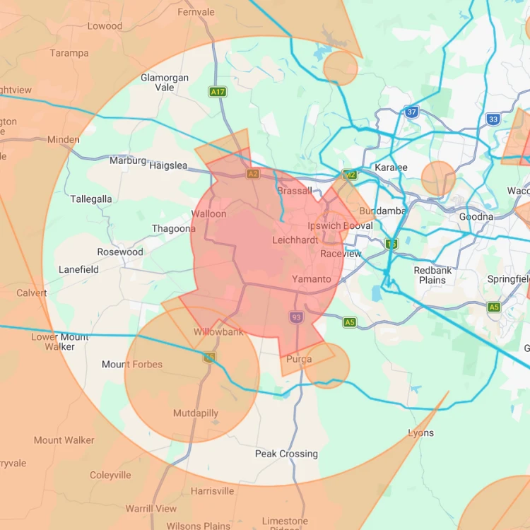
🔴 Red: No-Fly Zone
This is strictly off-limits. It covers the 5.5km radius around the base and the approach/departure paths where RAAF jets are lowest.
The Rule: Recreational flying is prohibited here at any height.
🟠 Orange: Caution Zone
This is “Controlled Airspace.” You can fly, but only under strict conditions.
The Rule: Max height 120m (400ft). You must keep a constant watch and land immediately if you see or hear any manned aircraft.